Cwm Penmachno

Last updated

Cwm Penmachno
Cwm Penmachno - geograph.org.uk - 147746.jpg
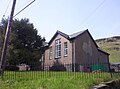
Houses in Cwm Penmachno, showing the quarry behind
Conwy UK location map.svg
Red pog.svg
Cwm Penmachno
Location within Conwy
OS grid reference SH750472
Community
Principal area
Country Wales
Sovereign state United Kingdom
Post town BETWS-Y-COED
Postcode district LL24
Dialling code 01690
Police North Wales
Fire North Wales
Ambulance Welsh
UK Parliament
Senedd Cymru – Welsh Parliament
List of places
UK
Wales
Conwy
53°00′29″N3°51′43″W / 53.008°N 3.862°W / 53.008; -3.862 Coordinates: 53°00′29″N3°51′43″W / 53.008°N 3.862°W / 53.008; -3.862

Cwm Penmachno (historically called Tre-Gynwal [1] ) is a village at the head of Cwm Machno in North Wales.

Contents

History

The village was built in the 1860s as a quarry settlement. The Penmachno quarry lay immediately south and above the settlement. Higher up the valley was the Rhiwbach slate quarry, which was formerly linked by the Rhiwbach Tramway to the Ffestiniog Railway at Blaenau Ffestiniog. [2] Streams flow from the steep-sided valley, forming the source of the River Machno, which flows through the larger village of Penmachno before joining the River Conwy south of Betws-y-Coed. [3]

Facilities

The village attracts tourists, particularly mountain bikers, kayakers, canoeists and walkers. The Penmachno Mountain Bike Trail starts at the car park located between Cwm Penmachno and Penmachno. [3]

There is a community centre and Heritage Room in the village at the former Shiloh Chapel. [4] [5]

Situated near the end of the valley is The Latymer School's outdoor centre, Ysgol Latymer Outdoor Pursuits Centre (occupying the buildings of the former primary school). The school runs residential trips each year for year 7 and year 9 pupils, as well as various Geography and PE trips. The Latymer School purchased this centre in Snowdonia National Park so that its pupils could get to know each other better and to discover their individual skills. [6]

Related Research Articles

Blaenau Ffestiniog Town in Gwynedd, North Wales

Blaenau Ffestiniog is a town in Gwynedd, Wales. Once a slate mining centre in the historic county of Merionethshire, it now relies heavily on tourists, drawn for instance to the Ffestiniog Railway and Llechwedd Slate Caverns. It was once the second largest town in North Wales, behind Wrexham. After reaching a population of 12,000 at the peak development of the slate industry, it fell with the decline in demand for slate. The population of the community of Ffestiniog, including the nearby village Llan Ffestiniog, was 4,875 in the 2011 census: the fourth most populous community in Gwynedd after Bangor, Caernarfon and Llandeiniolen. Blaenau's population is now only about 4,000.

Croesor Tramway

The Croesor Tramway was a Welsh, 2 ft narrow gauge railway line built to carry slate from the Croesor slate mines to Porthmadog. It was built in 1864 without an Act of Parliament and was operated using horse power.

Dyffryn Ogwen

Dyffryn Ogwen, or Ogwen Valley, is a valley mostly located in the Welsh county of Gwynedd. The upper section of the valley, east of Llyn Ogwen, lies in the county of Conwy.

Betws-y-Coed railway station Railway station in Conwy, Wales

Betws-y-Coed railway station is a railway station on the Conwy Valley Line from Llandudno Junction to Blaenau Ffestiniog, Wales. It is situated 15+12 miles (24.9 km) south of Llandudno Junction.

Corris Human settlement in Wales

Corris is a village and community in the south of Snowdonia in the Welsh county of Gwynedd. It lies in the historic county of Merionethshire/Sir Feirionnydd. Although the Snowdonia National Park covers much of the area around Corris, the village is not within the Park.

Penmachno Human settlement in Wales

Penmachno is a village in the isolated upland Machno valley, 4 miles (6 km) south of Betws-y-Coed in the county of Conwy, North Wales. The B4406 road runs through part of the village. The village is at the confluence of the Glasgwm and Machno rivers. It has a five-arched, stone bridge dating from 1785. The village has been referred to as Pennant Machno, Llandudclyd and Llan dutchyd in historical sources.

Rhiwbach Tramway

The Rhiwbach Tramway was a Welsh industrial, 1 ft 11+12 in narrow gauge railway connecting the remote slate quarries east of Blaenau Ffestiniog with the Ffestiniog Railway. It was in use by 1862, and remained so until progressively closed between 1956 and 1976. The route included three inclines, one of which became the last operational gravity incline in the North Wales slate industry. The tramway was worked by horses and gravity for much of its existence, but a diesel locomotive was used to haul wagons between on the top section between 1953 and its closure in 1961.

Y Fron Human settlement in Wales

Y Fron, also known locally as Cesarea, after the chapel, is a country village on the south-west side of Moel Tryfan, overlooking the Nantlle Valley, in North Wales, near Rhosgadfan and Carmel, on the tail of Mynydd Mawr, with epic views of Trum Y Ddysgl and Craig Cwm Silyn. It is in the community of Llandwrog.

River Machno is a river in Snowdonia in north-west Wales. It is the first major tributary of the River Conwy, which it joins south of Betws-y-coed, just past the impressive Penmachno Falls.

Maenofferen quarry

Maenofferen quarry is a major slate quarry in the town of Blaenau Ffestiniog, north Wales and one of the major users of the Ffestiniog Railway. It continues to produce crushed slate on a limited scale under the ownership of the nearby Llechwedd quarry.

The Cedryn Quarry Tramway was an industrial narrow gauge railway that connected the slate quarries at Cedryn and Cwm Eigiau to the quays at Dolgarrog in the Conwy valley.

Cwt y Bugail quarry

The Cwt y Bugail quarry is a former slate quarry located east of Blaenau Ffestiniog in Wales. It was first worked as a trial pit around 1840. Continuous production began in 1863 and continued until closure in 1961. The quarry was connected to the Ffestiniog Railway at Duffws Station via the Rhiwbach Tramway.

Blaen y Cwm quarry

The Blaen y Cwm quarry was a slate quarry located east of Blaenau Ffestiniog in Wales. It was first worked in some time between 1813 and 1818 and sporadically after that until 1914. The quarry was connected to the Ffestiniog Railway at Duffws Station via the Rhiwbach Tramway.

Bro Machno Human settlement in Wales

Bro Machno is a community in Conwy County Borough, in Wales, formed from the former civil parish of Penmachno. It covers the Penmachno Valley, through which runs the Afon Machno, and includes the villages of Penmachno and Cwm Penmachno. To the south west borders Gwynedd, and is located 4.8 miles (7.7 km) south of Betws-y-Coed, 21.8 miles (35.1 km) north west of Corwen, and 19.4 miles (31.2 km) south of Conwy. The whole of the community is within the Snowdonia national park, while much of it forms part of Gwydir Forest. According to the 2011 census, the population of the Bro Machno Parish was 617, of whom 342 (55%) were able to speak Welsh and 214 (34%) had no skills in Welsh.

Rhiwbach quarry Disused slate quarry in North Wales

Rhiwbach quarry was a slate quarry located to the east of Blaenau Ffestiniog in North Wales. The quarry was a remote site; it was nearly 4 miles (6.4 km) to north-east of Duffws, the Festiniog Railway's terminus in Blaenau Ffestiniog. It was the connected to the Ffestiniog Railway by the Rhiwbach Tramway. Commercial operation began around 1812, and it finally closed in 1952. It was the last Welsh slate quarry where workers lived in barracks on the site. 'Rhiwbach' is Welsh for 'Little Hill'

Wrysgan quarry

Wrysgan quarry was a slate quarry near the village of Tanygrisiau, Blaenau Festiniog, North Wales. It was worked intermittently from the 1830s, and was worked continuously from c.1850 until 1946. Wrysgan was an underground slate quarry, which was located on a small inaccessible site, some 1,390 feet (420 m) above sea level, to the west of Cwmorthin.

Fron-Boeth and Pant Mawr quarries

Fron-Boeth and Pant Mawr quarries were two closely related and interconnected quarries on the western slopes of Moelwyn Mawr in Gwynedd, North Wales. Pant Mawr operated from around 1850 to 1879, and was partly re-opened in 1886 when it was amalgamated with Fron-Boeth. Both quarries closed during the First World War. Finished product was transported to the slate quays of Porthmadog by the Croesor Tramway.

Owen Gethin Jones

Owen Gethin Jones, was a Welsh building contractor, quarry owner and prominent poet.

Penmachno quarry

The Penmachno quarry was a slate quarry near Cwm Penmachno, Conwy, North Wales. It was directly below the Rhiwbach Quarry. It was worked between 1818 and 1962.

References

  1. Caernarvonshire XXIX.NE (Map). Ordnance Survey. 1912.
  2. "Rhiwbach Slate Quarry and its tramway".
  3. 1 2 "Cwm Penmachno, Conwy County". Wales Directory.
  4. "New heritage room for Cwm Penmachno". Daily Post.
  5. "Shiloh Community Centre". Conwy Borough Council. Archived from the original on 18 April 2015.
  6. "Ysgol Latymer Outdoor Pursuits Centre". Latymer School. Archived from the original on 4 May 2015.