
Gandhinagar is the capital of the state of Gujarat in India. Gandhinagar is located approximately 23 km north of Ahmedabad, on the west central point of the industrial corridor between the metropolitan cities of Delhi and Mumbai.
Kheda, also known as Kaira, is a city and a municipality in the Indian state of Gujarat. It was former administrative capital of Kheda district. India's First Deputy Prime Minister Vallabhbhai Patel Was Born In Kheda District of Gujarat State. Kheda city is famous for tobacco farming. The nearest railway station is Mahemadavad Kheda Road. The nearest airport is Ahmedabad airport. The nearest bus station is "Kheda Bus Station".

Patan is the administrative seat of Patan district in the Indian state of Gujarat and is an administered municipality. It was the capital of Gujarat's Chavda and Chaulukya dynasties in medieval times, and is also known as Anhilpur-Patan to distinguish it from Prabhas Patan. During the rule of Gujarat Sultanate, it was the capital from 1407 to 1411.

Anand is the administrative centre of Anand District in the state of Gujarat, India. It is administered by Anand Municipal Corporation. It is part of the region known as Charotar, consisting of Anand and Kheda districts.

Motera is a neighbourhood in the northwestern part of the metropolis of Ahmedabad in Gujarat, India. It lies west of the Sabarmati River. It falls under the West Zone of Ahmedabad Municipal Corporation and under the Gandhinagar South constituency of Gujarat Legislative Assembly and under the Gandhinagar constituency of the Lok Sabha. The chief attraction in Motera is the world's largest sports stadium, Narendra Modi Stadium. The stadium is the venue for the international cricket matches held in Ahmedabad. In 2015, old stadium was demolished and new stadium was built which got the honour of world's largest stadium.

Gandhinagar district is an administrative division of Gujarat, India, whose headquarters are at Gandhinagar, the state capital. It was organized in 1964.
Ambaji (Ambājī) is a census town in Banaskantha district in the state of Gujarat, India.

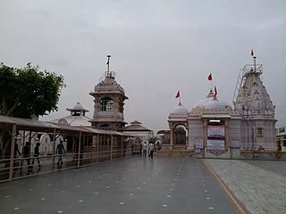
Adalaj is a census town in Gandhinagar district located in the western Indian state of Gujarat. With a population of roughly 12,000 residents within the town limits as of 2011, Adalaj is known for its semi-arid climate and its historic and religious establishments. The town sits in a generally flat area covering about 18 sq. km.
Chanasma is a small town and a municipality in Chanasma Taluka of Patan district in the state of Gujarat, India. Chanasma is a seat of Gujarat Assembly. The MP seat of Chanasma falls in the Patan Lok Sabha. Chanasma village is connected by Kandla-Mehsana highway. And since the broad gauge of the railway is being renovated, it is going to connect with Rajasthan via Patan from Ahmedabad. Patel, Brahmin, Vania, Darji, Panchal, Parmar, Rabari, Thakor, Nayi, all communities live in Chansma village. The old village of Chanasma was between Ugmano Darwaza and Athamano Darwaza. But now due to the increase in population and development of the village, the village is spreading to the outside. Chansma Village Shree Laljidas Laxmidas Patel Trust runs Rotla Ghar for feeding the poor where clean and nutritious meals are provided to the poor for free.
Chandkheda is a well-developed area in northwestern Ahmedabad. It is situated on west of Sabarmati River.

Kalol is a city in Gandhinagar district in the Indian state of Gujarat, located alongside Gujarat State Highway 41 between the cities of Mehsana and Ahmedabad.
Lambha is a census town in Ahmadabad district in the Indian state of Gujarat. Parts of Vejalpur, Daskroi, Danilimda, Vatva, and Maninagar assembly constituencies jut into Lambha. Many parts of Kheda, Gandhinagar, Ahmedabad West, and Ahmedabad East Lok Sabha constituencies fall in Lambha.
Meghraj is a town in the Indian state of Gujarat.
Visnagar is a city and a municipality in Mehsana district in the Indian state of Gujarat. Visnagar is also a taluka capital.
Sanoda is a village in Dehgam Taluka in Gandhinagar district in the state of Gujarat, India.

Bhat is a village in Daskroi Taluka in Ahmedabad district of Gujarat State, India. Bhat is located near the bank of the Sabarmati River, 24 km towards west from District headquarters Ahmedabad, 5 km from Daskroi and 49 km from State capital Gandhinagar.
Chamardi is a large village located within the Vallabhipur Taluka township of the Bhavnagar district (Gujarat), in West India. It was formerly a part of Rajput princely state.
Rupal is a village in Gandhinagar district of Gujarat state, India. It is located 13 km towards north from District headquarters Gandhinagar. Gujarati is the local language.
Ajol is a village in Mansa Taluka of Gandhinagar district, Gujarat, India. It is well known for its silk weaving.
Nandol Dehegam railway station is a railway station on Ahmedabad–Udaipur Line under the Ahmedabad railway division of Western Railway zone. This is situated beside State Highway 141 at Dahegam in Gandhinagar district of the Indian state of Gujarat.

