Danbury, Wisconsin Bikoganaagan | |
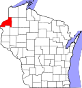
---|---|
Coordinates: 46°0′22″N92°22′16″W / 46.00611°N 92.37111°W | |
Country | United States |
State | Wisconsin |
County | Burnett |
Town | Swiss |
Area | |
• Total | 1.264 sq mi (3.27 km2) |
• Land | 1.264 sq mi (3.27 km2) |
• Water | 0 sq mi (0 km2) |
Population (2010) | |
• Total | 172 |
• Density | 140/sq mi (53/km2) |
Time zone | UTC-6 (Central (CST)) |
• Summer (DST) | UTC-5 (CDT) |
ZIP Codes | 54830 |
Area codes | 715 & 534 |
Danbury is an unincorporated census-designated place in Burnett County, Wisconsin, United States. [1] The community is located in the southwest corner of the town of Swiss. Its ZIP Code is 54830. As of the 2010 census, its population was 172. [2] The main intersection in the community is located at the intersection of two state highways, (Wisconsin Highway 35 and Wisconsin Highway 77).
Danbury is located at 46.006N. The longitude is -92.371W. It is in the Central Standard Time Zone. The elevation is 938 feet (286 m) above sea level.
Climate data for Danbury, Wisconsin (1991–2020) | |||||||||||||
---|---|---|---|---|---|---|---|---|---|---|---|---|---|
Month | Jan | Feb | Mar | Apr | May | Jun | Jul | Aug | Sep | Oct | Nov | Dec | Year |
Mean daily maximum °F (°C) | 21.6 (−5.8) | 27.4 (−2.6) | 39.7 (4.3) | 53.9 (12.2) | 67.3 (19.6) | 75.5 (24.2) | 79.7 (26.5) | 78.1 (25.6) | 70.0 (21.1) | 55.9 (13.3) | 40.2 (4.6) | 26.8 (−2.9) | 53.0 (11.7) |
Daily mean °F (°C) | 11.9 (−11.2) | 16.9 (−8.4) | 29.4 (−1.4) | 42.7 (5.9) | 55.4 (13.0) | 64.2 (17.9) | 69.0 (20.6) | 67.1 (19.5) | 59.1 (15.1) | 45.9 (7.7) | 32.0 (0.0) | 18.8 (−7.3) | 42.7 (6.0) |
Mean daily minimum °F (°C) | 2.2 (−16.6) | 6.5 (−14.2) | 19.0 (−7.2) | 31.4 (−0.3) | 43.6 (6.4) | 52.8 (11.6) | 58.3 (14.6) | 56.0 (13.3) | 48.3 (9.1) | 35.9 (2.2) | 23.8 (−4.6) | 10.8 (−11.8) | 32.4 (0.2) |
Average precipitation inches (mm) | 0.72 (18) | 0.79 (20) | 1.26 (32) | 2.67 (68) | 3.59 (91) | 4.08 (104) | 4.22 (107) | 3.89 (99) | 3.58 (91) | 3.01 (76) | 1.39 (35) | 0.90 (23) | 30.1 (764) |
Average snowfall inches (cm) | 10.3 (26) | 10.2 (26) | 9.3 (24) | 3.6 (9.1) | 0.1 (0.25) | 0.0 (0.0) | 0.0 (0.0) | 0.0 (0.0) | 0.0 (0.0) | 0.5 (1.3) | 6.7 (17) | 11.9 (30) | 52.6 (133.65) |
Source: NOAA [3] |
As of the census of 2000, there were 2,851 people and 1,312 households residing in the Danbury ZCTA. The racial makeup of the ZCTA was 91.1% White, 0.4% Black or African American, 6.1% Native American or Alaska Native, 0.1% Asian, and 2.1% from two or more races. Hispanic or Latino of any race were 0.6% of the population.
There were 1,312 households, out of which 15.9% had children under the age of 18 living with them, 57.5% were married couples living together, 6.1% had a female householder with no husband present, and 32.9.3% were non-families. 28.4% of all households were made up of individuals, and 12.2% had someone living alone who was 65 years of age or older. The average household size was 2.16 and the average family size was 2.57.
3.5% of the total population was under 5 years of age, 83.5% were 18 years and over, and 26.4% are 65 years and over.
The median household income in the ZCTA was $32,219, and the median income for a family was $37,845. Males had a median income of $31,133 versus $18,167 for females. The per capita income for the ZCTA was $17,596. About 5.4% of families and 9.2% of the population were below the poverty line, including 8.8% of individuals.