
Honduras is a country in Central America. Honduras borders the Caribbean Sea and the North Pacific Ocean. Guatemala lies to the west, Nicaragua south east and El Salvador to the south west. Honduras is the second largest Central American republic, with a total area of 112,890 square kilometres (43,590 sq mi).

Ahuachapán is a city and municipality and the capital of the Ahuachapán Department in western El Salvador. The municipality including the city covers an area of 244.84 km² and as of 2007 has a population of 110,511 people. Situated near the Guatemalan border, it is the westernmost city in the country and is the center of an agricultural region producing primarily coffee.

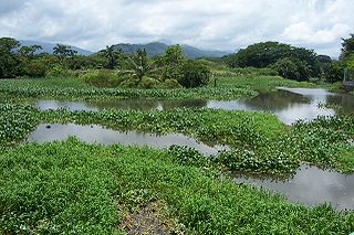
The Ulúa River is a river in western Honduras. It rises in the central mountainous area of the country close to La Paz and runs 240 kilometres (150 mi) approximately due northwards to the east end of the Gulf of Honduras at 15°55′N87°43′W. En route, it is joined by the Sulaco River, the Jicatuyo River, the Otoro River and the Chamelecón River.

The municipality of El Progreso is located in the Honduran department of Yoro.

Santa Rita is a municipality in the Honduran department of Copán.
Santa Rita is a municipality in the Honduran department of Yoro. The Humuya River passes through it.
San Marcos is a municipality in the Honduran department of Ocotepeque.
Concepción Las Minas is a municipality in southern Chiquimula department of Guatemala in Central America.
Monda River, also Monga River and Manga River is a river in the area of Sabá, Colón Department, Honduras.

The Choluteca River is a river in southern Honduras. Its source is in the Department of Francisco Morazán, near Lepaterique, and from there it flows north through the city of Tegucigalpa, then south through the department of El Paraíso, and the department and city of Choluteca. The mouth of the river—located among wetland—is near the coastal town of Cedeño, on the Gulf of Fonseca.

The Cangrejal River or Río Cangrejal is a river that drains several mountain tributaries and borders the rainforest of Pico Bonito National Park near La Ceiba, Honduras. The river offers some of the best whitewater rafting opportunities in Central America.
The Tela River or Río Tela is a river that runs through Tela, in Honduras, flowing into the Caribbean Sea. It begins in a marshy area inland and opens out near the sea.

The Lempa River is a 422-kilometre (262 mi) long river in Central America.
The Cuero River, also known as the Cuero and Salado River, is a river to the east of San Juan Pueblo and forming part of the Wildlife Refuge Cuero and Salada in Honduras.
The Leán River is a river on the northern Caribbean coast of Honduras slightly to the east of Tela, bordering the Punta Izopo National Park, in Atlántida Department.
The Otoro River, also known as the Grande de Otoro River, is a river in Honduras which begins in the department of Intibucá and then becomes the Ulúa River in the Santa Barbara Department.
The Papaloteca River is a river whose mouth runs through Nueva Armenia, in Honduras, flowing into the Caribbean Sea.

The Plátano River is a river in Honduras which runs through the Río Plátano Biosphere Reserve.

The El Salvador–Guatemala border is a 203 km international boundary in the northeast-southwest direction, northwest of El Salvador, and separating the country from the territory of Guatemala. From north to south, it starts in the triple border of the two countries with Honduras, near the peak Monte Cristo in Volcanoes National Park, extending to the southwest by the Pacific Ocean coast, following the final stage the Rio Paz. It separates the department of Jutiapa in Guatemala from Ahuachapan (north) and Santa Ana departments in El Salvador.


