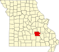
Darien, Missouri

Last updated

Darien
USA Missouri location map.svg
Red pog.svg
Darien
Coordinates: 37°31′12″N91°35′33″W / 37.52000°N 91.59250°W / 37.52000; -91.59250
CountryUnited States
State Missouri
County Dent County
Time zone UTC-6 (Central (CST))
  Summer (DST) UTC-5 (CDT)

Darien is an unincorporated community in Dent County, in the U.S. state of Missouri. [1]

History

A post office called Darien was established in 1888, and remained in operation until 1954. [2] The community was named after a place mentioned in the last line of the John Keats sonnet "On First Looking into Chapman's Homer". [3]

Related Research Articles

<span class="mw-page-title-main">Darien, Connecticut</span> Town in Connecticut, United States

Darien is a coastal town in Fairfield County, Connecticut, United States. With a population of 21,499 and a land area of just under 13 square miles (34 km2), it is the smallest town on Connecticut's Gold Coast. The town is part of the Western Connecticut Planning Region. It has a high rate of marriage, and high average number of children per household.

Fairdealing is an unincorporated community and census-designated place located in northeastern Ripley County in southeastern Missouri, United States. As of the 2020 census, the community had a population of 543. It is located along U.S. Route 160, approximately 16 miles (26 km) southwest of Poplar Bluff.

Elijah is an unincorporated community in eastern Ozark County, Missouri, United States. It is located approximately twenty-two miles west of West Plains on Missouri Supplemental Route V, one mile south of U.S. Route 160. The community is located on North Bridges Creek, with Spoon Spring within the village.

<span class="mw-page-title-main">Sherrill, Missouri</span> Unincorporated community in the American state of Missouri

Sherrill is an unincorporated community in northern Texas County, Missouri, United States. It is located approximately six miles north of Licking and is located just west of U.S. Route 63. Sherrill Creek flows past the north side of the community. The community of Beulah lies about 2.5 miles northwest on Sherrill Creek in Phelps County.

Philadelphia is an unincorporated community and census-designated place in western Marion County, Missouri, United States. It is located 12 miles (19 km) west of Palmyra on Missouri Route 168. The community is part of the Hannibal Micropolitan Statistical Area.

Simmons is a community in Texas County, in the U.S. state of Missouri. The community is located at the intersection of US Route 63 and Missouri Route Z, approximately seven miles south of Houston. The Big Piney River flows past the east side of the community.

Port Hudson is an unincorporated community in western Franklin County, in the U.S. state of Missouri. The community is on Missouri Route C and approximately two miles north of Leslie and US Route 50.

Good Water is an unincorporated community in northwest Iron County, in the U.S. state of Missouri.

New Market is a census designated place in northern Platte County, in the U.S. state of Missouri. It lies within the Kansas City metropolitan area. The population was 88 at the 2020 census.

Harper is an unincorporated community in St. Clair County, in the U.S. state of Missouri. The community is on Missouri Route 82 approximately ten miles east of Osceola and within one mile of the St. Clair - Hickory county line.

Bado is an unincorporated community in southwest Texas County, in the U.S. state of Missouri. Bado is located on Missouri Route M, along the banks of Little Piney Creek. The community is approximately nine miles west-southwest of Houston and nine miles north of Cabool. The store, post office, a rock house and White House are still standing.

Clear Springs is an unincorporated community in southern Texas County, in the U.S. state of Missouri. The community is located on Missouri Route Y, one mile east of Missouri Route 137. The spring is on the South Prong Jacks Fork, 1.5 miles south of the community site.

Dunn is an unincorporated community in southwest Texas County, in the U.S. state of Missouri. The community is located just south of U.S. Route 60, approximately four miles west of Cabool.

Dykes is an unincorporated community in southwest Texas County, in the U.S. state of Missouri. Dykes is located on Missouri Route 38, seven miles west of Houston.

Evening Shade is an unincorporated community in northwest Texas County, in the U.S. state of Missouri.

Hattie is an extinct town in southeast Texas County, in the U.S. state of Missouri. The GNIS classifies it as a populated place. The community is on the South Prong Jacks Fork, south of Missouri Route Y, and two miles north of the county line.

Kinderpost is an unincorporated community in northern Texas County, in the U.S. state of Missouri. The community is located on Missouri Route AT approximately 6.5 miles northwest of Licking. Spring Creek flows past to the east of the community.

Oscar is an unincorporated community within Jackson Township in Texas County, in the U.S. state of Missouri. The community is located on Missouri Route 137, approximately 5.5 miles south of Licking.

Sargent is an unincorporated community in southern Texas County, in the U.S. state of Missouri. The community is adjacent to the Burlington Northern Railroad, approximately four miles southeast of Cabool. The Texas County-Howell county line is about two miles south of the location. Potter Creek flows past the east side of the community.

Stultz is an unincorporated community in southern Texas County, in the U.S. state of Missouri. The community is located on a tributary of Elk Creek, approximately 2.3 miles east-southeast of the community of Elk Creek.

References

  1. U.S. Geological Survey Geographic Names Information System: Darien, Missouri
  2. "Post Offices". Jim Forte Postal History. Archived from the original on March 6, 2016. Retrieved September 27, 2016.
  3. Ramsay, Robert L. (1952). Our Storehouse of Missouri Place Names. University of Missouri Press. p. 137. ISBN   978-0-8262-0586-5.