Stone Hill | |
|---|---|
 Stone Hill | |
| Coordinates: 37°36′06″N91°20′31″W / 37.60167°N 91.34194°W | |
| Country | United States |
| State | Missouri |
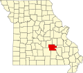
| County | Dent County |
| Time zone | UTC-6 (Central (CST)) |
| • Summer (DST) | UTC-5 (CDT) |
Stone Hill is an unincorporated community in eastern Dent County, Missouri. [1]
The community is on a county road just east of Missouri Route 72, approximately ten miles (16 km) east-southeast of Salem. Stone Hill Branch flows past the south side of the community to its confluence with the Meramec River two point five miles (4.0 km) to the west. Howes Mill is two point five miles (4.0 km) to the east-northeast on Missouri Route 32. [2] [3]