Darien | |
|---|---|
 Darien | |
| Coordinates: 37°31′12″N91°35′33″W / 37.52000°N 91.59250°W | |
| Country | United States |
| State | Missouri |
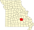
| County | Dent County |
| Time zone | UTC-6 (Central (CST)) |
| • Summer (DST) | UTC-5 (CDT) |
Darien is an unincorporated community in Dent County, in the U.S. state of Missouri. [1]