Dedza

Last updated

Dedza
Dedza.JPG
Malawi adm location map.svg
Red pog.svg
Dedza
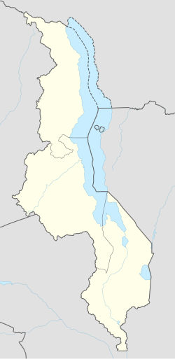
Location in Malawi
Coordinates: 14°20′S34°20′E / 14.333°S 34.333°E / -14.333; 34.333
CountryFlag of Malawi.svg  Malawi
Region Central Region
District Dedza District
Elevation
1,590 m (5,220 ft)
Population
 (2018 Census [1] )
  Total30,928
Time zone +2
Climate Cwb
Location of Dedza in Malawi Malawi-Dedza.png
Location of Dedza in Malawi
Altitude marker of Dedza in Malawi Dedza Altitude.JPG
Altitude marker of Dedza in Malawi

Dedza is the main township of Dedza District in the Central Region of Malawi.

Contents

Description

Dedza is located about 85 km south of Malawi's capital, Lilongwe, off the M1 road to Blantyre at a point where a trans-African highway from Johannesburg enters the country.

At an altitude of 1590m it is the highest town in Malawi. In June and July it can be chilly, especially in the mornings and evenings.

The town is based around a bypass loop of tarmac road connected to the M1. At the northern end of the town centre there is a bus station, Town Assembly offices, sports stadium, police station, banks and petrol station. At the southern end there is a hospital and large market. There are many shops and businesses along the road and a parallel dirt road. Two other petrol stations are located on the M1.

Accommodation is available at the Dedza Pottery, [2] Panjira Lodge, Rainbow Resthouse and other local resthouses. There are a number of bars and cafes in the town centre, such as the Boiz Club and Golden Dish and a cyber-café – AY Business Cafe. The Dedza Pottery Coffee Shop is 1 km along a dirt road near the M1 northern junction.

The Dedza Pottery sells a wide range of ceramics and there are a number of craft shops along the dirt road to it. A walk up to the top of Dedza Mountain (2198m) is possible on a maintenance road for the communication aerials.

The main industries of the town are Paragon Ceramics, which makes floor and roof tiles, etc., located at the Dedza Pottery and the WICO Sawmill on the opposite side of the road.

The offices of the various departments of the Dedza District Assembly are located in the township. So also are offices for several NGOs operating in the district, such as Save the Children, Concern Universal and the Red Cross. The town has several primary schools, Mchisu day secondary school and Umbwi and Dedza Secondary boarding schools.

Dedza is linked with Norwich, UK by the Norwich-Dedza Partnership, [3] a UK-based charity. The partnership supports education, health, agriculture, tourism development and public sector organisations in Dedza District through volunteer workers, supply of computers and other materials and small scale funding.

The eye clinic at Dedza District Hospital is supported by Norwich charity Far Sight which has provided training and equipment.

Climate

Dedza has a subtropical highland climate (Köppen: Cwb) with cool to warm temperatures year round. The rainy season runs from November to April, and the dry season runs from May to October.

Climate data for Dedza
MonthJanFebMarAprMayJunJulAugSepOctNovDecYear
Average high °C (°F)23.0
(73.4)
23.0
(73.4)
23.0
(73.4)
22.5
(72.5)
21.2
(70.2)
19.4
(66.9)
19.0
(66.2)
20.5
(68.9)
23.3
(73.9)
24.9
(76.8)
24.9
(76.8)
23.5
(74.3)
22.3
(72.1)
Daily mean °C (°F)18.7
(65.7)
19.0
(66.2)
18.5
(65.3)
17.6
(63.7)
15.9
(60.6)
14.0
(57.2)
13.6
(56.5)
15.2
(59.4)
17.8
(64.0)
19.7
(67.5)
20.0
(68.0)
19.1
(66.4)
17.4
(63.3)
Average low °C (°F)15.5
(59.9)
15.4
(59.7)
15.0
(59.0)
13.9
(57.0)
11.7
(53.1)
9.5
(49.1)
9.1
(48.4)
10.6
(51.1)
13.2
(55.8)
15.0
(59.0)
15.9
(60.6)
15.7
(60.3)
13.4
(56.1)
Average precipitation mm (inches)288.6
(11.36)
233.9
(9.21)
179.6
(7.07)
67.0
(2.64)
10.6
(0.42)
4.1
(0.16)
3.7
(0.15)
1.3
(0.05)
4.0
(0.16)
11.9
(0.47)
74.1
(2.92)
231.0
(9.09)
1,109.8
(43.69)
Average precipitation days (≥ 0.3 mm)201713622321261589
Average relative humidity (%)84868381726766605557658071
Mean monthly sunshine hours 151.9142.8182.9213.0248.0246.0241.8269.7288.0288.3225.0164.32,661.7
Mean daily sunshine hours 4.95.15.97.18.08.27.88.79.69.37.55.37.3
Source: NOAA [4]

Demographics

YearPopulation [5] [1]
19775,448
198716,899
199815,408
200820,241
201830,928

See also

Related Research Articles

Lilongwe Capital of Malawi

Lilongwe is the capital and most populated city of the African country of Malawi. It has a population of 989,318 as of the 2018 Census, up from a population of 674,448 in 2008. In 2020 that figure was 1,122,000. The city is located in the central region of Malawi, in the district of the same name, near the borders with Mozambique and Zambia, and it is an important economic and transportation hub for central Malawi. It is named after the Lilongwe River.

Conisbrough Town in South Yorkshire, England

Conisbrough is a town within the Metropolitan Borough of Doncaster, in South Yorkshire, England. It is roughly midway between Doncaster and Rotherham, and is built alongside the River Don at 53°29′N1°14′W. It has a ward population of 14,333.

Stoke-upon-Trent Human settlement in England

Stoke-upon-Trent, commonly called Stoke is one of the six towns that along with Hanley, Burslem, Fenton, Longton and Tunstall form the city of Stoke-on-Trent, in Staffordshire, England.

Somerville, Victoria Town in Victoria, Australia

Somerville is a town on the Mornington Peninsula in Victoria, Australia, 55 km southeast from Melbourne's central business district, and forms part of the urban enclave on Western Port comprising Somerville, Hastings, Bittern, Crib Point, and Tyabb. Statistically, it is part of Greater Melbourne. Its local government area is the Shire of Mornington Peninsula. At the 2016 Census, Somerville had a population of 11,336 up from 10,730 in 2011, 10,704 in 2006 and 10,049 in 2001.

Blantyre Place in Southern Region, Malawi

Blantyre is Malawi's centre of finance and commerce, and its second largest city, with an enumerated 800,264 inhabitants as of 2018. It is sometimes referred to as the commercial and industrial capital of Malawi as opposed to the political capital, Lilongwe. It is the capital of the country's Southern Region as well as the Blantyre District.

Nkhotakota Place in Central Region, Malawi

Nkhotakota (Un-kho-tah-kho-tuh) is a town and one of the districts in the Central Region of Malawi. It is on the shore of Lake Malawi and is one of the main ports on Lake Malawi. As of 2018, Nkhotakota had a population estimated at 28,350. The district had a population of 301.000.

Salima, Malawi Place in Central Region, Malawi

Salima is a township in the Central Region of Malawi and the capital of the Salima District.

Balaka Township, Malawi Place in Southern Region, Malawi

Balaka is a township in Southern Region, Malawi and headquarters for the Balaka District. The township was formerly a boma of Machinga District, before the Balaka District was created in 1998.

Manapouri Town in Fiordland, New Zealand

Manapouri is a small town in Southland / Fiordland, in the southwest corner of the South Island, in New Zealand. The township is the westernmost municipality in New Zealand. Located at the edge of the Fiordland National Park, on the eastern shore of Lake Manapouri, close to its outflow into the Waiau River, tourist boat services are based in the town.

Hillston, New South Wales Town in New South Wales, Australia

Hillston is a township in western New South Wales, Australia, in Carrathool Shire, on the banks of the Lachlan River. It was founded in 1863 and at the 2016 census had a population of 1,465.

Tunstall, Staffordshire Human settlement in England

Tunstall is one of the six towns that, along with Burslem, Longton, Fenton, Hanley and Stoke-upon-Trent, amalgamated to form the City of Stoke-on-Trent in Staffordshire, England. It was one of the original six towns that federated to form the city. Tunstall is the most northern, and fourth largest town of the Potteries. It is situated in the very northwest of the city borough, with its north and west boundaries being the city limit. It stands on a ridge of land between Fowlea Brook to the west and Scotia Brook to the east, surrounded by old tile making and brick making sites, some of which date back to the Middle Ages.

Dedza is a district in the Central Region of Malawi. It covers an area of 3,624 km.² to the south of the Malawi capital, Lilongwe, between Mozambique and Lake Malawi. The capital is Dedza.

Kulai Town in Johor, Malaysia

Kulai is a town and the capital of Kulai District, Johor, Malaysia. It is administered by the Kulai Municipal Council (MPKu), which was earlier known as the Kulai District Council.

Manises Municipality in Valencian Community, Spain

Manises is a municipality in the comarca of Horta Oest in the Valencian Community, Spain. Located in the province of Valencia, it had 30,693 inhabitants in 2018 (NSI) and is famous for its pottery and being the location of Valencia Airport.

Macanga District District in Tete, Mozambique

Macanga is a district situated in the north part of Tete Province in the central region of Mozambique. Its administrative center is the town of Furancungo. The district is located in the north of the province, and borders with Dedza District and Lilongwe District of Malawi in the north, Angónia District in the east, Tsangano District in the southeast, Chiuta District in the south, and with Chifunde District in the west. The area of the district is 6,999 square kilometres (2,702 sq mi). It has a population of 112,551 as of 2007.

Angónia District District in Tete, Mozambique

Angónia District is a district in the northern part of Tete Province in the central region of Mozambique. Its administrative center is the town of Ulongué. The district is located in the northwest of the province, and borders with Dedza District of Malawi in the north, Ntcheu District of Malawi in the east, Tsangano District in the south, and with Macanga District in the west. The area of the district is 3,277 square kilometres (1,265 sq mi). It has a population of 335,808 as of 2007.

Drayton, Norfolk Human settlement in England

Drayton, Norfolk, is a suburban village in the county of Norfolk and district of Broadland 4.3 miles (6.9 km) north west of Norwich. It is situated on the A1067 road between Hellesdon and Taverham.

Folkestone services Service station

Stop 24 services is a motorway service station on the M20 motorway at Westenhanger, seven miles from Folkestone in Kent, England. They are the second to be built on the motorway and were opened in 2007.

Putney School of Art and Design

Putney School of Art and Design (PSAD) is an art college in Putney, in the London Borough of Wandsworth.

The Golomoti Solar Power Station is a 20 MW (27,000 hp) solar power plant, under construction in Malawi. The power station is being developed by a consortium comprising InfraCo Africa of the United Kingdom and JCM Power, a Canadian independent power producer. The solar farm is expected to come online during the fourth quarter of 2021.

References

  1. 1 2 "2018 Population and Housing Census Main Report" (PDF). Malawi National Statistical Office. Retrieved 25 December 2019.
  2. "Index of /". nyasalodges.com. Retrieved 19 February 2018.
  3. "Norwich - Dedza Partnership : Home". www.norwich-dedza.org. Retrieved 19 February 2018.
  4. "Dedza Climate Normals 1961–1990". National Oceanic and Atmospheric Administration . Retrieved 8 March 2015.
  5. World Gazetteer: Malawi: largest cities and towns and statistics of their population Archived 27 September 2007 at archive.today

Coordinates: 14°22′S34°20′E / 14.367°S 34.333°E / -14.367; 34.333