Deer Plain, Illinois | |
|---|---|
 Deer Plain, Illinois  Deer Plain, Illinois | |
| Coordinates: 38°55′54″N90°31′59″W / 38.93167°N 90.53306°W | |
| Country | United States |
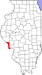
| State | Illinois |
| County | Calhoun |
| Elevation | 453 ft (138 m) |
| Time zone | UTC-6 (Central (CST)) |
| • Summer (DST) | UTC-5 (CDT) |
| Area code | 618 |
| GNIS feature ID | 422610 [1] |
Deer Plain is an unincorporated community in Calhoun County, Illinois, United States. It is located in the southeastern part of the county, near the confluence of the Illinois and Mississippi rivers. It was named "Deer Plain" because deer were commonly seen grazing in the area.