Mozier Landing, Illinois | |
|---|---|
 Mozier Landing, Illinois  Mozier Landing, Illinois | |
| Coordinates: 39°15′20″N90°43′33″W / 39.25556°N 90.72583°W | |
| Country | United States |
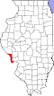
| State | Illinois |
| County | Calhoun |
| Elevation | 443 ft (135 m) |
| Time zone | UTC-6 (Central (CST)) |
| • Summer (DST) | UTC-5 (CDT) |
| Area code | 618 |
| GNIS feature ID | 414160 [1] |
Mozier Landing is an unincorporated community in Calhoun County, Illinois, United States. Mozier Landing is located along the Mississippi River north of Hamburg.