Dennis, Kansas | |
|---|---|
 | |
 Dennis  Dennis | |
| Coordinates: 37°20′49″N95°24′46″W / 37.34694°N 95.41278°W [1] | |
| Country | United States |
| State | Kansas |
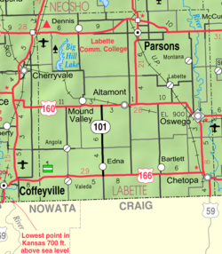
| County | Labette |
| Founded | 1880s |
| Elevation | 929 ft (283 m) |
| Population | |
• Total | 152 |
| Time zone | UTC-6 (CST) |
| • Summer (DST) | UTC-5 (CDT) |
| Area code | 620 |
| FIPS code | 20-17675 [1] |
| GNIS ID | 2804492 [1] |
Dennis is a census-designated place (CDP) in Labette County, Kansas, United States. [1] As of the 2020 census, the population was 152. [2]
