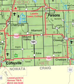
Labette County is a county located in Southeast Kansas. Its county seat is Oswego, and its most populous city is Parsons. As of the 2020 census, the county population was 20,184. The county was named after LaBette creek, the second-largest creek in the county, which runs roughly NNW-SSE from near Parsons to Chetopa. The creek in turn was named after French-Canadian fur trapper Pierre LaBette who had moved to the area, living along the Neosho River, and marrying into the Osage tribe in the 1830s and 1840s.

Latham is a city in Butler County, Kansas, United States. As of the 2020 census, the population of the city was 96.

Leon is a city in Butler County, Kansas, United States. As of the 2020 census, the population of the city was 669.

Mulberry is a city in Crawford County, Kansas, United States. As of the 2020 census, the population of the city was 409.

Jennings is a city in Decatur County, Kansas, United States. As of the 2020 census, the population of the city was 81.

Howard is a city in and the county seat of Elk County, Kansas, United States. As of the 2020 census, the population of the city was 570.

Hamilton is a city in Greenwood County, Kansas, United States. As of the 2020 census, the population of the city was 182.

Mankato is a city in and the county seat of Jewell County, Kansas, United States. As of the 2020 census, the population of the city was 836.

Altamont is a city in Labette County, Kansas, United States. As of the 2020 census, the population of the city was 1,061.
Chetopa is a city in Labette County, Kansas, United States. As of the 2020 census, the population of the city was 929. Chetopa was named for Chief Chetopah, an Osage Indian chief. Later, the community name was shortened.
Edna is a city in Labette County, Kansas, United States. As of the 2020 census, the population of the city was 388.
Labette is a city in Labette County, Kansas, United States. As of the 2020 census, the population of the city was 50.
Mound Valley is a city in Labette County, Kansas, United States. As of the 2020 census, the population of the city was 348.
Parsons is a city in Labette County, Kansas, United States. As of the 2020 census, the population of the city was 9,600. It is the most populous city of Labette County, and the second-most populous city in the southeastern region of Kansas. It is home to Labette Community College and the Parsons State Hospital & Training Center.

Meade is a city in and the county seat of Meade County, Kansas, United States. As of the 2020 census, the population of the city was 1,505.

Ogden is a city in Riley County, Kansas, United States. As of the 2020 census, the population of the city was 1,661. It is located near Fort Riley between Manhattan and Junction City.
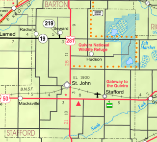
St. John is a city in and the county seat of Stafford County, Kansas, United States. As of the 2020 census, the population of the city was 1,228.

Belle Plaine is a city in Sumner County, Kansas, United States. As of the 2020 census, the population of the city was 1,467.

Palmer is a city in Washington County, Kansas, United States. As of the 2020 census, the population of the city was 125.

Lebo is a city in Coffey County, Kansas, United States. As of the 2020 census, the population of the city was 885.