
The York River is a river in Renfrew County, Hastings County and Haliburton County in Ontario, Canada. The river is in the Saint Lawrence River drainage basin, and flows from the southern extension of Algonquin Provincial Park to the Madawaska River.

Lennox and Addington County is a county and census division of the Canadian province of Ontario. The county seat is Greater Napanee. It is located in the subregion of Southern Ontario named Eastern Ontario.
The Moira River is a river in Hastings County in eastern Ontario, Canada. It travels from its source in the centre of the county to the Bay of Quinte at the county seat Belleville.

The Napanee River is a river in Lennox and Addington County and Frontenac County in Eastern Ontario, Canada. It is in the Great Lakes Basin and flows from its source at Camden Lake to its mouth at the Bay of Quinte on Lake Ontario at Napanee. It flows through a valley of preglacial origin. The valley of the Napanee is lined with settlements such as Greater Napanee, Newburgh, Camden East, Yarker, and Petworth.

The Bonnechere River is a river in the Saint Lawrence River drainage basin in Nipissing District and Renfrew County in eastern and northeastern Ontario, Canada. The river flows from Algonquin Provincial Park to the Ottawa River east and north of the town of Renfrew. The river's name is thought to come from the French "bonne chère" meaning "good cheer".

The Opeongo River is a river in the Saint Lawrence River drainage basin in Nipissing District in northeastern Ontario, Canada. The river is entirely within Algonquin Provincial Park and Opeongo River Provincial Park, except for a small portion around Victoria Lake, and is a left tributary of the Madawaska River.

The Barron River is a river in the Saint Lawrence River drainage basin in Nipissing District and Renfrew County, Ontario, Canada. It flows from Clemow Lake in northern Algonquin Provincial Park and joins the Petawawa River, whose southern branch it forms, in the municipality of Laurentian Hills, near the municipality of Petawawa.

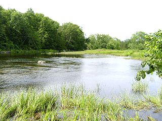
The Skootamatta River is a river in the Lake Ontario drainage basin in Hastings and Lennox and Addington Counties in Ontario, Canada. It flows from Joeperry Lake to join the Moira River in Tweed. The river's name is thought to come from Ojibwa words meaning "burnt shoreline".

The Crowe River is a river in the counties of Haliburton, Hastings, Northumberland and Peterborough in southern Ontario, Canada. It is in the Lake Ontario drainage basin and is a tributary of the Trent River.
King's Highway 41, commonly referred to as Highway 41, is a provincially maintained highway in the Canadian province of Ontario. The 159.6-kilometre (99.2 mi) highway travels in a predominantly north–south direction across eastern Ontario, from Highway 7 in Kaladar to Highway 148 in Pembroke. The majority of this distance crosses through a rugged forested region known as Mazinaw Country. However, the route enters the agricultural Ottawa Valley near Dacre. A significant portion of Highway 41 follows the historic Addington Colonization Road, built in 1854.
Partridge Creek is a creek in the Moira River and Lake Ontario drainage basins in Hastings and Lennox and Addington Counties, Ontario, Canada.
Black Donald Lake is a reservoir lake in the Township of Greater Madawaska, Renfrew County, and the Township of North Frontenac, Frontenac County, in Eastern Ontario, Canada. It is on the Madawaska River and is part of the Saint Lawrence River drainage basin.
Bobs Lake is a lake in Frontenac County and Lanark County in Eastern Ontario, Canada. It is in the St. Lawrence River drainage basin and is the source of the Tay River.

Centennial Lake is a reservoir lake in the Township of Greater Madawaska, Renfrew County, and the Township of North Frontenac, Frontenac County, in Eastern Ontario, Canada. It is on the Madawaska River and is part of the Saint Lawrence River drainage basin.
Depot Creek may refer to:
Haggart Creek is a creek in the municipalities of Georgian Bay and Muskoka Lakes, District Municipality of Muskoka in Central Ontario, Canada. It is in the Great Lakes Basin and is a right tributary of the Moon River.
The Chenal Ecarté is a river in the municipalities of Saint Clair and Chatham-Kent in Southwestern Ontario, Canada. It is a left distributary of the St. Clair River that flows to Lake St. Clair, and thus is part of the Great Lakes Basin. The river also separates mainland Ontario from the northeast edge of Walpole Island, and the entire eastern edge of St. Anne Island, which both are part of the Walpole Island 46 reserve of the Walpole Island First Nation.
Silver Lake Creek is a short stream in Tay Valley, Lanark County in Eastern Ontario, Canada. It flows from Silver Lake to the Fall River and is in the Ottawa River drainage basin.
Wesleys Creek is a stream in Central Frontenac, Frontenac County, and Tay Valley, Lanark County in Eastern Ontario, Canada. It flows to Silver Lake and is in the Ottawa River drainage basin.

Millhaven Creek is a stream in the municipalities of Loyalist, Lennox and Addington County, and South Frontenac, Frontenac County, and the single-tier municipality of Kingston in eastern Ontario, Canada. It is a tributary of Lake Ontario and is under the auspices of the Cataraqui Region Conservation Authority.
