
Natchitoches Parish is a parish located in the U.S. state of Louisiana. As of the 2020 census, the population was 37,515. The parish seat is Natchitoches. The parish was formed in 1805.
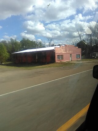
Natchez is a village in Natchitoches Parish, Louisiana, United States. The population was 597 at the 2010 census. It is part of the Natchitoches Micropolitan Statistical Area. The village and parish are part of the Cane River National Heritage Area and located on Isle Brevelle.

Natchitoches, officially the City of Natchitoches, is a small city and the parish seat of Natchitoches Parish, Louisiana, United States. Established in 1714 by Louis Juchereau de St. Denis as part of French Louisiana, the community was named after the indigenous Natchitoches people.

Provencal is a village in Natchitoches Parish, Louisiana, United States. The population was 611 at the 2010 census. It is part of the Natchitoches Micropolitan Statistical Area.

Robeline is a village in western Natchitoches Parish, Louisiana, United States. The population was 183 at the 2000 census. It is part of the Natchitoches Micropolitan Statistical Area.

Adai is an extinct Native American language that was spoken in northwestern Louisiana.

Cane River Lake is a 35 mi (56 km) oxbow lake formed from a portion of the Red River in Natchitoches Parish, Louisiana, United States. It runs throughout the Natchitoches' historic district to the south and is famous for the numerous plantations, particularly Melrose being located on or near its banks.

Cane River is a 30-mile-long (48 km) river formed from a portion of the Red River that is located in Natchitoches Parish, Louisiana. In the 19th and 20th centuries, it has been best known as the site of a historic Creole de couleur (multiracial) culture that has centers upon the National Historic Landmark Melrose Plantation and nearby St. Augustine Parish Church.
The Cane River National Heritage Area is a United States National Heritage Area in the state of Louisiana. The heritage area is known for plantations featuring Creole architecture, as well as numerous other sites that preserve the multi-cultural history of the area. The heritage area includes the town of Natchitoches, Louisiana and its national historic district. Founded in 1714, it is the oldest community in the territory covered by the Louisiana Purchase. Cane River Creole National Historical Park, including areas of Magnolia and Oakland plantations, also is within the heritage area.

Oakland Plantation, originally known as the Jean Pierre Emmanuel Prud'homme Plantation, and also known as Bermuda, is a historic plantation in and unincorporated area of Natchitoches Parish, Louisiana. Founded as a forced-labor farm worked by enslaved Black people for White owners, it is one of the nation's best and most intact examples of a French Creole cotton plantation complex. The Oakland Plantation is now owned by the National Park Service as part of the Cane River Creole National Historical Park.

Melrose Plantation, also known as Yucca Plantation, is a National Historic Landmark located in the unincorporated community of Melrose in Natchitoches Parish in north central Louisiana. This is one of the largest plantations in the United States built by and for free blacks. The land was granted to Louis Metoyer, who had the "Big House" built beginning about 1832. He was a son of Marie Thérèse Coincoin, a former slave who became a wealthy businesswoman in the area, and Claude Thomas Pierre Métoyer. The house was completed in 1833 after Louis' death by his son Jean Baptiste Louis Metoyer. The Metoyers were free people of color for four generations before the American Civil War.

Louisiana African American Heritage Trail is a cultural heritage trail with 38 sites designated by the state of Louisiana, from New Orleans along the Mississippi River to Baton Rouge and Shreveport, with sites in small towns and plantations also included. In New Orleans several sites are within a walking area. Auto travel is required to reach sites outside the city.

St. Augustine Catholic Church and Cemetery, or the Isle Brevelle Church, is a historic Catholic parish property founded in 1829 near Melrose, Natchitoches Parish, Louisiana. It is the cultural center of the Cane River area's historic French, Spanish, Native American and Black Creole community.
Flora is an unincorporated community in Natchitoches Parish, Louisiana, United States. It is located near the intersection of Louisiana highways 120 and 478, south of Natchitoches near Isle Brevelle and the El Camino Real de los Tejas National Historic Trail.

This is a list of the National Register of Historic Places listings in Natchitoches Parish, Louisiana.

The Basilica of the Immaculate Conception is a minor basilica located in Natchitoches, Louisiana, United States. It is also a parish church in the Diocese of Alexandria. The church building is the seventh structure to house the parish and was at one time the cathedral for the Roman Catholic Diocese of Natchitoches. As the Church of the Immaculate Conception it was listed as contributing property in the Natchitoches Historic District on the National Register of Historic Places.

Isle Brevelle is an ethnically and culturally diverse community, which began as a Native American and Louisiana Creole settlement and is located in Natchitoches Parish, Louisiana. For many years this area was known as Côte Joyeuse. It is considered the birthplace of Creole culture and remains the epicenter of Creole art and literature blending European, African, and Native American cultures. It is home to the Cane River Creole National Historical Park and part of the Louisiana African American Heritage Trail.
Anne des Cadeaux (unknown—1754), was a Native American and devout Catholic. She was enslaved but later gained her freedom. She was active in early colonial Louisiana, and was from one of the early Louisiana Creole families.
Bayou Brevelle is a series of interconnected, natural waterways totaling over 18 miles in length in Natchitoches Parish, Louisiana. Its main channel is at Old River at Montrose, LA to Natchez, LA near the Cane River. During heavy rains or floods, Bayou Brevelle joins the Cane River. The bayou is flanked by Interstate 49 on the west and the Cane River on the east, and is one of the many waterways on Isle Brevelle.


