Derwent, Ohio

Last updated

Location of Derwent, Ohio OHMap-doton-Derwent.png
Location of Derwent, Ohio

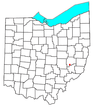
Derwent is an unincorporated community in central Valley Township, Guernsey County, Ohio, United States. [1] It is located near the southern border of Guernsey and Noble counties.

Derwent lies in southeastern Ohio, a part of the Unglaciated Allegheny Plateau region. It is located about seven miles from Senecaville Lake. State Route 313 (Clay Pike Road) runs on the southern edge of Derwent, and its interchange with Interstate 77 is a little over 1 mile (1.6 km) away. Major cities nearby include Zanesville (33.5 miles (53.9 km)) and Marietta (40 miles (64 km)). The intersection of two cross-country highways (Interstate 77 and 70) is 8 miles (13 km) away.

The Penn Central rail line ran through the eastern portion of Derwent (heading south to Marietta) and which crossed the Baltimore and Ohio rail line ran immediately to the south, heading toward Cumberland, Ohio and which eventually terminated at the Muskingum Electric Railroad. The former Penn Central line is in the process of being rebuilt by the Byesville Scenic Railway.

History

Derwent was platted in 1898. [2]

Related Research Articles

<span class="mw-page-title-main">U.S. Route 22</span> Highway in the United States

U.S. Route 22 (US 22) is a major west–east route and one of the original United States Numbered Highways, founded in 1926. It runs from Cincinnati, Ohio, at US 27, US 42, US 127, and US 52 to Newark, New Jersey, at US 1/9 at the Newark Airport Interchange.

<span class="mw-page-title-main">Interstate 77</span> Interstate Highway from South Carolina to Ohio

Interstate 77 (I-77) is a north–south Interstate Highway in the Eastern United States. It traverses diverse terrain, from the mountainous state of West Virginia to the rolling farmlands of North Carolina and Ohio. It largely supplants the old US Route 21 (US 21) between Cleveland, Ohio, and Columbia, South Carolina, as an important north–south corridor through the middle Appalachian Mountains. The southern terminus of I-77 is in Cayce, South Carolina, in Lexington County at the junction with I-26. The northern terminus is in Cleveland at the junction with I-90. Other major cities that I-77 connects to include Columbia, South Carolina; Charlotte, North Carolina; Charleston, West Virginia; and Akron, Ohio. The East River Mountain Tunnel, connecting Virginia and West Virginia, is one of only two instances in the US where a mountain road tunnel crosses a state line. The other is the Cumberland Gap Tunnel, connecting Tennessee and Kentucky. I-77 is a snowbird route to the Southern US for those traveling from the Great Lakes region.

<span class="mw-page-title-main">Byesville, Ohio</span> Village in Ohio, United States

Byesville is a village in Guernsey County, Ohio, United States, along Wills Creek. The population was 2,364 at the 2020 census.

<span class="mw-page-title-main">Kimbolton, Ohio</span> Census-designated place in Ohio, United States

Kimbolton is an unincorporated community and census-designated place in Guernsey County, Ohio, United States, along Wills Creek. The population was 152 at the 2020 census.

<span class="mw-page-title-main">Belle Valley, Ohio</span> Village in Ohio, United States

Belle Valley is a village in Noble County, Ohio, United States. The population was 201 at the 2020 census.

The Georgia Northeastern Railroad is a short line freight railroad which runs from the town of Elizabeth, Georgia to the city of Blue Ridge, Georgia. Goods hauled are mostly timber, grain, poultry, and marble products. The GNRR's subsidiary, the Blue Ridge Scenic Railway, also operates on this line north of Blue Ridge. Despite the name, it actually operates between north-central and northwest Georgia, from north-northwest metro Atlanta, and is a few counties away from northeast Georgia.

<span class="mw-page-title-main">U.S. Route 21</span> Highway in the United States

U.S. Route 21 or U.S. Highway 21 (US 21) is a major north–south United States Numbered Highway in the Southeastern United States that extends 394 miles (634 km). The southern terminus is in Hunting Island State Park, South Carolina, 14.4 miles (23.2 km) south of the junction with US 21 Business and South Carolina Highway 802 (SC 802) in Beaufort. The northern terminus is in Wytheville, Virginia, at an interchange with Interstate 81 (I-81) and US 52. Despite the "1" indicating that it is a major north–south highway, US 21 only travels through three states and is no longer a cross-country route as it has been replaced with I-77 in both Ohio and West Virginia. It also has the second-shortest length of all of the major north–south routes, just behind US 91. The route travels through the states of South Carolina, North Carolina, and Virginia. It also connects through major Southeastern cities such as Columbia, South Carolina, and Charlotte, North Carolina. The northern portion of the road travels parallel to I-77 in northern South Carolina and North Carolina. The road also has three interchanges with I-26 in Lexington and Calhoun counties in South Carolina.

<span class="mw-page-title-main">Ohio State Route 821</span> State highway in southeastern Ohio, US

State Route 821 (SR 821) is a north–south state highway in the southeastern portion of the U.S. state of Ohio. A state-maintained section of the old US 21, its southern terminus is at SR 60 approximately 2 miles (3.2 km) north of Marietta, and its northern terminus is at I-77 in Byesville, along with the eastern terminus of SR 209. The route is entirely undivided surface road, and is much less direct than the newer I-77 which supplanted it as a through route. As the interstate was being built, the designation of US 21 was moved to the freeway before Ohio wholly decommissioned the now-superfluous U.S. route. SR 821 was designated about two years after US 21 was moved onto I-77 in southeastern Ohio.

<span class="mw-page-title-main">West Orange Trail</span>

The West Orange Trail is a 22-mile (35 km) long multi-use rail trail owned by Orange County Parks and Recreation in Orange County, Florida, in the United States. The paved trail passes through downtown Oakland, Winter Garden, and Apopka with most of its length built on old railroad alignments. To the west of the West Orange Trail is the South Lake-Lake Minneola Scenic Trail in Lake County which was connected to the trail in 2007.

<span class="mw-page-title-main">Interstate 76 (Ohio–New Jersey)</span> Interstate from Ohio to New Jersey

Interstate 76 (I-76) is an east–west Interstate Highway in the Eastern United States. The highway runs approximately 435 miles (700 km) from an interchange with I-71 west of Akron, Ohio, east to I-295 in Bellmawr, New Jersey. This route is not contiguous with I-76 in Colorado and Nebraska.

The Whitewater Valley Railroad is a heritage railroad in southeastern Indiana between Connersville and Metamora.

<span class="mw-page-title-main">U.S. Route 422</span> Highway in Ohio and Pennsylvania

U.S. Route 422 (US 422) is a 271-mile (436 km) long spur route of US 22 split into two segments in the U.S. states of Ohio and Pennsylvania. The western segment of US 422 runs from downtown Cleveland, Ohio, east to Ebensburg, Pennsylvania. The eastern segment, located entirely within Pennsylvania, runs from Hershey east to King of Prussia, near Philadelphia. US 422 Business serves as a business route into each of four towns along the way.

<span class="mw-page-title-main">Transportation in Virginia</span> Overview of land sea and air transport systems in Virginia

Transportation in the Commonwealth of Virginia is by land, sea and air. Virginia's extensive network of highways and railroads were developed and built over a period almost 400 years, beginning almost immediately after the founding of Jamestown in 1607, and often incorporating old established trails of the Native Americans.

<span class="mw-page-title-main">Ohio State Route 60</span> State highway in Ohio, US

State Route 60 is a north–south state highway that runs the entire length of the U.S. state of Ohio, from the Williamstown Bridge over the Ohio River in Marietta to U.S. Route 6 near Lake Erie in Vermilion. It is the seventh longest state route in Ohio.

<span class="mw-page-title-main">Interstate 81 in New York</span> Highway in New York

Interstate 81 (I-81) is a part of the Interstate Highway System that runs from I-40 at Dandridge, Tennessee, to the Thousand Islands Bridge at Wellesley Island in New York, beyond which the short 2.7-mile (4.3 km) Ontario Highway 137 (Highway 137) links it to Highway 401. In the US state of New York, I-81 extends 183.60 miles (295.48 km) from the Pennsylvania state line southeast of Binghamton to the Canadian border at Wellesley Island northwest of Alexandria Bay. The freeway runs north–south through Central New York, serving the cities of Binghamton, Syracuse, and Watertown. It passes through the Thousand Islands in its final miles and crosses two bridges, both part of the series of bridges known as the Thousand Islands Bridge.

Byesville Scenic Railway is a tourist railroad located in Byesville, Ohio. Service was suspended in 2011, and as of late 2021 has not resumed.

<span class="mw-page-title-main">Ohio State Route 761</span> State highway in Ohio, US

State Route 761 (SR 761) is a short state highway in the east-central portion of Ohio. The highway runs for 4.3 miles (6.9 km) from a T-intersection with SR 313 approximately four miles (6.4 km) southwest of Salesville to its junction with SR 265 in Salesville. This state route is also known as Kennonsburg Road for its entire length.

<span class="mw-page-title-main">Hi Carpenter Memorial Bridge</span> Cantilever bridge over the Ohio River between Newport, Ohio and St. Marys, West Virginia

The Hi Carpenter Memorial Bridge is a cantilever bridge over the Ohio River between Newport, Ohio and St. Marys, West Virginia. It carries Ohio State Route 807 and West Virginia Route 807 and serves to connect WV 2 with OH 7.

<span class="mw-page-title-main">Owensburg, Indiana</span> Census-designated place in Indiana, United States

Owensburg is an unincorporated community and census-designated place (CDP) in Jackson Township, Greene County, Indiana, United States. It was named in honor of the Owens family of early settlers. As of the 2010 census it had a population of 406.

<span class="mw-page-title-main">Seven Ranges</span> Land tract in eastern Ohio, US

The Seven Ranges was a land tract in eastern Ohio that was the first tract to be surveyed in what became the Public Land Survey System. The tract is 42 miles (68 km) across the northern edge, 91 miles (146 km) on the western edge, with the south and east sides along the Ohio River. It consists of all of Monroe, Harrison, Belmont and Jefferson, and portions of Carroll, Columbiana, Tuscarawas, Guernsey, Noble, and Washington County.

References

  1. U.S. Geological Survey Geographic Names Information System: Derwent, Ohio
  2. Sarchet, Cyrus Parkinson Beatty (1911). History of Guernsey County, Ohio, Volume 1. B.F. Bowen & Company. p. 347.

39°55′23″N81°32′39″W / 39.92306°N 81.54417°W / 39.92306; -81.54417