Quaker City, Ohio

Last updated

Quaker City, Ohio
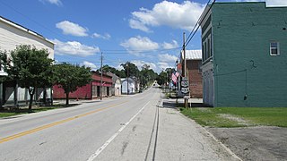
South below Fair in Quaker City.jpg
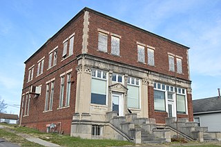
Houses on South Street
Nickname(s): 
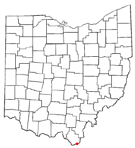
OHMap-doton-Quaker City.png
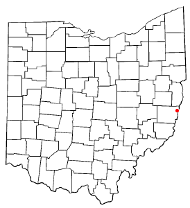
Location of Quaker City, Ohio
Map of Guernsey County Ohio Highlighting Quaker City Village.png
Location of Quaker City in Guernsey County
Coordinates: 39°58′11″N81°17′50″W / 39.96972°N 81.29722°W / 39.96972; -81.29722
Country United States
State Ohio
County Guernsey
Township Millwood
Area
[1]
  Total0.53 sq mi (1.36 km2)
  Land0.53 sq mi (1.36 km2)
  Water0.00 sq mi (0.00 km2)
Elevation
[2]
863 ft (263 m)
Population
 (2020)
  Total379
  Density720.53/sq mi (278.46/km2)
Time zone UTC-5 (Eastern (EST))
  Summer (DST) UTC-4 (EDT)
ZIP codes
43736, 43773
Area code 740
FIPS code 39-65116 [3]
GNIS feature ID2399031 [2]

Quaker City is a village in Guernsey County, Ohio, United States. The population was 379 at the 2020 census.

Contents

History

The first settlement at Quaker City was made ca. 1850, but growth remained static until a store opened at the site in 1870. [4] A post office called Quaker City has been in operation until 1872. [5]

Geography

Quaker City is located along Leatherwood Creek. [6]

According to the United States Census Bureau, the village has a total area of 0.53 square miles (1.37 km2), all land. [7]

Demographics

Historical population
CensusPop.Note
1880 594
1890 84542.3%
1900 8783.9%
1910 746−15.0%
1920 732−1.9%
1930 613−16.3%
1940 6343.4%
1950 6553.3%
1960 583−11.0%
1970 510−12.5%
1980 69836.9%
1990 560−19.8%
2000 5630.5%
2010 502−10.8%
2020 379−24.5%
U.S. Decennial Census [8]

2010 census

As of the census [9] of 2010, there were 502 people, 202 households, and 142 families living in the village. The population density was 947.2 inhabitants per square mile (365.7/km2). There were 233 housing units at an average density of 439.6 per square mile (169.7/km2). The racial makeup of the village was 99.0% White, 0.4% Asian, 0.4% from other races, and 0.2% from two or more races. Hispanic or Latino of any race were 0.8% of the population.

There were 202 households, of which 32.7% had children under the age of 18 living with them, 52.5% were married couples living together, 14.4% had a female householder with no husband present, 3.5% had a male householder with no wife present, and 29.7% were non-families. 24.3% of all households were made up of individuals, and 9.9% had someone living alone who was 65 years of age or older. The average household size was 2.49 and the average family size was 2.98.

The median age in the village was 37.8 years. 25.5% of residents were under the age of 18; 9.5% were between the ages of 18 and 24; 25% were from 25 to 44; 24.8% were from 45 to 64; and 15.5% were 65 years of age or older. The gender makeup of the village was 48.6% male and 51.4% female.

2000 census

As of the census [3] of 2000, there were 563 people, 220 households, and 159 families living in the village. The population density was 1,063.6 inhabitants per square mile (410.7/km2). There were 241 housing units at an average density of 455.3 per square mile (175.8/km2). The racial makeup of the village was 99.29% White, 0.18% African American, 0.36% from other races, and 0.18% from two or more races. Hispanic or Latino of any race were 0.36% of the population.

There were 220 households, out of which 36.4% had children under the age of 18 living with them, 57.3% were married couples living together, 9.1% had a female householder with no husband present, and 27.3% were non-families. 25.0% of all households were made up of individuals, and 13.2% had someone living alone who was 65 years of age or older. The average household size was 2.56 and the average family size was 3.04.

In the village, the population was spread out, with 27.4% under the age of 18, 8.7% from 18 to 24, 29.5% from 25 to 44, 19.7% from 45 to 64, and 14.7% who were 65 years of age or older. The median age was 34 years. For every 100 females there were 94.1 males. For every 100 females age 18 and over, there were 89.4 males.

The median income for a household in the village was $22,176, and the median income for a family was $28,750. Males had a median income of $24,583 versus $15,865 for females. The per capita income for the village was $11,148. About 16.3% of families and 16.0% of the population were below the poverty line, including 18.7% of those under age 18 and 27.5% of those age 65 or over.

Notable person

Related Research Articles

<span class="mw-page-title-main">Fort Shawnee, Ohio</span> CDP in Ohio, United States

Fort Shawnee is census-designated place (CDP) in Allen County, Ohio, United States. The population was 6,263 at the 2020 census. It is included in the Lima, Ohio Metropolitan Statistical Area. Fort Shawnee is adjacent to the city of Lima and the village of Cridersville in Auglaize County. In 2012, village residents voted to disincorporate the village. According to the United States Census Bureau, the village had a total area of 7.25 square miles (18.78 km2), of which 7.21 square miles (18.67 km2) is land and 0.04 square miles (0.10 km2) is water.
<span class="mw-page-title-main">Clarksville, Ohio</span> Village in Ohio, United States

Clarksville is a village in Clinton County, Ohio, United States. The population was 534 at the 2020 census. It is served by the Clinton Massie branch of the Wilmington Public Library of Clinton County.

<span class="mw-page-title-main">Castine, Ohio</span> Village in Ohio, United States

Castine is a village in Darke County, Ohio, United States. The population was 110 at the 2020 census.

<span class="mw-page-title-main">Wayne Lakes, Ohio</span> Village in Ohio, United States

Wayne Lakes is a village in Darke County, Ohio, United States. The population was 693 at the 2020 census.

<span class="mw-page-title-main">Addyston, Ohio</span> Village in Ohio, United States

Addyston is a village in Miami Township, Hamilton County, Ohio, United States. Located along the Ohio River, it is a western suburb of the neighboring city of Cincinnati. The population was 927 at the 2020 census.

<span class="mw-page-title-main">Cleves, Ohio</span> City in Ohio, United States

Cleves is a village in Miami Township, Hamilton County, Ohio, United States. Located along the Ohio River, it is a western suburb of Cincinnati. The population was 3,414 at the 2020 census.

<span class="mw-page-title-main">Elmwood Place, Ohio</span> Village in Hamilton County, Ohio, United States

Elmwood Place is a village in Hamilton County, Ohio, United States. The population was 2,087 at the 2020 census. Except for a small portion which touches neighboring St. Bernard, Elmwood Place is nearly surrounded by the city of Cincinnati.

<span class="mw-page-title-main">Evendale, Ohio</span> Village in Ohio, United States

Evendale is a village in Hamilton County, Ohio, United States, within the Cincinnati metropolitan area. The population was 2,669 at the 2020 census.

<span class="mw-page-title-main">Golf Manor, Ohio</span> Village in Ohio, United States

Golf Manor is a village in Hamilton County, Ohio, United States. It is almost completely surrounded by the Pleasant Ridge and Roselawn neighborhoods of Cincinnati. The population was 3,814 at the 2020 census.

<span class="mw-page-title-main">Woodlawn, Ohio</span> Village in Ohio, United States

Woodlawn is a village in Hamilton County, Ohio, United States. The population was 3,916 at the 2020 census.

<span class="mw-page-title-main">Mount Pleasant, Ohio</span> Village in Ohio, United States

Mount Pleasant is a village in southern Jefferson County, Ohio, United States. The population was 394 at the 2020 census. It is part of the Weirton–Steubenville metropolitan area. Founded in 1803 by anti-slavery Quakers, the village was an early center of abolitionist activity and a well-known haven for fugitive slaves on the Underground Railroad.

<span class="mw-page-title-main">Proctorville, Ohio</span> Village in Ohio, United States

Proctorville is a village in Lawrence County, Ohio, United States, along the Ohio River. The population was 523 at the 2020 census. The East End Bridge connects Proctorville to Huntington, West Virginia across the Ohio River.

<span class="mw-page-title-main">Hanover, Ohio</span> Village in Ohio, United States

Hanover is a village in Licking County, Ohio, United States. The population was 1,270 at the 2020 census. The village lies along Ohio State Route 16.

<span class="mw-page-title-main">Hebron, Ohio</span> Village in Ohio, USA

Hebron is a village in Licking County, Ohio, United States. The population was 2,326 at the 2020 census.

<span class="mw-page-title-main">St. Louisville, Ohio</span> Village in Ohio, United States

St. Louisville is a village in Licking County, Ohio, United States, along the North Fork of the Licking River. The population was 352 at the 2020 census.

<span class="mw-page-title-main">Camden, Ohio</span> Village in Ohio, United States

Camden is a village in Preble County, Ohio, United States. The population was 1,989 at the 2020 census.

<span class="mw-page-title-main">Waynesville, Ohio</span> Village in Ohio, United States

Waynesville is a village in Wayne Township, Warren County, Ohio, United States. The population was 2,669 at the 2020 census. It is named for General "Mad" Anthony Wayne. The village, located at the crossroads of U.S. Route 42 and State Route 73, is known for its antique stores and its annual sauerkraut festival. Caesar Creek State Park is located 5 miles (8.0 km) east of the village.

<span class="mw-page-title-main">Bloomdale, Ohio</span> Village in Ohio, United States

Bloomdale is a village in Wood County, Ohio, United States. The population was 665 at the 2020 census.

<span class="mw-page-title-main">Wilson, Ohio</span> Village in Ohio, United States

Wilson is a village in Belmont and Monroe counties in the U.S. state of Ohio. The population was 129 at the 2020 census. It is part of the Wheeling metropolitan area.

<span class="mw-page-title-main">Verona, Ohio</span> Village in Ohio, United States

Verona is a village in Montgomery and Preble counties in the U.S. state of Ohio. The population was 403 at the 2020 census. It is part of the Dayton Metropolitan Statistical Area.

References

  1. "ArcGIS REST Services Directory". United States Census Bureau. Retrieved September 20, 2022.
  2. 1 2 U.S. Geological Survey Geographic Names Information System: Quaker City, Ohio
  3. 1 2 "U.S. Census website". United States Census Bureau . Retrieved January 31, 2008.
  4. Overman, William Daniel (1958). Ohio Town Names. Akron, OH: Atlantic Press. p. 115.
  5. "Post offices". Jim Forte Postal History. Retrieved June 19, 2016.
  6. Ohio Atlas & Gazetteer. Yarmouth, Me.: DeLorme. 1991. p. 72. ISBN   0-89933-233-1.
  7. "US Gazetteer files 2010". United States Census Bureau. Archived from the original on January 12, 2012. Retrieved January 6, 2013.
  8. "Census of Population and Housing". Census.gov. Retrieved June 4, 2015.
  9. "U.S. Census website". United States Census Bureau . Retrieved January 6, 2013.