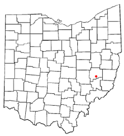
Lore City, Ohio | |
---|---|
Coordinates: 39°59′00″N81°27′36″W / 39.98333°N 81.46000°W | |
Country | United States |
State | Ohio |
County | Guernsey |
Townships | Wills, Center, & Richland |
Area | |
• Total | 0.33 sq mi (0.85 km2) |
• Land | 0.33 sq mi (0.85 km2) |
• Water | 0.00 sq mi (0.00 km2) |
Elevation | 843 ft (257 m) |
Population (2020) | |
• Total | 282 |
• Density | 859.76/sq mi (332.05/km2) |
Time zone | UTC-5 (Eastern (EST)) |
• Summer (DST) | UTC-4 (EDT) |
ZIP code | 43755 |
Area code | 740 |
FIPS code | 39-44954 [3] |
GNIS feature ID | 2398476 [2] |
Lore City is a village in Guernsey County, Ohio, United States. The population was 282 at the 2020 census.
A post office has been in operation at Lore City since 1876. [4] Lore City was not platted until 1903. [5] The village was incorporated in 1906. [5]
According to the United States Census Bureau, the village has a total area of 0.33 square miles (0.85 km2), all land. [6] Leatherwood Creek flows through the village. [7]
Census | Pop. | Note | %± |
---|---|---|---|
1910 | 609 | — | |
1920 | 784 | 28.7% | |
1930 | 580 | −26.0% | |
1940 | 606 | 4.5% | |
1950 | 495 | −18.3% | |
1960 | 458 | −7.5% | |
1970 | 401 | −12.4% | |
1980 | 443 | 10.5% | |
1990 | 384 | −13.3% | |
2000 | 305 | −20.6% | |
2010 | 325 | 6.6% | |
2020 | 282 | −13.2% | |
U.S. Decennial Census [8] |
As of the census [9] of 2010, there were 325 people, 118 households, and 88 families living in the village. The population density was 984.8 inhabitants per square mile (380.2/km2). There were 139 housing units at an average density of 421.2 per square mile (162.6/km2). The racial makeup of the village was 95.7% White, 0.6% African American, 0.3% Native American, 0.9% from other races, and 2.5% from two or more races. Hispanic or Latino of any race were 2.5% of the population.
There were 118 households, of which 40.7% had children under the age of 18 living with them, 52.5% were married couples living together, 11.9% had a female householder with no husband present, 10.2% had a male householder with no wife present, and 25.4% were non-families. 21.2% of all households were made up of individuals, and 10.2% had someone living alone who was 65 years of age or older. The average household size was 2.75 and the average family size was 3.16.
The median age in the village was 32.8 years. 31.4% of residents were under the age of 18; 4.9% were between the ages of 18 and 24; 26.7% were from 25 to 44; 20.3% were from 45 to 64; and 16.6% were 65 years of age or older. The gender makeup of the village was 47.7% male and 52.3% female.
As of the census [3] of 2000, there were 305 people, 125 households, and 88 families living in the village. The population density was 914.1 inhabitants per square mile (352.9/km2). There were 145 housing units at an average density of 434.6 per square mile (167.8/km2). The racial makeup of the village was 95.41% White, 0.66% Native American, 0.33% Pacific Islander, and 3.61% from two or more races. Hispanic or Latino of any race were 0.33% of the population.
There were 125 households, out of which 33.6% had children under the age of 18 living with them, 57.6% were married couples living together, 8.0% had a female householder with no husband present, and 29.6% were non-families. 27.2% of all households were made up of individuals, and 13.6% had someone living alone who was 65 years of age or older. The average household size was 2.44 and the average family size was 2.93.
In the village, the population was spread out, with 24.9% under the age of 18, 7.9% from 18 to 24, 29.8% from 25 to 44, 24.3% from 45 to 64, and 13.1% who were 65 years of age or older. The median age was 38 years. For every 100 females there were 84.8 males. For every 100 females age 18 and over, there were 92.4 males.
The median income for a household in the village was $30,000, and the median income for a family was $39,500. Males had a median income of $30,357 versus $16,635 for females. The per capita income for the village was $16,272. About 11.1% of families and 14.2% of the population were below the poverty line, including 16.4% of those under the age of eighteen and 16.3% of those 65 or over.
Lore City is within the Rolling Hills School District. Students attend Meadowbrook High School, Meadowbrook Middle School, Brook Intermediate and Secrest Elementary.
Guernsey County is a county located in the U.S. state of Ohio. As of the 2020 census, the population was 38,438. Its county seat and largest city is Cambridge. It is named for the Isle of Guernsey in the English Channel, from which many of the county's early settlers emigrated.
Brookside is a village in eastern Belmont County, Ohio, United States. The population was 538 at the 2020 census. It is part of the Wheeling metropolitan area.
Castine is a village in Darke County, Ohio, United States. The population was 110 at the 2020 census.
Palestine is a village in Darke County, Ohio, United States. The population was 180 at the 2020 census.
Byesville is a village in Guernsey County, Ohio, United States, along Wills Creek. The population was 2,364 at the 2020 census.
Cumberland is a village in Guernsey County, Ohio, United States. It is seventy miles east of Columbus. The population was 317 at the 2020 census.
Old Washington is a village in Guernsey County, Ohio, United States. The population was 223 at the 2020 census.
Pleasant City is a village in Guernsey County, Ohio, United States. The population was 400 at the 2020 census.
Salesville is a census-designated place and former village in Guernsey County, Ohio, United States. As of the 2020 census, the population was 123, down from 129 at the 2010 census. Its residents voted for dissolution in 2016.
Senecaville is a village in Guernsey County, Ohio, United States. The population was 422 at the 2020 census.
Evendale is a village in Hamilton County, Ohio, United States, within the Cincinnati metropolitan area. The population was 2,669 at the 2020 census.
Holmesville is a village in Holmes County, Ohio, United States, along Killbuck Creek. The population was 371 at the 2020 census.
St. Louisville or Saint Louisville is a village in Licking County, Ohio, United States, along the North Fork of the Licking River. The population was 352 at the 2020 census.
Gloria Glens Park is a village in Medina County, Ohio, United States. The population was 369 at the 2020 census.
Laura is a village in Miami County, Ohio, United States. The population was 398 at the 2020 census. It is part of the Dayton Metropolitan Statistical Area.
Chesterville is a village in Morrow County, Ohio, United States, along the Kokosing River. The population was 191 at the 2020 census. Chesterville is southeast of Mount Gilead, the county seat.
Edison is a village in Morrow County, Ohio, United States. The population was 422 at the 2020 census. Edison is adjacent to and west of Mount Gilead, Ohio, the county seat.
Gibsonburg is a village in Sandusky County, Ohio, United States, about 33 miles (53 km) southeast of Toledo. The population was 2,452 at the 2020 census. The National Arbor Day Foundation has designated Gibsonburg as a Tree City USA.
Burbank is a village in Wayne County, Ohio, United States, along Killbuck Creek. The population was 296 at the 2020 census.
Fairview is a village in Belmont and Guernsey counties in the U.S. state of Ohio. The population was 67 as of the 2020 census. It is part of the Wheeling metropolitan area.