
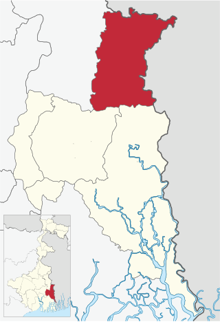
North 24 Parganas (abv. 24 PGS (N)) or sometimes North Twenty Four Parganas is a district in southern West Bengal, of eastern India. North 24 Parganas extends in the tropical zone from latitude 22° 11′ 6″ north to 23° 15′ 2″ north and from longitude 88º20' east to 89º5' east. Barasat is the district headquarters of North 24 Parganas. North 24 Parganas is West Bengal's most populous district and also (since 2014) the most populated district in the whole of India. It is the tenth-largest district in the State by area.

Bangaon is a city and a municipality in North 24 Parganas district in the state of West Bengal, India. It is the headquarters of the Bangaon subdivision.
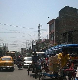
Habra is a city and a municipality under Barasat sadar subdivision in North 24 Parganas district of the Indian state of West Bengal. It is situated on the Jessore Road between Kolkata and the Bangladesh border at Petrapole. Its location makes it an important town for export and import of goods between India and Bangladesh.
Petrapole is the Indian side of Petrapole-Benapole border checkpoint between India and Benapole of Bangladesh, on the Bangladesh-India border, near Bongaon in North 24 Parganas district of West Bengal. Petrapole border is the only land port in south Bengal. It is also the largest land customs station in Asia.
Sonatikiri is a census town in the Gaighata CD block of the Bangaon subdivision in North 24 Parganas district in the Indian state of West Bengal.

Gaighata is a community development block that forms an administrative division in Bangaon subdivision of North 24 Parganas district in the Indian state of West Bengal.
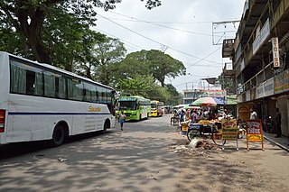
Bangaon subdivision is an administrative subdivision of the North 24 Parganas district in the Indian state of West Bengal.

Thakurnagar is a town in the Indian state of West Bengal. It is close to the border with Bangladesh. It is situated on the east side of the Jessore Road. Thakurnagar is famous for "Baruni Mela".
Chandrapur is a census town in the Barasat I CD block in the Barasat Sadar subdivision in the North 24 Parganas district in the Indian state of West Bengal. It is a part of Kolkata Urban Agglomeration.

Chandpara is a census town in the Gaighata CD block in the Bangaon subdivision of the North 24 Parganas district in the state of West Bengal, India.
Nahata is a village in the Bangaon CD Block in the Bangaon subdivision of the North 24 Parganas, West Bengal.
Shimulpur is a census town in the Gaighata CD block in the Bangaon subdivision of North 24 Parganas district in the state of West Bengal, India.
Chikanpara is a census town in the Gaighata CD block in the Bangaon subdivision of the North 24 Parganas district in state of West Bengal, India.
Bagdah is a village in the Bagdah CD block in the Bangaon subdivision of the North 24 Parganas district in the state of West Bengal, India.
Helencha is one of the largest colony village in the Bagdah CD block in the Bangaon subdivision of the North 24 Parganas district in the state of West Bengal, India. It is divided among many small area namely Old Helencha, Dakshin Helencha, Helencha 1 to 5 Colony.
Gopalnagar is a village and a gram panchayat in the Bangaon CD block in the Bangaon subdivision of the North 24 Parganas district in the state of West Bengal, India.
Gaighata is a village in the Gaighata CD block in the Bangaon subdivision of the North 24 Parganas district in the state of West Bengal, India.
Palla is a village and a gram panchayat in the Bangaon CD block in the Bangaon subdivision of the North 24 Parganas district in the state of West Bengal, India.
Chhekati is a census town in the Gaighata CD block in the Bangaon subdivision of North 24 Parganas district in the state of West Bengal, India.
Bara is a census town in the Gaighata CD block in the Bangaon subdivision of North 24 Parganas district in the state of West Bengal, India.


