Rameswarpur, Maheshtala

Last updated

Rameswarpur
Census Town
West Bengal location map.svg
Red pog.svg
Rameswarpur
Location in West Bengal
India location map.svg
Red pog.svg
Rameswarpur
Location in India
Coordinates: 22°27′30″N88°13′27″E / 22.4583°N 88.2242°E / 22.4583; 88.2242 Coordinates: 22°27′30″N88°13′27″E / 22.4583°N 88.2242°E / 22.4583; 88.2242
CountryFlag of India.svg  India
State..West Bengal Flag(INDIA).png West Bengal
District South 24 Parganas
CD block Thakurpukur Maheshtala
Area
  Total2.32 km2 (0.90 sq mi)
Elevation
9 m (30 ft)
Population
 (2011)
  Total7,200
  Density3,100/km2 (8,000/sq mi)
Languages
  Official Bengali [1] [2]
  Additional official English [1]
Time zone UTC+5:30 (IST)
PIN
700141
Telephone code+91 33
Vehicle registration WB-19 to WB-22, WB-95 to WB-99
Lok Sabha constituency Diamond Harbour
Vidhan Sabha constituency Bishnupur (SC)
Website www.s24pgs.gov.in

Rameswarpur is a census town within the jurisdiction of the Maheshtala police station in the Thakurpukur Maheshtala CD block in the Alipore Sadar subdivision of the South 24 Parganas district in the Indian state of West Bengal.

Contents

Geography

[Interactive fullscreen map]
Cities and towns in the western part of Alipore Sadar subdivision (including Budge Budge I & II, Thakurpukur Maheshtala CD blocks) in South 24 Parganas district
M: municipal city/ town, CT: census town, R: rural/ urban centre,
Owing to space constraints in the small map, the actual locations in a larger map may vary slightly
Bakrahat is in Bishnupur II CD block, but Lakshmibala Rural Hospital at Bakrahat serves Budge Budge II CD block and so it is included here.

Area overview

Alipore Sadar subdivision is the most urbanized part of the South 24 Parganas district. 59.85% of the population lives in the urban areas and 40.15% lives in the rural areas. In the northern portion of the subdivision (shown in the map alongside) there are 21 census towns. The entire district is situated in the Ganges Delta and the subdivision, on the east bank of the Hooghly River, is an alluvial stretch, with industrial development. [3] [4] [5]

Note: The map alongside presents some of the notable locations in the subdivision. All places marked in the map are linked in the larger full screen map.

Location

Rameswarpur is located at 22°27′30″N88°13′27″E / 22.4583°N 88.2242°E / 22.4583; 88.2242 . It has an average elevation of 9 metres (30 ft).

Rameswarpur, Chata Kalikapur, Ganye Gangadharpur and Asuti form a cluster of census towns on the southern side of Maheshtala, as per the map of the Thakurpukur Maheshtala CD block on page 153 of the District Census Handbook 2011 for the South 24 Parganas. [6]

Demographics

According to the 2011 Census of India, Rameswarpur had a total population of 7,200, of which 3,738 (52%) were males and 3,642 (48%) were females. There were 814 persons in the age range of 0 to 6 years. The total number of literate people in Rameswarpur was 4,999 (78.28% of the population over 6 years). [7]

Infrastructure

According to the District Census Handbook 2011, Rameswarpur covered an area of 2.3248 km2. Nangi railway station is 3 km away. Among the civic amenities it had 5 km of roads with both open and covered drains. The source of protected water supply was borewell tank and overhead tank. It had 950 domestic electric connections and 150 road lights. Among the medical facilities it had was a nursing home 3 km away. Among the educational facilities it had were 2 primary schools, 1 middle school, 1 secondary school and the nearest general degree college was at Maheshtala 5 km away. Among the social, recreational and cultural facilities, the nearest public library was at Chattan 3 km away. The nearest cinema theatre was at Maheshtala 3 km away. Three important commodities manufactured were: garments, dyeing and cotton spinning. [8]

Transport

A short stretch of local roads link Rameswarpur to the Budge Budge Trunk Road. [9]

Nangi railway station is located nearby. [9]

Healthcare

Sarsuna Block Primary Health Centre, with 15 beds, at Sarsuna, is the major government medical facility in the Thakurpukur Maheshtala CD block. [10]

Related Research Articles

Chata Kalikapur Census Town in West Bengal, India

Chata Kalikapur is a census town within the jurisdiction of the Maheshtala police station in the Thakurpukur Maheshtala CD block in the Alipore Sadar subdivision of the South 24 Parganas district in the Indian state of West Bengal.

Kanyanagar Census Town in West Bengal, India

Kanyanagar is a census town within the jurisdiction of the Bishnupur police station in the Bishnupur I CD block in the Alipore Sadar subdivision of the South 24 Parganas district in the Indian state of West Bengal.

Maheshtala City in West Bengal, India

Maheshtala is a city and a municipality of the South 24 Parganas district in the Indian state of West Bengal. It is situated on the eastern banks of the Hooghly River. It is a part of the area covered by the Kolkata Metropolitan Development Authority (KMDA).

Uttar Raypur Census Town in West Bengal, India

Uttar Raypur is a census town and a gram panchayat within the jurisdiction of the Budge Budge police station in the Budge Budge I CD block in the Alipore Sadar subdivision of the South 24 Parganas district in the Indian state of West Bengal.

Bishnupur, South 24 Parganas Census Town in West Bengal, India

Bishnupur is a census town within the jurisdiction of the Bishnupur police station in the Bishnupur I CD block in the Alipore Sadar subdivision of the South 24 Parganas district in the Indian state of West Bengal.

Balarampur, Budge Budge Census Town in West Bengal, India

Balarampur is a census town within the jurisdiction of the Budge Budge police station in the Budge Budge I CD block in the Alipore Sadar subdivision of the South 24 Parganas district in the Indian state of West Bengal.

Alipore Sadar subdivision Subdivision in West Bengal, India

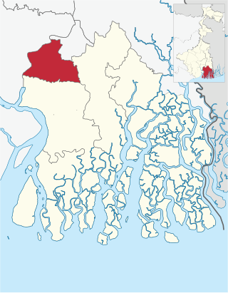
Alipore Sadar subdivision is an administrative subdivision of the South 24 Parganas district in the Indian state of West Bengal.

Thakurpukur Maheshtala Community Development Block in West Bengal, India

Thakurpukur Maheshtala is a community development block that forms an administrative division in the Alipore Sadar subdivision of South 24 Parganas district in the Indian state of West Bengal.

Ganye Gangadharpur Census Town in West Bengal, India

Ganye Gangadharpur is a census town within the jurisdiction of the Maheshtala police station in the Thakurpukur Maheshtala CD block in the Alipore Sadar subdivision of the South 24 Parganas district in the Indian state of West Bengal.

Asuti Census Town in West Bengal, India

Asuti is a census town and a gram panchayat within the jurisdiction of the Maheshtala police station in the Thakurpukur Maheshtala CD block in the Alipore Sadar subdivision of the South 24 Parganas district in the Indian state of West Bengal.

Hanspukuria Census Town in West Bengal, India

Hanspukuria is a census town within the jurisdiction of the Maheshtala police station in the Thakurpukur Maheshtala CD block in the Alipore Sadar subdivision of the South 24 Parganas district in the Indian state of West Bengal.

Kalua, Maheshtala Census Town in West Bengal, India

Kalua is a census town within the jurisdiction of the Maheshtala police station in the Thakurpukur Maheshtala CD block in the Alipore Sadar subdivision of the South 24 Parganas district in the Indian state of West Bengal.

Ramchandrapur, Maheshtala Census Town in West Bengal, India

Ramchandrapur is a census town within the jurisdiction of the Maheshtala police station in the Thakurpukur Maheshtala CD block in the Alipore Sadar subdivision of the South 24 Parganas district in the Indian state of West Bengal.

Samali Census Town in West Bengal, India

Samali is a census town within the jurisdiction of the Maheshtala police station in the Thakurpukur Maheshtala CD block in the Alipore Sadar subdivision of the South 24 Parganas district in the Indian state of West Bengal.

Abhirampur Census Town in West Bengal, India

Abhirampur is a census town within the jurisdiction of the Budge Budge police station in the Budge Budge I CD block in the Alipore Sadar subdivision of the South 24 Parganas district in the Indian state of West Bengal.

Nischintapur, Budge Budge Census Town in West Bengal, India

Nischintapur is a census town and a gram panchayat within the jurisdiction of the Budge Budge police station in the Budge Budge I CD block in the Alipore Sadar subdivision of the South 24 Parganas district in the Indian state of West Bengal.

Poali Census Town in West Bengal, India

Poali is a census town within the jurisdiction of the Nodakhali police station in the Budge Budge II CD block in the Alipore Sadar subdivision of the South 24 Parganas district in the Indian state of West Bengal.

Kanganbaria Census Town in West Bengal, India

Kanganbaria is a census town and a gram panchayat within the jurisdiction of the Bishnupur police station in the Bishnupur II CD block in the Alipore Sadar subdivision of the South 24 Parganas district in the Indian state of West Bengal.

Chanddandaha Census Town in West Bengal, India

Chanddandaha is a census town within the jurisdiction of the Bishnupur police station in the Bishnupur II CD block in the Alipore Sadar subdivision of the South 24 Parganas district in the Indian state of West Bengal.

Barkalikapur Census Town in West Bengal, India

Barkalikapur is a census town within the jurisdiction of the Bishnupur police station in the Bishnupur II CD block in the Alipore Sadar subdivision of the South 24 Parganas district in the Indian state of West Bengal.

References

  1. 1 2 "Fact and Figures". Wb.gov.in. Retrieved 5 July 2019.
  2. "52nd REPORT OF THE COMMISSIONER FOR LINGUISTIC MINORITIES IN INDIA" (PDF). Nclm.nic.in. Ministry of Minority Affairs. p. 85. Archived from the original (PDF) on 25 May 2017. Retrieved 5 July 2019.
  3. "District Statistical Handbook 2014 South Twety-four Parganas". Table 2.1 , 2.2, 2.4b. Department of Statistics and Programme Implementation, Government of West Bengal. Retrieved 5 December 2019.
  4. "Census of India 2011, West Bengal, District Census Handbook, South Twentyfour Parganas, Series – 20, Part XII-A, Village and Town Directory" (PDF). Page 13, Physiography. Directorate of Census Operations, West Bengal. Retrieved 5 December 2019.
  5. "District Human Development Report: South 24 Parganas". Chapter 9: Sundarbans and the Remote Islanders, p 290-311. Development & Planning Department, Government of West Bengal, 2009. Archived from the original on 5 October 2016. Retrieved 5 December 2019.
  6. "District Census Handbook South Twentyfour Parganas, Census of India 2011, Series 20, Part XII A" (PDF). Page 153 – Map of Thakurpukur Maheshtala CD block. Directorate of Census Operations, West Bengal. Retrieved 3 November 2019.
  7. "CD block Wise Primary Census Abstract Data(PCA)". West Bengal – District-wise CD blocks. Registrar General and Census Commissioner, India. Retrieved 5 November 2019.
  8. "District Census Handbook South Twenty Four Parganas, Census of India 2011, Series 20, Part XII A" (PDF). Section II Town Directory, Pages 999-1006 Statement I: Status and Growth History, Pages 1006-1010; Statement II: Physical Aspects and Location of Towns, Pages 1010-1015; Statement III: Civic and other Amenities, Pages 1015-1019; Statement IV: Medical Facilities 2009, Pages 1019-1027 Statement V: Educational, Recreational and Cultural Facilities, Pages 1027- 1029: Statement VI:Industry and Banking. Directorate of Census Operations V, West Bengal. Retrieved 9 November 2018.
  9. 1 2 Google maps
  10. "Health & Family Welfare Department" (PDF). Health Statistics – Block Primary Health Centres. Government of West Bengal. Retrieved 5 November 2019.