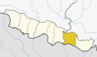
Arnama Lalpur is a village development committee in Siraha District in the Sagarmatha Zone of south-eastern Nepal. At the time of the 2011 Nepal census it had a population of 6841 people living in 1255 individual households.

Aurahi is a Rural municipality in Siraha District in Province No. 2 of Nepal. It was formed in 2016 occupying current 5 sections (wards) from previous 5 former VDCs. It occupies an area of 35.87 sq. km with a total population of 23,046.

Bariyarpatti is a Rural municipality in Siraha District in Province No. 2 of Nepal. It was formed in 2016 occupying current 5 sections (wards) from previous 5 former VDCs. It occupies an area of 37.72 sq. km with a total population of 25,256.

Bhagawatipur is a village development committee in Siraha District in the Sagarmatha Zone of south-eastern Nepal. At the time of the 2011 Nepal census it had a population of 4495 people living in 865 individual households.

Bhawanpur Kalabanjar is a village development committee in Siraha District in the Sagarmatha Zone of south-eastern Nepal. At the time of the 2011 Nepal census it had a population of 3796 people living in 740 individual households.

Bishnupur Pra. Ma. is a village development committee in Siraha District in the Sagarmatha Zone of south-eastern Nepal. At the time of the 2011 Nepal census it had a population of 5208.

Bishnupur Pra. Ra. is a village development committee in Siraha District in the Sagarmatha Zone of south-eastern Nepal. At the time of the 2011 Nepal census it had a population of 5020.

Brahmagaughadi is a village development committee in Siraha District in the Sagarmatha Zone of south-eastern Nepal. At the time of the 2011 Nepal census it had a population of 3470.

Chandra Ayodhyapur is a village development committee in Siraha District in the Sagarmatha Zone of south-eastern Nepal. At the time of the 2011 Nepal census it had a population of 7211.

Chandralalpur is a village development committee in Siraha District in the Sagarmatha Zone of south-eastern Nepal. At the time of the 2011 Nepal census it had a population of 7211 people living in 1307 individual households.

Maheshpur Patari is a village development committee in Siraha District in the Sagarmatha Zone of south-eastern Nepal. At the time of the 2011 Nepal census it had a population of 4396 people living in 753 individual households.

Sukhipur is a municipality in Siraha District in the Sagarmatha Zone of south-eastern Nepal. After the government announcement the municipality was established on 19 September 2015 by merging the existing Mohanpur Kamalpur, Vidhyanagar, Kushaha Laksiminiya, Kabilasi, Silorba Pachhawari Balhi and Sukhipur village development committees (VDCs). The center of the municipality is establish in Sukhipur Bazaar. At the time of the 2011 Nepal census after merging the seven VDCs population it had a total population of 20,915 persons. After the government decision the number of municipalities has reached 217 in Nepal.

Golbazar is a Municipality in Siraha District in the Sagarmatha Zone of south-eastern Nepal. Golbazar Municipality was formed by merging former VDCs of Asanpur, Jamadaha, Ashokpur Balkawa, Betauna, Durgapur, Lalpur, Muksar, Chandraudyapur, Chandralalpur under new local administrative structure implemented by Government of Nepal. As per 2011 Nepal census it had a population of 47763 people living in 2500 individual households.

Dhangadhimai is a municipality in Siraha District in the Sagarmatha Zone of eastern Nepal. After the government announcement the municipality was established on 19 September 2015 by merging the existing Bhawanipur, Hanuman Nagar, Phulkaha Kati, Dhangadi and Bishnupurkahi village development committees (VDCs). The center of the municipality is establish in Dhangadi Bazaar. At the time of the 2011 Nepal census after merging the four VDCs population it had a total population of 47,449 persons. After the government decision the number of municipalities has reached 217 in Nepal.

Kalyanpur is a municipality in Siraha District in the Sagarmatha Zone of south-eastern Nepal. At the time of the 2011 Nepal census it had a population of 49288 people living.

Bhagwanpur is a rural municipality in Siraha District in the Sagarmatha Zone of south-eastern Nepal. At the time of the 2011 Nepal census it had a population of 20957 people living.

Bishnupur is a rural municipality in Siraha District in the Sagarmatha Zone of south-eastern Nepal. At the time of the 2011 Nepal census it had a population of 18,522 people living.

Naraha is a rural municipality in Siraha District in the Sagarmatha Zone of south-eastern Nepal. At the time of the 2011 Nepal census it had a population of 19,369 people living.

Arnama is a rural municipality in Siraha District in the Sagarmatha Zone of south-eastern Nepal. At the time of the 2011 Nepal census it had a population of 22,912 people living.


