
Bagalakote district, is an administrative district in the Indian state of Karnataka. The district headquarters is located in the town of Bagalakote. The district is located in northern Karnataka and borders Belgaum, Gadag, Koppal, Raichur and Bijapur. The new Bagalakote district was carved out of Vijayapura in 1997 via Government of Karnataka directive Notification RD 42 LRD 87 Part III. The bifurcated Bagalakote district consists of ten taluks — Badami, Bagalakote, Bilagi, Guledgudda, Rabkavi Banhatti, Hunagund, Ilkal, Jamakhandi and Mudhol, Teradal.
Amarawati is a panchayat village in Hungund Taluka, Bagalkot district, in Karnataka State of India.
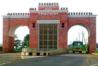
Bagalakote, is a city in the state of Karnataka, India, which is also the headquarters of Bagalakote district. It is situated on branch of River Ghataprabha about 481 km (299 mi) northwest of state capital Bengaluru, 410 km (255 mi) southwest of Hyderabad, and about 570 km (354 mi) southeast of Mumbai. The population of the urban agglomeration was 111,933 according to the provisional results of 2011 national census of India, and the city is spread over an area of 49.06 square kilometres (18.94 sq mi) with an average elevation of 532 m (1,745 ft) above MSL. bagracotta 1832 baugeracotta

Hungund or Hunagunda is a taluk in the northern district of Bagalkot in Karnataka, India. Major towns in the taluk are Amingad, Hunagunda. Kudalasangama, where the social reformist Basavanna died, is located in the taluk. Hunagunda Taluk also contains Aihole and Pattadkal which were once under the rule of Chalukyas of Badami. Amingad is known for Amingad karadantu, a sweet dish.
Aminagad is a village in the southern state of Karnataka, India. It is located in the Hungund taluk of Bagalkot district in Karnataka. Amingad is famous for its “Karadantu”. Karadantu is prepared using edible gum, dry fruits, sugar or jaggery. Amingad is also famous in cattle, Sheep, Lamb selling bazar in the state, bazar is on every Saturday, even sheep business from distant Tumukur and other parts of the state.
RannaBelagali is a Pattan Panchayat Town in the southern state of Karnataka, India. It is located in the Mudhol taluka of Bagalkot district in Karnataka
Bevoor is a village in the southern state of Karnataka, India. It is located in the Bagalkot taluk of Bagalkot district in Karnataka.
Dhavaleshwar is a village in the southern state of Karnataka, India. It is located in the Mahalingpur taluk of Bagalkot district in Karnataka. Dhavaleshwar is located on the bank of Ghataprabha river. The river bifurcates the Belgaum and Bagalkot districts. Just on the other side of the river, there is one more village which, is also known as Dhavaleshwar. This Dhavaleshwar belongs to Gokak Taluk of Belgaum district. Many politicians promised to build a bridge between both villages, but no one has initiated. The villagers grow sugar cane, which is the source of their income.
Jalihal is a village in the southern state of Karnataka, India. It is located in the Badami taluk of Bagalkot district in Karnataka.
Kamatagi is a town in the northern state of Karnataka, India. It is located in the Hungund taluk of Bagalkot district in Karnataka.
Kandgal is a village in the northern state of Karnataka, India. It is located in the Hungund taluk of Bagalkot district in Karnataka.
Malali is a village in Bagalkot district, Karnataka, India.
Mantur is a village in the southern state of Karnataka, India. It is located in the Mudhol taluk of Bagalkot district in Karnataka.
Nagaral(ನಾಗರಾಳ) is a village in the southern state of Karnataka, India. It is located in the Bilagi taluk of Bagalkot district in Karnataka. It is about 35 kilometres (22 mi) from the district headquarters of Bagalkot town and is about 5 kilometres (3.1 mi) from taluka headquarters of Bilagi and on the left bank of the Krishna River. It is famous for the Digamabareshwara temple and well educated persons.
Sulibhavi is a village in the southern state of Karnataka, India. It is located in the Hungund taluk of Bagalkot district in Karnataka.
Adihal is a village in the southern state of Karnataka, India. It is located in the Hungund taluk of Bagalkot district in Karnataka.

Aiahole is a village in the southern state of Karnataka, India. It is located in the Hungund taluk of Bagalkot district in Karnataka.
Ingalagi is a panchayat village in Belgaum district in the southern state of Karnataka, India.

Hungund Assembly seat is one of 224 assembly constituencies in Karnataka, India. It is part of Bagalkot.

