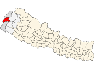
Basantapur is a Village Development Committee in Baitadi District in the Mahakali Zone of western Nepal. At the time of the 1991 Nepal census it had a population of 2,141 and had 366 houses in the village.
Basant pur is a place which is almost 50 kilometres (31 mi) away from the Daimadu. This village is very nice, and people there are very helpful. Many of the people from this village are settled in metro cities of India and in the large cities of the Nepal. Many of the people are settled in Delhi; some of them are businessmen, and a number of youngsters have joined the army in Nepal and are serving their nation. Those who are away from their village they come once in a year and see their native village. Many NGO's are working for the village. The village has its own high school and is having water supply to almost every house. Many festivals like "Gaura", "Dasai" (etc.) are celebrated round the year. The main earning of the people comes from agriculture. The village has many mills for the grinding of wheat. The public transport system is not connected to it, but maybe in the coming years, there will be a transport system of the village.
Bisalpur is a village development committee in Baitadi District in the Mahakali Zone of western Nepal. At the time of the 2011 Nepal census it had a population of 4,174 and had 699 houses in the village.
Deulek is a village development committee in Baitadi District in the Mahakali Zone of western Nepal. At the time of the 1991 Nepal census it had a population of 2,004 and had 354 houses in the village.
Dhikarim is a village development committee in Baitadi District in the Mahakali Zone of western Nepal. At the time of the 1991 Nepal census it had a population of 3,497 and had 636 houses in the town.
Gokuleshwar is a Village Development Committee in Baitadi District in the Mahakali Zone of western Nepal. At the time of the 1991 Nepal census it had a population of 3,444 and had 601 houses in the town.
Kotila is a village development committee in Baitadi District in the Mahakali Zone of western Nepal. At the time of the 1991 Nepal census it had a population of 2,713 and had 472 houses in the town.
Kuwakot is a Village Development Committee in Baitadi District in the Mahakali Zone of western Nepal. At the time of the 1991 Nepal census it had a population of 3804 and had 644 houses in the town.
Mahadevsthan is a village development committee in Baitadi District in the Mahakali Zone of western Nepal. At the time of the 1991 Nepal census it had a population of 3,291 and had 599 houses in the town.
Sankar is a village development committee in Baitadi District in the Mahakali Zone of western Nepal. At the time of the 1991 Nepal census it had a population of 1,964 and had 404 houses in the village.
Srikedar is a village development committee in Baitadi District in the Mahakali Zone of western Nepal. At the time of the 1991 Nepal census it had a population of 2,081 and had 389 houses in the village.
Bhairabnath is a village in Bajhang District in the Seti Zone of north-western Nepal. At the time of the 1991 Nepal census it had a population of 3,275 and had 613 houses in the village.
Deulekh is a village in Bajhang District in the Seti Zone of north-western Nepal. At the time of the 1991 Nepal census it had a population of 2,952 and had 456 houses in the village.
Pipalkot is a village in Bajhang District in the Seti Zone of north-western Nepal. At the time of the 1991 Nepal census it had a population of 3,296 and had 611 houses in the village.
Barchhen is a village development committee in Doti District in the Seti Zone of western Nepal. At the time of the 1991 Nepal census it had a population of 4343 living in 675 individual households.
Bhumirajmandau is a village development committee in Doti District in the Seti Zone of western Nepal. At the time of the 1991 Nepal census it had a population of 3891 living in 743 individual households.
Durgamandau is a village development committee in Doti District in the Seti Zone of western Nepal. At the time of the 1991 Nepal census it had a population of 3285 living in 660 individual households.
Girichauka is a village development committee in Doti District in the Seti Zone of western Nepal. At the time of the 1991 Nepal census it had a population of 3320 living in 616 individual households.
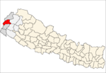
Gokuleshwar is a village development committee in Darchula District in the Mahakali Zone of western Nepal. At the time of the 1991 Nepal census it had a population of 2694 people living in 486 individual households.
Rapla is a Village Development Committee in Darchula District in the Mahakali Zone of western Nepal. At the time of the 1991 Nepal census it had a population of 1112 people residing in 205 individual households.
Rampurwa is a village development committee in Nawalparasi District in the Lumbini Zone of southern Nepal. At the time of the 1991 Nepal census it had a population of 3689 people living in 542 individual households.