Imperial County is a county located on the southeast border of the U.S. state of California. As of the 2020 census, the population was 179,702, making it the least populous county in Southern California. The county seat and largest city is El Centro. Imperial is the most recent California county to be established, as it was created in 1907 out of portions of San Diego County.

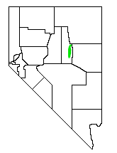
Eureka County is a county in the U.S. state of Nevada. As of the 2020 census, the population was 1,855, making it the second-least populous county in Nevada. Its county seat is Eureka.

Portola is the only incorporated city in Plumas County, California, United States. The population was 2,104 at the 2010 census, down from 2,227 at the 2000 census. Portola is located on the Middle Fork of the Feather River and was named after Spanish explorer Gaspar de Portolá, although he did not explore this area.

Paradise is an unincorporated town and census-designated place (CDP) in Clark County, Nevada, United States, adjacent to the city of Las Vegas. It was formed on December 8, 1950. Its population was 191,238 at the 2020 census, making it the fifth-most-populous CDP in the United States; if it were an incorporated city, it would be the fifth-largest in Nevada. As an unincorporated town, it is governed by the Clark County Commission with input from the Paradise Town Advisory Board.
Carlin is a small city located near the western border of Elko County in northeast Nevada, 23 miles (37 km) west of the city of Elko. It is part of the Elko Micropolitan Statistical Area. Carlin sits along Interstate 80 at an elevation of approximately 4,900 feet (1,500 m). As of the 2010 census, its population was 2,368, up from 2,161 at the 2000 census. The city was named for Civil War general William Passmore Carlin. Its slogan is "Where the Train Stops...And the Gold Rush Begins".

U.S. Route 93 (US 93) is a major north–south 1,359-mile (2,187 km) U.S. Numbered Highway in the western United States, that connects U.S. Route 60 (US 60) in Wickenburg, Arizona with British Columbia Highway 93 at the Canadian border. The highway passes through Kingman, Arizona; Las Vegas, Nevada; Twin Falls, Idaho; and Missoula, Montana.

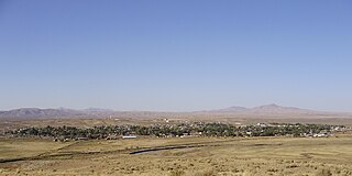
Eureka is an unincorporated town and census-designated place in and the county seat of Eureka County, Nevada, United States. With a population of 480 as of the 2018 American Community Survey 5-Year Estimates, it is by far the largest community in Eureka County. Attractions include the Eureka Opera House, Raine’s Market and Wildlife Museum, the Jackson House Hotel, and the Eureka Sentinel Museum.

The Feather River is the principal tributary of the Sacramento River, in the Sacramento Valley of Northern California. The river's main stem is about 73 miles (117 km) long. Its length to its most distant headwater tributary is just over 210 miles (340 km). The main stem Feather River begins in Lake Oroville, where its four long tributary forks join—the South Fork, Middle Fork, North Fork, and West Branch Feather Rivers. These and other tributaries drain part of the northern Sierra Nevada, and the extreme southern Cascades, as well as a small portion of the Sacramento Valley. The total drainage basin is about 6,200 square miles (16,000 km2), with approximately 3,604 square miles (9,330 km2) above Lake Oroville.


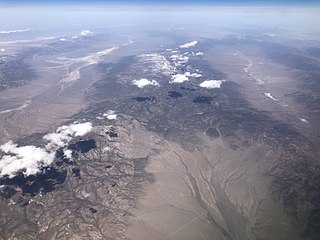
The Pancake Range is located in east-central Nevada in the United States. The range extends as an irregular sinuous line for approximately 90 miles (140 km) with a roughly north-south trend in Nye and White Pine counties. The range reaches an elevation of 9,240 feet (2,820 m) at Portuguese Mountain. Neighboring ranges include the White Pine, Grant and Quinn Canyon ranges across Railroad Valley on the east-southeast; and Park and Hot Creek ranges across Big Sandy Springs and Hot Creek valleys on the west-northwest. The south end of Newark Valley lies at the extreme north end of the range. The Lunar Crater Volcanic Field lies at the southwestern end of the chain with the Reveille Range to the south.

The Grant Range is a mountain chain in east-central Nevada in the western United States. It runs for approximately 30 miles (50 km) in a generally north-south direction in northeastern Nye County. It is located south of the Horse Range and northeast of the closely associated Quinn Canyon Range. To the west is the expansive Railroad Valley and to the east is the White River Valley. The White River Valley drains the eastern slopes of the range into the Colorado River.

The Diamond Mountains are a mountain range along the border of Eureka and White Pine Counties, in northern Nevada, Western United States.

The Jarbidge River is a 51.8-mile-long (83.4 km), high elevation river in Elko County, Nevada and Owyhee County, Idaho in the United States. The Jarbidge originates as two main forks in the Jarbidge Mountains of northeastern Nevada and then flows through basalt and rhyolite canyons on the high plateau of the Owyhee Desert before joining the Bruneau River.

U.S. Route 50 (US 50) is a transcontinental highway in the United States, stretching from West Sacramento, California, in the west to Ocean City, Maryland, on the east coast. The Nevada portion crosses the center of the state and was named "The Loneliest Road in America" by Life magazine in July 1986. The name was intended as a pejorative, but Nevada officials seized it as a marketing slogan. The name originates from large desolate areas traversed by the route, with few or no signs of civilization. The highway crosses several large desert valleys separated by numerous mountain ranges towering over the valley floors, in what is known as the Basin and Range province of the Great Basin.
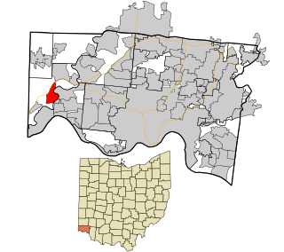
Hooven is a census-designated place (CDP) in southeastern Whitewater Township, Hamilton County, Ohio, United States. The population was 464 at the 2020 census. Hooven has a ZIP code of 45033.
The Antelope Range is a mountain range in Nye County, Nevada. A small part of the range extends north into southern Eureka County. The community of Eureka is about 35 km (22 mi) to the northeast of north end of the range.
The Antelope Valley of southern Eureka County is a small 35 mi long valley, surrounded by four mountain ranges. Antelope Wash flows north, to endorheic flatlands at the valley's north end. Eureka, Nevada lies 20 mi east nestled among mountain ranges. From Eureka U.S. Route 50 travels west through the north end of the valley on a route to Austin.

Newark Valley is a north–south trending endorheic valley in western White Pine County, Nevada. The valley contains the dry Newark Lake bed, which is approximately 23 km (14 mi) by 3.5 km (2.2 mi). To the west, the Diamond Mountains border the valley and to the east, various minor mountains separate the Newark from Long Valley. To the north across a relatively low divide lies Huntington and Ruby valleys.