
Taşkent, formerly Pirlerkondu, is a town and district of Konya Province in the Akdeniz region of Turkey. It literally means The Stone City. According to 2000 census, population of the district is 46,396 of which 10,779 live in the town of Taşkent.

Jasenová is a village and municipality in Dolný Kubín District in the Zilina Region of northern Slovakia. It has population of 401 people.

Hănești Commune is a commune in Botoșani County, Romania. It is composed of five villages: Borolea, Hănești, Moara Jorii, Sărata-Basarab and Slobozia Hănești. The population is 2844 people, and the commune has an area of 6052 ha. The commune has three primary schools and five secondary schools.

Yaroo khosa is a village located at 13 km away from Dera Ghazi khan in province of Punjab, Pakistan. The mountains are 20 km away. The people speak Balochi and Sraiki in this village.

Grabówka Ukazowa is a village in the administrative district of Gmina Annopol, within Kraśnik County, Lublin Voivodeship, in eastern Poland. It lies approximately 9 kilometres (6 mi) north-east of Annopol, 21 km (13 mi) west of Kraśnik, and 57 km (35 mi) south-west of the regional capital Lublin.

Qızqayıtdı is a village in the Neftchala Rayon of Azerbaijan. The village forms part of the municipality of Mikayıllı. According to Azerbaijan's State Statistics Committee, only three people lived in the village as of 2014.
Keş is a village in the Siazan Rayon of Azerbaijan.
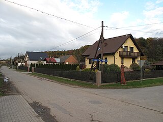
Ciosny is a village in the administrative district of Gmina Zgierz, within Zgierz County, Łódź Voivodeship, in central Poland. It lies approximately 9 kilometres (6 mi) north of Zgierz and 17 km (11 mi) north of the regional capital Łódź.
Karolin is a village in the administrative district of Gmina Zakrzew, within Lublin County, Lublin Voivodeship, in eastern Poland.
Klin is a village in the administrative district of Gmina Baranów, within Puławy County, Lublin Voivodeship, in eastern Poland.
Ponięcice is a village in the administrative district of Gmina Rudnik, within Racibórz County, Silesian Voivodeship, in southern Poland. It lies approximately 6 kilometres (4 mi) north of Rudnik, 12 km (7 mi) north-west of Racibórz, and 61 km (38 mi) west of the regional capital Katowice.
Stanisławka is a village in the administrative district of Gmina Debrzno, within Człuchów County, Pomeranian Voivodeship, in northern Poland. It lies approximately 5 kilometres (3 mi) north-west of Debrzno, 17 km (11 mi) south-west of Człuchów, and 132 km (82 mi) south-west of the regional capital Gdańsk.
Paczewo is a village in the administrative district of Gmina Sierakowice, within Kartuzy County, Pomeranian Voivodeship, in northern Poland. It lies approximately 3 kilometres (2 mi) north-east of Sierakowice, 19 km (12 mi) west of Kartuzy, and 47 km (29 mi) west of the regional capital Gdańsk.
Stołpie is a village in the administrative district of Gmina Polanów, within Koszalin County, West Pomeranian Voivodeship, in north-western Poland. It lies approximately 17 kilometres (11 mi) north-west of Polanów, 20 km (12 mi) east of Koszalin, and 151 km (94 mi) north-east of the regional capital Szczecin.
Krasna is a settlement in the administrative district of Gmina Świdwin, within Świdwin County, West Pomeranian Voivodeship, in north-western Poland. It lies approximately 14 kilometres (9 mi) south-east of Świdwin and 95 km (59 mi) east of the regional capital Szczecin.

Topla is a village in the municipality of Bor, Serbia. According to the 2002 census, the village has a population of 100 people.
Uudeküla is a village in Tapa Parish, Lääne-Viru County, in northeastern Estonia.
Soe is a village in Orava Parish, Põlva County in southeastern Estonia.

Mačkatica is a village in the municipality of Surdulica, Serbia. According to the 2002 census, the village has a population of 259 people.

Jezdkovice is a village in the Moravian-Silesian Region of the Czech Republic. As of June 17, 2011, the population was 226.


