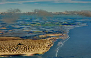
The Wadden Sea is an intertidal zone in the southeastern part of the North Sea. It lies between the coast of northwestern continental Europe and the range of low-lying Frisian Islands, forming a shallow body of water with tidal flats and wetlands. It has a high biological diversity and is an important area for both breeding and migrating birds. In 2009, the Dutch and German parts of the Wadden Sea were inscribed on UNESCO's World Heritage List and the Danish part was added in June 2014.
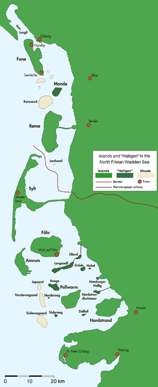
The North Frisian Islands are the Frisian Islands off the coast of North Frisia.

Frisia is a cross-border cultural region in Northwestern Europe. Stretching along the Wadden Sea, it encompasses the north of the Netherlands and parts of northwestern Germany. Wider definitions of "Frisia" may include the island of Rem and the other Danish Wadden Sea Islands. The region is traditionally inhabited by the Frisians, a West Germanic ethnic group.

Vlieland is a municipality and island in the northern Netherlands. The municipality of Vlieland is the second most sparsely populated municipality in the Netherlands, after Schiermonnikoog.

The Frisian Islands, also known as the Wadden Islands or the Wadden Sea Islands, form an archipelago at the eastern edge of the North Sea in northwestern Europe, stretching from the northwest of the Netherlands through Germany to the west of Denmark. The islands shield the mudflat region of the Wadden Sea from the North Sea.
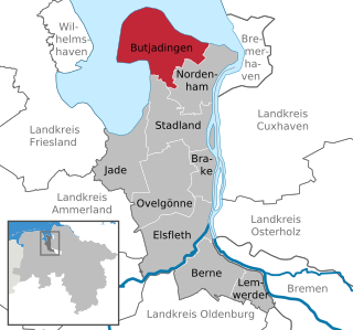
Butjadingen is a peninsula and municipality in the Wesermarsch district, in Lower Saxony, Germany.

Wittmund is a town and capital of the district of Wittmund, in Lower Saxony, Germany.

Roggenstede is an East Frisian village in Lower Saxony, Germany. It is an Ortsteil of the municipality of Dornum, in the district of Aurich. Roggenstede is located about 2 kilometers southeast of Dornum.

Kornwerderzand is a village on the Afsluitdijk, a major dam in the Netherlands that links Friesland with North Holland.

Baltrum is a barrier island off the coast of East Frisia, in Germany, and is a municipality in the district of Aurich, Lower Saxony. It is located in-between the chain of the seven inhabited East Frisian Islands. Baltrum is the smallest island in this chain by area and inhabitants. It has a land area of 6.5 square kilometres, and a population in (2011) of just over 500 resident inhabitants.
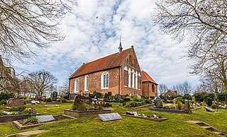
Dornum is a village and a municipality in the East Frisian district of Aurich, in Lower Saxony, Germany. It is located near the North Sea coast, approx. 15 km east of Norden, and 20 km north of Aurich.

Spiekeroog is one of the East Frisian Islands, off the North Sea coast of Germany. It is situated between Langeoog to its west, and Wangerooge to its east. The island belongs to the district of Wittmund, in Lower Saxony in Germany. The only village on the island is also called Spiekeroog. The island is part of the Wadden Sea World Heritage Site by the UNESCO and the Lower Saxon Wadden Sea National Park.
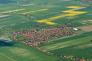
Neßmersiel is an East Frisian village and seaside resort on the Wadden Sea coast in Lower Saxony, Germany. It is an Ortsteil of the municipality of Dornum, in the district of Aurich. Neßmersiel is located about 5 kilometers northwest of Dornum.
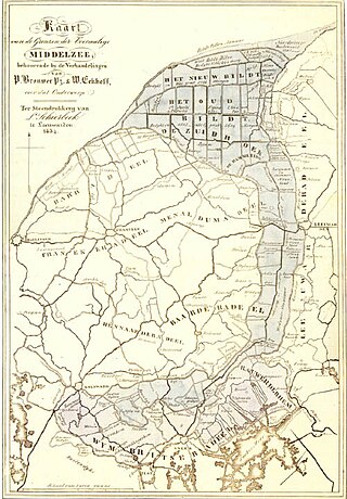
The Middelzee, also called Bordine, was the estuary mouth of the River Boorne now in the Dutch province of Friesland. It ran from as far south as Sneek northward to the Wadden Sea and marked the border between main Frisian regions of Westergoa (Westergo) and Eastergoa (Oostergo). Other historical names for the Middelzee include Bordaa, Borndiep, Boerdiep, and Bordena. The names like Bordine, mean "border".
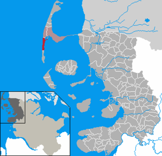
Rantum is a village and a former municipality on the island of Sylt in the district of Nordfriesland, in Schleswig-Holstein, Germany. Since 1 January 2009, it has been an Ortsteil (part) of the municipality Sylt.

Norderoog is one of the ten German halligen islands of the North Frisian Islands in the Wadden Sea, which is part of the North Sea off the coast of Germany. A part of Hooge municipality, the island belongs to the Nordfriesland district.

The Norderland was a historic territory, set on the northwestern edge of East Frisia immediately next to the Wadden Sea off North Germany, which embraced a wide area around the town of Norden. The Norderland was bordered in the east by the Harlingerland and in the south by the Brokmerland.

Nesse is an East Frisian village in Lower Saxony, Germany. It is an Ortsteil of the municipality of Dornum, in the district of Aurich. It is situated near the Wadden Sea coast, approximately 2.5 km west of the village of Dornum, and 20 km north of the town of Aurich. As of 2021, the village and surrounding farms had a population of 639.

Dornumergrode is an East Frisian village near the Wadden Sea coast in Lower Saxony, Germany. It is an Ortsteil of the municipality of Dornum, in the Aurich district.

Westerbur is an East Frisian village in Lower Saxony, Germany. It is an Ortsteil of the municipality of Dornum, in the district of Aurich. Administratively, the settlement of Middelsbur, located slightly to the northeast, belongs to Westerbur.


