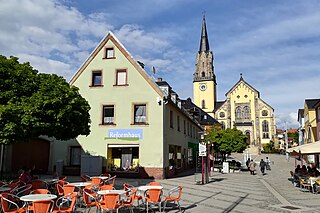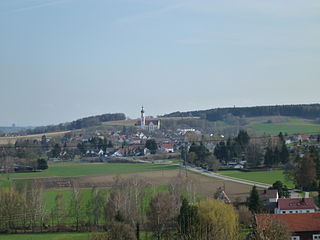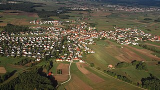
Neubiberg is a municipality and a village in south-east of Munich, Germany, founded in 1912. Today, the largest part of the area is used by Bundeswehr University Munich. Neubiberg consists mainly of semi-detached and detached houses and has many gardens. The village of Unterbiberg is part of the municipality. It hosts the headquarters of Infineon Technologies (Campeon) located in the west of Unterbiberg, as well as the headquarters of Intel Deutschland GmbH, a wireless semiconductor business. In 2023, there was Nazi graffiti in Neubiberg which caused a public reaction.

Bayerisch Eisenstein, until 1951 just Eisenstein is a village and a municipality in the Regen district, in Bavaria, Germany.

Selb is a town in the district of Wunsiedel, in Upper Franconia, Bavaria, Germany. It is situated in the Fichtel Mountains, on the border with the Czech Republic, 20 km northwest of Cheb and 23 km southeast of Hof.

Nersingen is a municipality in the District of Neu-Ulm in Bavaria, Germany. The neighbours are Neu-Ulm, Elchingen, Bibertal and Pfaffenhofen an der Roth.

Unterföhring is a municipality in Upper Bavaria. It lies adjacent to the northeast side of Munich, and is one of the nearest suburbs to Munich's central district.

Marktoberdorf is the capital of the Bavarian district of Ostallgäu in the Regierungsbezirk of Swabia.

Bischofsheim in der Rhön is a town in the district Rhön-Grabfeld, in Bavaria, Germany. It is situated in the Rhön Mountains, 29 km southeast of Fulda.

Lichtenau is a market town in the district of Ansbach, Middle Franconia, Bavaria, Germany. A small village/town of roughly 3,780 population on the “Castle Road” theme route of Southern Germany. It lies at 390 meters above sea level with an area of 41.39 km2. A very traditional little town, it is also home to the “Veste Lichtenau” (castle) which now houses the Nuremberg Archives.

Biberbach is a municipality in the northern part of the district of Augsburg in Bavaria in Germany. A famous baroque pilgrimage church is located on the hill above the village.

Münster is a municipality in the district of Donau-Ries in Bavaria in Germany.

Langensendelbach is a municipality in the district of Forchheim in Bavaria in Germany with a population of over 3100. The village Bräuningshof is a part of Langensendelbach.

Gammelsdorf is a municipality in the district of Freising in Bavaria in Germany.

Grainau is a municipality in the district of Garmisch-Partenkirchen, in southern Bavaria, Germany. It is located at the foot of the Zugspitze mountain, the tallest mountain in Germany in the sub-mountain range of the Wetterstein Alps which is a branch off the main mountain range it is connected to, the Alps. Lake Eibsee in Grainau lies at the foot of the Zugspitze surrounded by forest.

Oberau is a municipality in the district of Garmisch-Partenkirchen, in Bavaria, Germany.

Rottach-Egern is a municipality and town located at Lake Tegernsee in the district of Miesbach in Upper Bavaria, Germany, about 55 km south of central Munich. Late Austrian actor Walter Slezak is buried in this area.

Westendorf is a municipality in the district of Ostallgäu in Bavaria in Germany.

Bastheim is a municipality in the district of Rhön-Grabfeld in Bavaria in Germany. Wechterswinkel Abbey stands in the village of Wechterswinkel, part of Bastheim.

Tittling is a municipality in the district of Passau in Bavaria in Germany.

Bad Endorf is a municipality and a village in the district of Rosenheim in Bavaria in Germany. The market town is located about 15 km outside of Rosenheim and is in close proximity to Lake Simssee and Chiemsee lake and its larger shore towns, Prien, Gstadt, and Seebruck.

Halfing is a municipality in the district of Rosenheim in Bavaria in Germany. It is located in the western part of the Chiemgau area, half-way between Chiemsee and Wasserburg am Inn.


