Teisnach

Last updated

Teisnach
Kirche und Rathaus von Teisnach.JPG
Saint Margaret Church and the Town Hall
DEU Teisnach COA.svg
Location of Teisnach within Regen district
Teisnach in REG.svg
Germany adm location map.svg
Red pog.svg
Teisnach
Bavaria location map.svg
Red pog.svg
Teisnach
Coordinates: 49°2′N13°0′E / 49.033°N 13.000°E / 49.033; 13.000
Country Germany
State Bavaria
Admin. region Niederbayern
District Regen
Government
   Mayor (202329) Daniel Graßl [1] (SPD)
Area
  Total25.79 km2 (9.96 sq mi)
Highest elevation
700 m (2,300 ft)
Lowest elevation
440 m (1,440 ft)
Population
 (2022-12-31) [2]
  Total3,023
  Density120/km2 (300/sq mi)
Time zone UTC+01:00 (CET)
  Summer (DST) UTC+02:00 (CEST)
Postal codes
94244
Dialling codes 09923
Vehicle registration REG
Website teisnach.de

Teisnach (Northern Bavarian: Deisna) is a larger municipality in the district of Regen in Bavaria in Germany.

Contents

Geography

Teisnach is situated in the Bavarian Forest region in Lower Bavaria. The municipality lies on the estuary of the river Teisnach into the Schwarzer Regen (river) about 25 kilometers north of Deggendorf and around 170 kilometers northeast of the Bavarian capital Munich.

History

The village of Teisnach was first mentioned in an official document in the year 1367 as a small fishing village. In 1818, today's municipality formed out of the merging with Teisnach and the nearby municipalities of Kaikenried and Sohl. By the late 19th century, the once small village developed into an industrial hub within the region when a paper factory was opened on the shore of the Schwarzer Regen. This led to a growth in population and the construction of the Teisnach church in 1900. In 1890, Teisnach was linked to the railway network with the opening of the Gotteszell-Blaibach railway. In 1969, the Rohde & Schwarz company opened a manufacturing plant in Teisnach which expanded into one of the largest employees in the region, employing nearly 2000 workers. Since 2009, Teisnach hosts a branch of the Technische Hochschule Deggendorf, where the world's largest machine for producing space telescope mirrors is situated.

Population History

Between 1988 and 2018 the population of the town grew from 2686 to 2950 to 264 inhabitants i.e. by ca. 10 %, which was the highest growth rate in the region in this time.

Politics

The current mayor of Teisnach is Daniel Graßl (SPD), having taken office in 2018. His predecessor, Rita Röhrl who was mayor since 1990, left office after she was elected head of the Regen district. The current parish council consists of 14 members, 6 from the cristian-social Christlich Soziale Union, 5 members from the social-democratic SPD, 2 further members from the Free Voters and one Independent.

Related Research Articles

Cham is a Landkreis (district) in Bavaria, Germany. It is bounded by the districts of Regen, Straubing-Bogen, Regensburg and Schwandorf and by the Czech Plzeň Region.

Deggendorf is a Landkreis (district) in Bavaria, Germany. It is bordered by the districts of Regen, Freyung-Grafenau, Passau, Rottal-Inn, Dingolfing-Landau and Straubing-Bogen.

Freyung-Grafenau is a Landkreis (district) in Bavaria, Germany. It is bounded by the districts of Passau, Deggendorf and Regen, the Czech Republic and by Austria.

Regen is a Landkreis (district) in Bavaria, Germany. It is bounded by the districts of Freyung-Grafenau, Deggendorf, Straubing-Bogen and Cham, and by the Czech Republic.

Straubing-Bogen is a Landkreis (district) in the eastern part of Bavaria, Germany. Neighboring districts are Cham, Regen, Deggendorf, Dingolfing-Landau, Landshut and Regensburg. The independent town of Straubing is surrounded by the district. The seat of the government of the district (Landratsamt) is located in Straubing.

<span class="mw-page-title-main">Zwiesel</span> Town in Bavaria, Germany

Zwiesel is a town in the lower-Bavarian district of Regen, and since 1972 is a Luftkurort with particularly good air. The name of the town was derived from the Bavarian word stem zwisl which refers to the form of a fork. The fork of the rivers Großer Regen and Kleiner Regen and the land that lies between these two rivers were called Zwiesel.

<span class="mw-page-title-main">Stamsried</span> Municipality in Bavaria, Germany

Stamsried is a village and municipality in the district of Cham in the Upper Palatinate region of Bavaria, Germany, near the Czech border. It is also located in the Roman Catholic diocese of Regensburg. Stamsried has a population of 2,319 as of June 2004 and an area of 4,343 hectares which includes surrounding countryside outside the built up area of the village itself, the population density is 53.4 persons per square kilometer. Stamsried is located 456 meters above sea level and contains rolling hills as high as 600 meters.

<span class="mw-page-title-main">Regen</span> Town in Bavaria, Germany

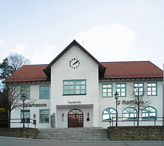
Regen is a town in Bavaria, Germany, and the district town of the district of Regen.

<span class="mw-page-title-main">Cham, Germany</span> Town in Bavaria, Germany

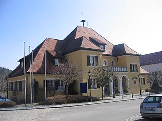
Cham is the capital of the district of Cham in the Upper Palatinate in Bavaria in Germany.

<span class="mw-page-title-main">Aldersbach</span> Municipality in Bavaria, Germany

Aldersbach is a municipality in the district of Passau in Bavaria in Germany. The former Cistercian Aldersbach Abbey, of which the Baroque church remains, is located in the village. There is also a brewery with museum. Aldersbach has around 4,500 inhabitants.

<span class="mw-page-title-main">Viechtach</span> Town in Bavaria, Germany

Viechtach is a town in the district of Regen in Bavaria in Germany. It is situated on the river Schwarzer Regen, 31 km northeast of Straubing, and it is known for the quartz mountains nearby.

<span class="mw-page-title-main">Schmidmühlen</span> Municipality in Bavaria, Germany

Schmidmühlen is a municipality in the district of Amberg-Sulzbach in Bavaria in Germany. It is situated at the junction of the Vils and Lauterach rivers.

<span class="mw-page-title-main">Außernzell</span> Municipality in Bavaria, Germany

Außernzell is a municipality in the district of Deggendorf in Bavaria in Germany. It is part of the municipal union of Schöllnach.

<span class="mw-page-title-main">Lalling</span> Municipality in Bavaria, Germany

Lalling is a municipality in the Lower Bavarian district of Deggendorf in Germany. It is a nationally recognized resort town.

<span class="mw-page-title-main">Oberding</span> Municipality in Bavaria, Germany

Oberding is a municipality in the district of Erding in Upper Bavaria in Germany, and member of the same administrative community. Almost half of the area of Munich Airport, including both terminals, falls within the municipal bounds.

<span class="mw-page-title-main">Neuburg am Inn</span> Municipality in Bavaria, Germany

Neuburg am Inn is a municipality in the district of Passau in Bavaria in Germany.

<span class="mw-page-title-main">Kollnburg</span> Municipality in Bavaria, Germany

Kollnburg is a municipality in the district of Regen, in Bavaria, Germany. A part of the municipal area, including the parish village of the same name, is a state-approved resort.

<span class="mw-page-title-main">Rinchnach</span> Municipality in Bavaria, Germany

Rinchnach is a municipality in the Lower Bavarian district of Regen, of Germany. As of 2000, the population was 3,261.

<span class="mw-page-title-main">Pleinfeld</span> Municipality in Bavaria, Germany

Pleinfeld is a Franconian municipality and market town in the Weißenburg-Gunzenhausen district, in the German state of Bavaria. It is situated in the Metropolitan Area of Nuremberg and in the Franconian Lake District. Pleinfeld is a nationally recognized recreation area.

<span class="mw-page-title-main">Gotteszell–Blaibach railway</span> Railway line in Germany

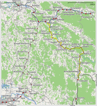
The Gotteszell–Blaibach railway is a railway line in the state of Bavaria in southern Germany that runs from Gotteszell in Lower Bavaria to Blaibach in the Upper Palatinate.

References