
Berchtesgaden is a municipality in the district Berchtesgadener Land, Bavaria, in southeastern Germany, near the border with Austria, 30 km (19 mi) south of Salzburg and 180 km (110 mi) southeast of Munich. It lies in the Berchtesgaden Alps. South of the town, the Berchtesgaden National Park stretches along three parallel valleys.

Garmisch-Partenkirchen is an Alpine ski town in Bavaria, southern Germany. It is the seat of government of the district of Garmisch-Partenkirchen, in the Oberbayern region, which borders Austria. Nearby is Germany's highest mountain, Zugspitze, at 2,962 metres (9,718 ft) above sea level.

Zwiesel is a town in the lower-Bavarian district of Regen, and since 1972 is a Luftkurort with particularly good air. The name of the town was derived from the Bavarian word stem zwisl which refers to the form of a fork. The fork of the rivers Großer Regen and Kleiner Regen and the land that lies between these two rivers were called Zwiesel.

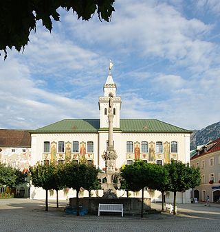
Miesbach is a town in Bavaria, Germany, and is the capital of the Miesbach district. The district is at an altitude of 697 metres above sea level. It covers an area of approximately 863.50 km2 of alpine headlands and in 2017 had a population of 11,477. The town is located 48 km southeast of Munich. Lake Schliersee and Lake Tegernsee, around which are the internationally renowned spas, Bad Wiessee, Rottach-Egern and Tegernsee, are nearby. Miesbach was founded around the year 1000 and was for hundreds of years the seat of the County of Hohenwaldeck. In the 19th century, it became the centre of the conservation movement for the traditional costumes, the Tracht. Miesbach also has a rich history as a pilgrimage and a mining village, which can still be seen in the city landscape.
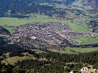
Oberstdorf is a municipality and skiing and hiking town in Germany, located in the Allgäu region of the Bavarian Alps. It is the southernmost settlement in Germany and one of its highest towns.
Bad Reichenhall is a spa town, and administrative center of the Berchtesgadener Land district in Upper Bavaria, Germany. It is located near Salzburg in a basin encircled by the Chiemgau Alps. Together with other alpine towns Bad Reichenhall engages in the Alpine Town of the Year Association for the implementation of the Alpine Convention to achieve sustainable development in the alpine arc. Bad Reichenhall was awarded Alpine Town of the Year in 2001.

Bischofsgrün is a municipality in the district of Bayreuth in Bavaria in Germany.

Ofterschwang is a municipality in southern Germany, in Oberallgäu, Bavaria. It is a professional winter sports venue, regularly used for World Cup alpine events.

Lenggries is a municipality and a village in Bavaria, Germany. It is the center of the Isarwinkel, the region along the Isar between Bad Tölz and Wallgau. The town has about 9,500 inhabitants. By area, it is the largest rural municipality ("Gemeinde") in what was formerly West Germany, and the 7th-largest overall.

Mittenwald is a German municipality in the district of Garmisch-Partenkirchen, in Bavaria.
Fichtelberg is a municipality in the district of Bayreuth in Bavaria in Germany. It is a state-recognised climatic spa (Luftkurort).

Bad Kohlgrub is a German municipality in the district of Garmisch-Partenkirchen, in Bavaria. It lies 12 kilometres (7.5 mi) west of Murnau am Staffelsee and 8 kilometres (5.0 mi) north of Oberammergau, and is connected to both by the Ammergau Railway.
Krün is a municipality in the Upper Bavarian district of Garmisch-Partenkirchen. It belongs with Garmisch-Partenkirchen as district capital and cultural center as well as other municipalities to the region Werdenfelser Land. A few kilometers south runs the German-Austrian border.

Apfeldorf is a municipality in the district of Landsberg in Bavaria in Germany.

Bayrischzell is a municipality in the district of Miesbach in Bavaria in Germany.

Rottach-Egern is a municipality and town located at Lake Tegernsee in the district of Miesbach in Upper Bavaria, Germany, about 55 km south of central Munich. Late Austrian actor Walter Slezak is buried in this area.

Weiherhammer is a municipality in the district of Neustadt an der Waldnaab in Bavaria, Germany.

Kiefersfelden is a municipality with about 7000 inhabitants located in the district of Rosenheim in Bavaria, Germany, on the border with Tyrol, Austria.

Inzell is a municipality in the district of Traunstein in Bavaria, Germany. It is known for the Eisstadion Inzell, an outdoor artificial ice rink that has been used for many international speed skating championships. It is now an indoor oval.

Moosbach is a municipality in the district of Neustadt an der Waldnaab in Bavaria, Germany.


