Drayton, Northamptonshire

Last updated

Drayton
Drayton school and green 22nd Jan 2008 (2).JPG
Drayton Green
Northamptonshire UK location map (2021).svg
Red pog.svg
Drayton
Location within Northamptonshire
Population6,415 (2001 Census) Includes Daventry
OS grid reference SP5763
Unitary authority
Ceremonial county
Region
Country England
Sovereign state United Kingdom
Post town DAVENTRY
Postcode district NN11
Dialling code 01327
Police Northamptonshire
Fire Northamptonshire
Ambulance East Midlands
UK Parliament
List of places
UK
England
Northamptonshire
52°16′N1°11′W / 52.26°N 1.18°W / 52.26; -1.18 Coordinates: 52°16′N1°11′W / 52.26°N 1.18°W / 52.26; -1.18

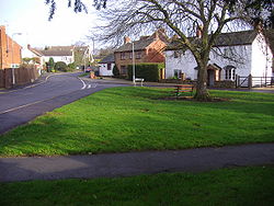
Drayton is a hamlet in England, in the county of Northamptonshire, in the parish of Daventry, 34 mile (1.2 km) from the centre, occupying mainly with suburban housing the lower-lying north western side of the town. [1] [2]

Contents

Toponymy

The name derives from the Old English "Drægtūn", meaning "farmstead at or near a portage or slope used for dragging down loads" or "Farmstead where drays or sledges are used". This is a common place-name throughout England. [3]

History

Not much is known about the origins of the hamlet but it is thought to be as old, or nearly as old, as Daventry. [4] It is thought[ who? ] to have peasant origins, although a Roman pavement was discovered near to the hamlet in 1736[ citation needed ].

It was enclosed in 1753. In recent years the hamlet has expanded and is surrounded by and is part of the modern town of Daventry (both civil and ecclesiastical parishes)[ citation needed ].

There are seven buildings or groups of buildings on the List of Buildings of Special Architectural or Historic Interest. They are all listed as Grade II in the Daventry list under Orchard Street, the Orchards and School Street. [5] They include the Manor House and the school built in 1859 which once catered for the education of 45 children, but it is now a private residence[ citation needed ].

Related Research Articles

<span class="mw-page-title-main">Long Buckby</span> Human settlement in England

Long Buckby is a large village and civil parish in West Northamptonshire, England. In the 2021 census the parish of Long Buckby, which includes the hamlet of Long Buckby Wharf, was recorded as having a population of 4,511.

<span class="mw-page-title-main">Braunston</span> Human settlement in England

Braunston is a village and civil parish in West Northamptonshire, England, next to the border with Warwickshire. At the 2011 Census, the parish had a population of 1,759. Braunston is situated just off the A45 main road and lies between the towns of Daventry and Rugby. Braunston is categorised by the Office for National Statistics as Suburbs and Small Towns: Suburbs There are 776 households in the village.

<span class="mw-page-title-main">Naseby</span> Human settlement in England

Naseby is a village in West Northamptonshire, England. The population of the civil parish at the 2011 Census was 687.

<span class="mw-page-title-main">Daventry</span> Market town and civil parish in Northamptonshire, England

Daventry is a market town and civil parish in the West Northamptonshire unitary authority in Northamptonshire, England, close to the border with Warwickshire. At the 2021 Census Daventry had a population of 28,123, making it the sixth largest town in Northamptonshire.

<span class="mw-page-title-main">Towcester</span> Human settlement in England

Towcester is an affluent market town in Northamptonshire, England. It currently lies in West Northamptonshire but was the former administrative headquarters of the South Northamptonshire district council.

<span class="mw-page-title-main">Bannaventa</span> Settlement in Northamptonshire, England

Bannaventa or Benaventa was a Romano-British fortified town which was on the Roman road later called Watling Street, which today is here, as in most places, the A5 road. Bannaventa straddles the boundaries of Norton and Whilton, Northamptonshire, England, villages highly clustered 1 kilometre (0.62 mi) and double that away, respectively.

<span class="mw-page-title-main">Badby</span> Human settlement in England

Badby is a village and a rural parish of about 2,020 acres (820 ha) in West Northamptonshire, England.

<span class="mw-page-title-main">Barby, Northamptonshire</span> Village in Northamptonshire, England

Barby is a village and civil parish about 5 miles (8 km) north of Daventry in Northamptonshire, England. The 2011 Census recorded the parish population as 2,336. Barby is located right off the M45 motorway a short spur from the M1 motorway to the A45 Trunk Road.

<span class="mw-page-title-main">Spratton</span> Human settlement in England

Spratton is a village and civil parish in the English county of Northamptonshire. The local government authority is West Northamptonshire. Before changes in 2021 it was governed by Daventry District Council. At the time of the 2001 census, the parish's population was 1,099 people, increasing to 1,150 at the 2011 Census. Spratton is 7.1 miles north of Northampton, 6.5 miles from Long Buckby and 11.4 miles from Daventry. The village is situated on the A5199 road.

Newnham is a village in West Northamptonshire in England. The village is 2 miles (3.2 km) south of Daventry, 3 miles (4.8 km) west from Weedon Bec, 6 miles (9.7 km) west of junction 16 of the M1 motorway and 11 miles (18 km) west of Northampton. The A45 road runs a mile northwest of the village. The nearest railway station is at Long Buckby, 8 miles (13 km) northeast.

The history of Northamptonshire spans the same period as English history.

<span class="mw-page-title-main">Willoughby, Warwickshire</span> Human settlement in England

Willoughby is a village and civil parish about 5 miles (8 km) south of Rugby, Warwickshire, England. The village is about 4.5 miles (7 km) northwest of Daventry in neighbouring Northamptonshire and the eastern boundary of the parish forms part of the county boundary.

<span class="mw-page-title-main">Thorpe Mandeville</span> Human settlement in England

Thorpe Mandeville is a village and civil parish in West Northamptonshire, England about 6 miles (10 km) northeast of Banbury in neighbouring Oxfordshire. The hamlet of Lower Thorpe is just north of the village.

<span class="mw-page-title-main">Weedon Bec</span> Human settlement in England

Weedon Bec, usually just Weedon, is a village and parish in West Northamptonshire, England. It is close to the source of the River Nene. The population of the civil parish at the 2011 census was 2,706.

<span class="mw-page-title-main">Welton, Northamptonshire</span> Human settlement in England

Welton is a village and civil parish in the English county of Northamptonshire. The village is located 2.6 miles (4.2 km) north of the nearest town Daventry. It is 13 miles (21 km) west-north west of Northampton, 9 miles (14 km) south east of Rugby and 78 miles (126 km) north-west of London. The village is 1 mile (1.6 km) of the A361 that runs between Daventry and Crick where the M1 junction 18 gives access to the national motorway network north and south. Welton formerly had its own railway station, but today, the nearest railway station is at Long Buckby for the West Midlands Trains services to Birmingham New Street, Northampton and London Euston stations, on the Northampton loop of the West Coast Main Line. For inter-city services, passengers should change at Rugby, the next station westbound. The Village and parish of Welton had in the 2011 census, a population of 608. For the purposes of local government, the village falls within West Northamptonshire.

<span class="mw-page-title-main">Milton Malsor</span> Human settlement in England

Milton Malsor is a village and civil parish in West Northamptonshire, England. The population of the civil parish at the 2011 census was 761. It is 4 miles (6.4 km) south of Northampton town centre, 45 miles (72 km) south-east of Birmingham, and 66 miles (106 km) north of central London; junction 15 of the M1 motorway is 2 miles (3.2 km) east by road. The area of the Milton Malsor civil parish is about 1,650 acres (670 ha), stretching from north of the M1 motorway between junctions 15 and 15A, south to the West Coast Main Line, east to the A508 and A45 roads, and west to the A43 road.

<span class="mw-page-title-main">Grimsbury</span> Human settlement in England

Grimsbury is a largely residential area which forms the eastern part of Banbury, Oxfordshire, England. It is situated east of the River Cherwell, the Oxford Canal and the Cherwell Valley Line railway.

<span class="mw-page-title-main">Wardington</span> Human settlement in England

Wardington is a village and civil parish in Oxfordshire, about 4 miles (6.4 km) northeast of Banbury. The village consists of two parts: Wardington and Upper Wardington. The village is on a stream that rises in Upper Wardington and flows north to join the River Cherwell.

<span class="mw-page-title-main">Salvington</span> Human settlement in England

Salvington is a neighbourhood of Worthing, in the borough of Worthing in West Sussex, England. It lies south of the A27 road two miles (3 km) north-west of the town centre. It is served by three elected Worthing Borough Councillors at any given time, currently Nicola Waight, Noel Atkins and Michael Cloake, all Conservative.

<span class="mw-page-title-main">History of Banbury</span> History of Banbury, England

Banbury is a circa 1,500-year-old market town and civil parish on the River Cherwell in the Cherwell District of Oxfordshire, England. It is 64 miles (103 km) northwest of London, 38 miles (61 km) southeast of Birmingham, 27 miles (43 km) south of Coventry and 21 miles (34 km) north northwest of the county town of Oxford.

References

  1. ’OS’ Explorer Map, Rugby & Daventry 222, ISBN   978-0-319-23734-2
  2. Ordnance Survey of Great Britain New Popular Edition, Sheet 132 - Coventry and Rugby
  3. 'A Dictionary of British Place-Names', 'Oxford Paperback Reference', A. D. Mills, OUP Oxford, 2003, ISBN   0191578479, 9780191578472
  4. History On Line
  5. British Listed Buildings

Commons-logo.svg Media related to Drayton, Northamptonshire at Wikimedia Commons