Drummond Nature Reserve

Last updated

View from the south western boundary into the reserve; the yellow flowers are species of Acacia Drummond nature reserve gnangarra 01.JPG
View from the south western boundary into the reserve; the yellow flowers are species of Acacia

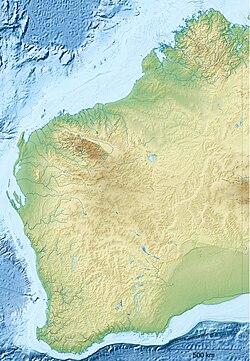
The Drummond Nature Reserve is an A class nature reserve 10 kilometres west of Bolgart, Western Australia. Named after the botanist James Drummond, the reserve has 439 species of vascular plants within its boundaries, including two rare and seven priority species.
Contents

History

In 1993 the land was purchased by the Mundaring district office of the Department of Conservation and Land Management and gazetted as an A class reserve. Prior to purchasing the land was uncleared freehold grazing land. Despite this use the land was in excellent condition, though evidence of grazing impact was visible in part of the eastern area of the reserve. The reserve was named after botanist James Drummond who lived in nearby Toodyay. Between 1841 and 1844 Drummond explored and collected specimens in the area which were part of his second collection. [1] [2] [3]

Topography and vegetation

The Drummond Nature Reserve is constructed with a series of lateritic hills with spillway deposits plus a small outcrop of bedrock. There have been ten different vegetation areas identified, and these are based on different soil types, topography and drainage. The area has six different woodland types, two granite heath types, a mallee vegetation type and two of the last claypan wetland areas remaining in the state. [1] [4]

The vegetation of the two granite heath types are; Xanthorrhoea preissii , Gastrolobium calycinum with a Borya herbfield, while the other is dominated by Melaleuca and Dodonaea with a herbfield of Borya. The soil of the mallee area is a yellow sandy clay with the dominant plants being the low dense Eucalyptus drummondii and Allocasuarina . [1]

The north west corner is a wandoo woodland that has been affected by salinity. Most of the trees are either dead or affected by dieback, the understorey has died and been replaced by weeds.

Flora

During 1999 and 2000, the first major survey of the plant species was conducted on foot, identifying 439 species of vascular plants. This consisted of 405 native plant species and 35 alien plant species. There were two declared rare flora; the aquatic herb Trithuria leptogyne (this is the only known location of this species) and Eleocharis keigheryi in two population groups. [1] [5] Additionally there are seven priority species in the reserve.

SpeciesPriority
Acacia chapmanii subsp. australis rare [6] [7]
Comesperma rhadinocarpum two
Tricoryne arenicola two
Platysace ramosissima three
Stenanthemum tridentatum three
Hydrocotyle lemnoides four
Schoenus natans four

There are several other factors of botanical interest in Drummond Nature Reserve. The occurrence of Cyathochaeta equitans is the only known inland population, as this species is found predominantly in the sands of the Swan Coastal Plain. A hybrid of Eucalyptus loxophleba has been found within the reserve, Schoenus aff. loliaceus which may be a new species of Schoenus and Rhodanthe pyrethrum is at it northern limit. [1]

Related Research Articles

<span class="mw-page-title-main">Esperance Plains</span> Bioregion in Western Australia

Esperance Plains, also known as Eyre Botanical District, is a biogeographic region in southern Western Australia on the south coast between the Avon Wheatbelt and Hampton bioregions, and bordered to the north by the Mallee region. It is a plain punctuated by granite and quartz outcrops and ranges, with a semi-arid Mediterranean climate and vegetation consisting mostly of mallee-heath and proteaceous scrub. About half of the region has been cleared for intensive agriculture. Recognised as a bioregion under the Interim Biogeographic Regionalisation for Australia (IBRA), it was first defined by John Stanley Beard in 1980.

Wongan Hills is a range of low flat-topped hills in the Avon Wheatbelt bioregion of Western Australia. It is located at 30°48′S116°37′E, in the Shire of Wongan–Ballidu.

<span class="mw-page-title-main">Mallee bioregion</span> Biogeographic region in southern Western Australia

Mallee, also known as Roe Botanical District, is a biogeographic region in southern Western Australia. Located between the Esperance Plains, Avon Wheatbelt and Coolgardie bioregions, it has a low, gently undulating topography, a semi-arid mediterranean climate, and extensive Eucalyptus mallee vegetation. It has an area of 73,975.59 square kilometres (28,562.13 sq mi). About half of the region has been cleared for intensive agriculture. Recognised as a region under the Interim Biogeographic Regionalisation for Australia (IBRA), it was first defined by John Stanley Beard in 1980.

Assemblages of plants and invertebrate animals of tumulus springs of the Swan Coastal Plain are ecological communities in Western Australia. They have been managed under a number of other, similar names, including Mound springs of the Swan Coastal Plain and Communities of Tumulus Springs . The tumulus mounds were common to a narrow range of groundwater discharge at the boundary of 'bassendean sand' and 'guildford clay', along the edge of the Gnangara Mound aquifer. The communities are critically endangered.

<span class="mw-page-title-main">Western Mallee</span> Biioregion in Western Australia

Western Mallee is an Interim Biogeographic Regionalisation for Australia (IBRA) subregion in southern Western Australia. It is a sparsely populated subregion with an area of about 47,000 square kilometres, roughly centred on the town of Newdegate. Largely cleared for intensive agriculture, it still retains patches of native vegetation, but these are under environmental stress from threats such as rising salinity, and are poorly managed.

<span class="mw-page-title-main">Eastern Mallee</span> Biogeographic region in Western Australia

Eastern Mallee is an Interim Biogeographic Regionalisation for Australia (IBRA) subregion in southern Western Australia.

<span class="mw-page-title-main">Avon Wheatbelt</span> Bioregion in Western Australia

The Avon Wheatbelt is a bioregion in Western Australia. It has an area of 9,517,104 hectares. It is considered part of the larger Southwest Australia savanna ecoregion.

<span class="mw-page-title-main">Hampton bioregion</span> Bioregion in Western Australia

Hampton is an interim Australian bioregion located in southeastern coastal Western Australia, with a small portion (4%) extending into adjacent South Australia. It has an area of 1,088,198 hectares. The Hampton bioregion is part of the Coolgardie woodlands ecoregion.

<span class="mw-page-title-main">Eyre Yorke Block</span>

The Eyre Yorke Block, also known as the Eyre and Yorke mallee, is an interim Australian (IBRA) bioregion and a World Wildlife Fund ecoregion covering part of the Eyre Peninsula and all of Yorke Peninsula as well as land to its immediate east in South Australia.

<span class="mw-page-title-main">Yathong Nature Reserve</span> Protected area in New South Wales, Australia

The Yathong Nature Reserve is a protected nature reserve that is also a nationally and internationally recognized biosphere situated in the central-western region of New South Wales, in eastern Australia. The 107,240-hectare (265,000-acre) reserve was listed by UNESCO in 1977 as a Biosphere Reserve under the Man and the Biosphere Programme (MAB). The reserve is significant for its biodiversity in both native plant and animal species. Cultural heritage and historical grazing activities add to the significance of this site as a conservation area.

<span class="mw-page-title-main">Charcoal Tank Nature Reserve</span> Protected area in New South Wales, Australia

The Charcoal Tank Nature Reserve is a protected nature reserve in the central western region of New South Wales, Australia. The 86.4-hectare (213-acre) reserve is situated 10 kilometres (6.2 mi) south of West Wyalong and may be accessed via the Newell Highway and The Charcoal Tank Road. The reserve is an important refuge for native flora and fauna in a highly fragmented landscape, one in which the majority of the original vegetation has been removed.

Clackline Nature Reserve is the largest nature reserve in the Shire of Northam. It is located approximately one kilometre (0.62 mi) north of Clackline, in Western Australia's Wheatbelt region. The reserve is extends east to Clackline–Toodyay Road, south to one kilometre (0.62 mi) before Great Eastern Highway, and west to an unnamed road that runs north-west from Refractory Road. In March 2005, the reserve was 693.7 hectares in size, with an additional 45 hectares added in 2008/09. It is listed on the non-statutory Register of the National Estate.

Boginderra Hills Nature Reserve is a protected nature reserve situated to the north of Temora, located in the Riverina region of New South Wales in eastern Australia. It has an area of 756 hectares.

Ingalba, Big Bush and Pucawan Nature Reserves are three Nature Reserves situated to the west of Temora, New South Wales. Ingalba Nature Reserve is situated 10 kilometres west of Temora and Pucawan Nature Reserve a further 6 km west. Big Bush Nature Reserve is 15 kilometres northwest of Temora. All three reserves are located within Temora Shire. They are managed concurrently by the New South Wales Parks and Wildlife Service. The reserves are linked by corridors of vegetation in adjacent private land and along roads and Travelling Stock Routes.

Verran Tanks Conservation Park is a protected area in the Australian state of South Australia, located on the Eyre Peninsula in the gazetted locality of Verran about 105 kilometres (65 mi) north of Port Lincoln and about 55 kilometres (34 mi) south-east of Lock.

.

<span class="mw-page-title-main">Nocoleche Nature Reserve</span> Nature reserve in Australia

The Nocoleche Nature Reserve is a conservation area in New South Wales on the Paroo River located 20 kilometres south of the town of Wanaaring, New South Wales. It was created in 1979, and has an area of 711.08 km².

Scabby Range Nature Reserve is a heritage-listed protected area at Sams River Fire Trail, Yaouk, New South Wales, Australia. It was established on 3 December 1982 and added to the former Australian Register of the National Estate on 30 June 1992. It was added to the Australian National Heritage List as part of the Australian Alps National Parks and Reserves on 7 November 2008.

<i>Acacia glandulicarpa</i> Species of legume

Acacia glandulicarpa, commonly known as the hairy-pod wattle, is a perennial shrub belonging to the genus Acacia and the subgenus Phyllodinea that is native to parts of south eastern Australia.

References

  1. 1 2 3 4 5 G.Keighery; N.Gibson; A.Webb & W.P.Muir (2002). "A biological survey of the agricultural zone : vegetation and vascular flora of Drummond Nature Reserve" (PDF). Conservation Science W. Aust. 4 (1). Department of Conservation and Land Management. pp. 63–78. Retrieved 29 August 2008.[ permanent dead link ]
  2. Serle, Percival (1949). "Drummond, James". Dictionary of Australian Biography . Sydney: Angus & Robertson.
  3. Nelson, Charles. "Drummond, James (c. 1786 1863)". Bright Sparcs. University of Melbourne. Retrieved 29 August 2008.
  4. "Drummond Nature reserve, freshwater claypan wetlands" (PDF). Legislative Assembly of Western Australia Hansard for 18 November 2003. WA Government. 18 November 2003. Retrieved 22 March 2014.
  5. "Hydatella leptogyne – Few-flowered Hydatella". Species profile and Threats database. Department of Environment, Water and Heritage. Retrieved 29 August 2008.
  6. "Acacia chapmanii subsp. australis". FloraBase . Western Australian Government Department of Biodiversity, Conservation and Attractions.
  7. http://www.environment.gov.au/biodiversity/threatened/species/pubs/acacia-chapmanii-australis-listing.pdf [ bare URL PDF ]

Further reading

31°19′01″S116°24′25″E / 31.317°S 116.407°E / -31.317; 116.407