Dundarrach, North Carolina

Last updated

Dundarrach, North Carolina
Stores in Dundarrach, North Carolina.jpg
NCMap-doton-Dundarrach.PNG
Location of Dundarrach, North Carolina
Coordinates: 34°55′29″N79°09′27″W / 34.92472°N 79.15750°W / 34.92472; -79.15750
Country United States
State North Carolina
County Hoke
Area
[1]
  Total1.32 sq mi (3.41 km2)
  Land1.32 sq mi (3.41 km2)
  Water0.00 sq mi (0.00 km2)
Elevation
[2]
220 ft (70 m)
Population
 (2020)
  Total34
  Density25.84/sq mi (9.97/km2)
Time zone UTC-5 (Eastern (EST))
  Summer (DST) UTC-4 (EDT)
FIPS code 37-18300 [3]
GNIS feature ID2402416 [2]

Dundarrach is a census-designated place (CDP) in Hoke County, North Carolina, United States. At the 2010 census, the population was 41. [4]

Contents

Geography

Dundarrach is located in southeastern Hoke County along North Carolina Highway 20, which leads northwest 5 miles (8 km) to Raeford, the county seat, and southeast the same distance to Lumber Bridge.

According to the United States Census Bureau, the Dundarrach CDP has a total area of 1.3 square miles (3.4 km2), all of it land. [4]

Demographics

Historical population
CensusPop.Note
2020 34
U.S. Decennial Census [5]

As of the census [3] of 2000, 62 people, 25 households, and 19 families resided in the CDP. The population density was 39.7 inhabitants per square mile (15.3/km2). The 31 housing units averaged 19.8/sq mi (7.7/km2). The racial makeup of the CDP was 69.35% White, 11.29% African American, and 19.35% Native American. Hispanics or Latinos of any race were 9.68% of the population.

Of the 25 households, 32.0% had children under the age of 18 living with them, 48.0% were married couples living together, 28.0% had a female householder with no husband present, and 24.0% were not families. About 20.0% of all households were made up of individuals, and 12.0% had someone living alone who was 65 years of age or older. The average household size was 2.48 and the average family size was 2.74.

In the CDP, the population was distributed as 22.6% under the age of 18, 4.8% from 18 to 24, 35.5% from 25 to 44, 16.1% from 45 to 64, and 21.0% who were 65 years of age or older. The median age was 38 years. For every 100 females, there were 100.0 males. For every 100 females age 18 and over, there were 84.6 males.

The median income for a household in the CDP was $4,659, and for a family was $16,250. Males had a median income of $0 versus $0 for females. The per capita income for the CDP was $6,975. No families and 39.3% of the population were living below the poverty line, including none under 18 and 57.9% of those over 64.

Related Research Articles

<span class="mw-page-title-main">Altamahaw, North Carolina</span> Census-designated place in North Carolina, United States

Altamahaw is a census-designated place (CDP) in Alamance County, North Carolina, United States. It is part of the Burlington, North Carolina Metropolitan Statistical Area. As of the 2010 census it had a population of 347. The community was listed as Altamahaw-Ossipee at the 2000 census, at which time the population was 996. The town of Ossipee incorporated in 2002 and currently has a population of 543. The remainder of the territory was reassigned as the Altamahaw CDP.

<span class="mw-page-title-main">Butters, North Carolina</span> Census-designated place in North Carolina, United States

Butters is a census-designated place (CDP) in Bladen County, North Carolina, United States. As of the 2010 census, the population was 294.

<span class="mw-page-title-main">Royal Pines, North Carolina</span> Census-designated place in North Carolina, United States

Royal Pines is a census-designated place (CDP) in Buncombe County, North Carolina, United States. The population was 4,272 at the 2010 census. It is part of the Asheville Metropolitan Statistical Area.

<span class="mw-page-title-main">St. Stephens, North Carolina</span> Census-designated place in North Carolina, United States

St. Stephens is a census-designated place (CDP) in Catawba County, North Carolina, United States. The population was 8,759 at the 2010 census, down from 9,439 in 2000. It is part of the Hickory–Lenoir–Morganton Metropolitan Statistical Area.
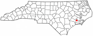
<span class="mw-page-title-main">Neuse Forest, North Carolina</span> Census-designated place in North Carolina, United States

Neuse Forest is a census-designated place (CDP) in Craven County, North Carolina, United States. The population was 2,005 at the 2010 census. It is part of the New Bern, North Carolina Metropolitan Statistical Area.

<span class="mw-page-title-main">South Gastonia, North Carolina</span> Neighborhood in Gaston, North Carolina, United States

South Gastonia is a neighborhood of Gastonia in Gaston County, North Carolina, United States. The population was 5,433 at the 2000 census, at which time it was erroneously listed as a census-designated place. The majority of the community has now been annexed into the city of Gastonia and is now considered to be a neighborhood on the southside of Gastonia.

<span class="mw-page-title-main">South Weldon, North Carolina</span> Census-designated place in North Carolina, United States

South Weldon is an unincorporated community and census-designated place (CDP) in Halifax County, North Carolina, United States. As of the 2010 census, the CDP population was 705. It is part of the Roanoke Rapids, North Carolina Micropolitan Statistical Area.
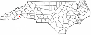
<span class="mw-page-title-main">East Flat Rock, North Carolina</span> Census-designated place in North Carolina, United States

East Flat Rock is an unincorporated area and census-designated place (CDP) in Henderson County, North Carolina, United States. The population was 4,995 at the 2010 census, up from 4,151 at the 2000 census. It is part of the Asheville Metropolitan Statistical Area.

<span class="mw-page-title-main">Valley Hill, North Carolina</span> Census-designated place in North Carolina, United States

Valley Hill is an unincorporated community and census-designated place (CDP) in Henderson County, North Carolina, United States. The population was 2,070 at the 2010 census. It is part of the Asheville Metropolitan Statistical Area.

<span class="mw-page-title-main">Ashley Heights, North Carolina</span> Census-designated place in North Carolina, United States

Ashley Heights is an unincorporated community and census-designated place (CDP) in Hoke County, North Carolina, United States. The population was 380 at the 2010 census.

<span class="mw-page-title-main">Bowmore, North Carolina</span> Census-designated place in North Carolina, United States

Bowmore is an unincorporated community and census-designated place (CDP) in Hoke County, North Carolina, United States. The population was 103 at the 2010 census.

<span class="mw-page-title-main">Five Points, North Carolina</span> Census-designated place in North Carolina, United States

Five Points is a census-designated place (CDP) in Hoke County, North Carolina, United States. The population was 689 at the 2010 census.
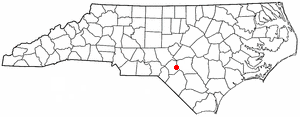
<span class="mw-page-title-main">Rockfish, North Carolina</span> Census-designated place in North Carolina, United States

Rockfish is a census-designated place (CDP) in Hoke County, North Carolina, United States. The population was 3,298 at the 2010 census, up from 2,353 at the 2000 census.
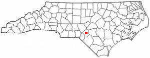
<span class="mw-page-title-main">Silver City, North Carolina</span> Census-designated place in North Carolina, United States

Silver City is an unincorporated area and census-designated place (CDP) in Hoke County, North Carolina in the United States. The population was 882 at the 2010 census, down from 1,146 at the 2000 census.

<span class="mw-page-title-main">West Smithfield, North Carolina</span> Former census-designated place in North Carolina, United States

West Smithfield was an unincorporated community and census-designated place and is now a district of Smithfield, North Carolina in Johnston County, North Carolina, United States. The population was last recorded separately from Smithfield in 2000, when 59 people resided in the CDP.
<span class="mw-page-title-main">Lowesville, North Carolina</span> Census-designated place in North Carolina, United States

Lowesville is a census-designated place (CDP) in Lincoln County, North Carolina, United States. The population was 2,945 at the 2010 census, up from 1,440 in 2000.
<span class="mw-page-title-main">Piney Green, North Carolina</span> CDP in North Carolina, United States

Piney Green is a census-designated place (CDP) in Onslow County, North Carolina, United States. The population was 11,658 at the 2000 census. It is part of the Jacksonville, North Carolina Metropolitan Statistical Area.

Ivanhoe is a census-designated place (CDP) in Sampson County, North Carolina, United States. The population was 198 at the 2020 U.S. census.

<span class="mw-page-title-main">East Gaffney, South Carolina</span> Census-designated place in South Carolina, United States

East Gaffney is a census-designated place (CDP) in Cherokee County, South Carolina, United States. The population was 3,085 at the 2010 United States Census.
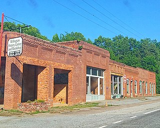
<span class="mw-page-title-main">Willington, South Carolina</span> CDP in South Carolina, United States

Willington is a census-designated place (CDP) in McCormick County, South Carolina, United States. The population was 177 at the 2000 census.

References

  1. "ArcGIS REST Services Directory". United States Census Bureau. Retrieved September 20, 2022.
  2. 1 2 U.S. Geological Survey Geographic Names Information System: Dundarrach, North Carolina
  3. 1 2 "U.S. Census website". United States Census Bureau . Retrieved January 31, 2008.
  4. 1 2 "Geographic Identifiers: 2010 Census Summary File 1 (G001): Dundarrach CDP, North Carolina". American Factfinder. U.S. Census Bureau. Archived from the original on February 13, 2020. Retrieved December 21, 2017.
  5. "Census of Population and Housing". Census.gov. Retrieved June 4, 2016.