Dunkirk, Maryland

Last updated

Dunkirk, Maryland
Calvert County Maryland Incorporated and Unincorporated areas Dunkirk Highlighted.svg
Location of Dunkirk, Maryland
Coordinates: 38°42′49″N76°40′12″W / 38.71361°N 76.67000°W / 38.71361; -76.67000 Coordinates: 38°42′49″N76°40′12″W / 38.71361°N 76.67000°W / 38.71361; -76.67000
CountryUnited States
State Maryland
County Calvert
Area
[1]
  Total7.33 sq mi (19.00 km2)
  Land6.59 sq mi (17.06 km2)
  Water0.75 sq mi (1.94 km2)
Elevation
121 ft (37 m)
Population
 (2020)
  Total2,431
  Density369.12/sq mi (142.52/km2)
Time zone UTC−5 (Eastern (EST))
  Summer (DST) UTC−4 (EDT)
ZIP code
20754
Area code 410
FIPS code 24-24062
GNIS feature ID1852590

Dunkirk is a census-designated place (CDP) in Calvert County, Maryland, United States. The population was 2,521 at the 2010 census. [2]

Contents

Geography

Dunkirk is located in northwestern Calvert County at 38°42′49″N76°40′12″W / 38.71361°N 76.67000°W / 38.71361; -76.67000 (38.713499, −76.670070). [3] Its western border is the Patuxent River, which is also the Prince George's County line. Maryland Route 4 passes through the center of Dunkirk, leading northwest 10 miles (16 km) to Upper Marlboro and south 14 miles (23 km) to Prince Frederick, the Calvert County seat. Downtown Washington, D.C., is 25 miles (40 km) to the northwest.

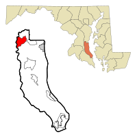
According to the United States Census Bureau, the Dunkirk CDP has a total area of 7.3 square miles (19.0 km2), of which 6.6 square miles (17.1 km2) is land and 0.73 square miles (1.9 km2), or 10.21%, is water. [2]

Climate

The climate in this area is characterized by hot, humid summers and generally mild to cool winters. According to the Köppen Climate Classification system, Dunkirk has a humid subtropical climate, abbreviated "Cfa" on climate maps. [4]

Demographics

Historical population
CensusPop.
2020 2,431
U.S. Decennial Census [5]

As of the census [6] of 2000, there were 2,363 people, 757 households, and 681 families residing in the CDP. The population density was 348.7 inhabitants per square mile (134.6/km2). There were 773 housing units at an average density of 114.1 per square mile (44.1/km2). The racial makeup of the CDP was 91.62% White, 5.97% African American, 0.08% Native American, 1.02% Asian, 0.25% from other races, and 1.06% from two or more races. Hispanic or Latino of any race were 0.85% of the population.

There were 757 households, out of which 40.7% had children under the age of 18 living with them, 80.2% were married couples living together, 7.4% had a female householder with no husband present, and 10.0% were non-families. 7.9% of all households were made up of individuals, and 2.4% had someone living alone who was 65 years of age or older. The average household size was 3.12 and the average family size was 3.28.

In the CDP, the population was spread out, with 29.1% under the age of 18, 5.9% from 18 to 24, 25.8% from 25 to 44, 31.3% from 45 to 64, and 7.9% who were 65 years of age or older. The median age was 39 years. For every 100 females, there were 100.6 males. For every 100 females age 18 and over, there were 97.1 males.

The median income for a household in the CDP was $107,508, and the median income for a family was $102,240. Males had a median income of $157,900 versus $61,025 for females. The per capita income for the CDP was $31,923. None of the families and 0.2% of the population were living below the poverty line, including no under eighteens and none of those over 64.

Related Research Articles

<span class="mw-page-title-main">East Whittier, California</span> Place in California, United States

East Whittier is an unincorporated community in Los Angeles County, California, United States. The population was 9,757 at the 2010 census, up from 9,538 at the 2000 census. For statistical purposes, the United States Census Bureau has defined this community as a census-designated place (CDP). The name was changed from East La Mirada in 2012, likely due to its precise location in relation to the city of Whittier. The previous delineation of East Whittier CDP occurred during the 1960 census, when the area recorded a population of 19,884.

<span class="mw-page-title-main">Ferndale, Maryland</span> Census-designated place in Maryland, United States

Ferndale is a census-designated place (CDP) in Anne Arundel County, Maryland, United States. At the 2010 census, the population was 16,746.

<span class="mw-page-title-main">Hillsmere Shores, Maryland</span> Former census-designated place in Maryland, United States

Hillsmere Shores was a census-designated place (CDP) in Anne Arundel County, Maryland, United States. It is a suburb of Annapolis. The population was 2,977 at the 2000 census. It was included in the Annapolis Neck CDP at the 2010 census. Built in phases, beginning in 1960, the community has been home to The Key School, a non-sectarian private school, since the 1960s.

<span class="mw-page-title-main">Selby-on-the-Bay, Maryland</span> Former census-designated place in Maryland, United States

Selby-on-the-Bay is a census-designated place (CDP) in Anne Arundel County, Maryland, United States, for the 2000 census, at which time its population was 3,674. It was added to the Mayo CDP for the 2010 census.

<span class="mw-page-title-main">Shady Side, Maryland</span> Census-designated place in Maryland, United States

Shady Side is a census-designated place (CDP) in Anne Arundel County, Maryland, United States. The population was 5,803 at the 2010 census.

<span class="mw-page-title-main">Lochearn, Maryland</span> Census-designated place in Maryland, United States

Lochearn is an unincorporated community and census-designated place in Baltimore County, Maryland, United States, located immediately to the west of the City of Baltimore. Per the 2020 census, the population was 25,511.

<span class="mw-page-title-main">Calvert Beach-Long Beach, Maryland</span> Former Census-designated place in Maryland, United States

Calvert Beach-Long Beach was a census-designated place (CDP) in Calvert County, Maryland, United States. The population was 2,487 at the 2000 census. For the 2010 census the area was split into two CDPs: Calvert Beach and Long Beach.

<span class="mw-page-title-main">Chesapeake Ranch Estates-Drum Point, Maryland</span> Former Census-designated place in Maryland, United States

Chesapeake Ranch Estates-Drum Point was a census-designated place in Calvert County, Maryland, for the 2000 United States Census, when it had a population of 11,503. For the 2010 census the area was split into the CDPs of Chesapeake Ranch Estates and Drum Point. The communities are only a few minutes from the popular weekend resort town Solomons as well as the Calvert Cliffs Nuclear Power Plant, Calvert Cliffs State Park and fossil grounds, and the Dominion Cove Point liquefied natural gas terminal.

<span class="mw-page-title-main">Lusby, Maryland</span> Census-designated place in Maryland, United States

Lusby is an unincorporated community and census-designated place (CDP) in Calvert County, Maryland, United States. The population of the CDP was 1,835 at the 2010 census. Residents of the Chesapeake Ranch Estates and Drum Point communities also use the Lusby ZIP code designation.

<span class="mw-page-title-main">Owings, Maryland</span> Census-designated place in Maryland, United States

Owings is a town center and census-designated place (CDP) in northern Calvert County, Maryland, United States. The population was 2,149 at the 2010 census, up from 1,325 in 2000.

<span class="mw-page-title-main">Solomons, Maryland</span> Census-designated place in Maryland, United States

Solomons, also known as Solomons Island, is an unincorporated community and census-designated place (CDP) in Calvert County, Maryland, United States. The population was 2,368 at the 2010 census, up from 1,536 in 2000. Solomons is a popular weekend destination spot in the Baltimore–Washington metropolitan area.

<span class="mw-page-title-main">St. Leonard, Maryland</span> Census-designated place in Maryland

St. Leonard is a census-designated place (CDP) in Calvert County, Maryland, United States. The population was 742 at the 2010 census. Residents of the Calvert Beach and Long Beach communities also use the St. Leonard ZIP code designation. St. Leonard has a large antique dealer complex.

<span class="mw-page-title-main">Algonquin, Maryland</span> Census-designated place in Maryland, United States

Algonquin is a census-designated place (CDP) in Dorchester County, Maryland, United States. The population was 1,241 at the 2010 census. The community was named for the Algonquin people, one of the Native American tribes in the East.

<span class="mw-page-title-main">Perryman, Maryland</span> Census-designated place in Maryland, United States

Perryman is an unincorporated community and census-designated place (CDP) in Harford County, Maryland, United States. The population was 2,342 at the 2010 census.

<span class="mw-page-title-main">Chester, Maryland</span> CDP in Maryland, United States

Chester is a census-designated place on Kent Island in Queen Anne's County, Maryland, United States. The population was 3,723 at the 2000 census.

<span class="mw-page-title-main">Kent Narrows, Maryland</span> CDP in Maryland, United States

Kent Narrows is a census-designated place and town in Queen Anne's County, Maryland, United States. As of the 2000 census, the town had a population of 567.

<span class="mw-page-title-main">Charlotte Hall, Maryland</span> CDP in Maryland, United States

Charlotte Hall is a census-designated place (CDP) in Charles and St. Mary's counties, Maryland, United States. The population was 1,420 at the 2010 census. The Maryland Veterans Home for disabled veterans, including a U.S. Veterans Affairs clinic, is located on the site of the former Charlotte Hall Military Academy. The Academy site was declared the Charlotte Hall Historic District, and listed on the National Register of Historic Places in 1975. Since 1940, a sizable Amish farming community has existed nearby, along with a farmers' market and large flea market complex on Maryland Route 5, which is also the site of numerous strip-mall businesses continuing into the adjacent community of Mechanicsville.

<span class="mw-page-title-main">West Ocean City, Maryland</span> CDP in Maryland, United States

West Ocean City is a census-designated place (CDP) in Worcester County, Maryland, United States. The population was 4,375 at the 2010 census. It is part of the Salisbury, Maryland-Delaware Metropolitan Statistical Area.

<span class="mw-page-title-main">Angola on the Lake, New York</span> Census-designated place in New York, United States

Angola on the Lake is a hamlet and census-designated place (CDP) in Erie County, New York, United States. The population was 1,675 at the 2010 census. It is part of the Buffalo–Niagara Falls Metropolitan Statistical Area.

<span class="mw-page-title-main">Fancy Gap, Virginia</span> CDP in Virginia, United States

Fancy Gap is a census-designated place (CDP) in Carroll County, Virginia. The population was 237 at the 2010 census.

References

  1. "2020 U.S. Gazetteer Files". United States Census Bureau. Retrieved April 26, 2022.
  2. 1 2 "Geographic Identifiers: 2010 Demographic Profile Data (G001): Dunkirk CDP, Maryland". U.S. Census Bureau, American Factfinder. Archived from the original on February 12, 2020. Retrieved August 22, 2014.
  3. "US Gazetteer files: 2010, 2000, and 1990". United States Census Bureau. February 12, 2011. Retrieved April 23, 2011.
  4. Climate Summary for Dunkirk, Maryland
  5. "Census of Population and Housing". Census.gov. Retrieved June 4, 2016.
  6. "U.S. Census website". United States Census Bureau . Retrieved 2008-01-31.