Lusby, Maryland

Last updated

Lusby, Maryland
Calvert County Maryland Incorporated and Unincorporated areas Lusby Highlighted.svg
Location of Lusby, Maryland
Coordinates: 38°21′13″N76°26′12″W / 38.35361°N 76.43667°W / 38.35361; -76.43667
CountryUnited States
State Maryland
County Calvert
Area
[1]
  Total3.68 sq mi (9.53 km2)
  Land3.51 sq mi (9.10 km2)
  Water0.17 sq mi (0.43 km2)
Elevation
105 ft (32 m)
Population
 (2020)
  Total2,072
  Density589.81/sq mi (227.72/km2)
Time zone UTC−5 (Eastern (EST))
  Summer (DST) UTC−4 (EDT)
ZIP code
20657
Area code 410
FIPS code 24-48800
GNIS feature ID0590708

Lusby is an unincorporated community and census-designated place (CDP) in Calvert County, Maryland, United States. The population of the CDP was 1,835 at the 2010 census. [2] Residents of the Chesapeake Ranch Estates and Drum Point communities also use the Lusby ZIP code designation.

Contents

Geography

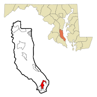
Lusby is located near the southern end of Calvert County at 38°21′13″N76°26′12″W / 38.35361°N 76.43667°W / 38.35361; -76.43667 (38.353555, 76.436615). [3] It is bordered to the southwest by Solomons, a tourist resort town, to the south by Drum Point (across tidal Mill Creek), and to the southeast by Chesapeake Ranch Estates, a large community governed by a homeowners' association.

Dominion Cove Point LNG, one of the nation's largest liquefied natural gas import facilities, is located just northeast of Lusby, and the Calvert Cliffs Nuclear Power Plant is 5 miles (8 km) to the north. Maryland Routes 2 and 4 run along the western edge of Lusby, leading south to the Patuxent River Naval Air Station and north to Andrews Air Force Base and the Washington, D.C., and Annapolis areas.

There is one public high school in Lusby, Patuxent High School, with the mascot being the Panthers. In 2015 the Panthers won states in football. In 2016, the Panthers won states in marching band and got third place at nationals. In 2002 and 2013, the Panthers won Maryland high school volleyball championships, with multiple other teams reaching the state finals such as the football team in 2013 and 2001, the baseball team in 2012, and the field hockey team in 2008. Lusby also has a public middle school and three public elementary schools, Patuxent Elementary (Pre-K through 2nd grade), Appeal (3rd-5th grade), and Dowell (Pre-K through 5th grade). While there are no private schools in Lusby, there is one in Solomon's Island at Our Lady Star of the Sea Church that serves the area and has Pre-K through 8th grade.

Lusby's central business district has been growing rapidly in recent years. Three shopping centers have recently been built, bringing in new grocery stores, restaurants, and other businesses. Several new roads have either been built or are in planning stages in order to ease traffic congestion to and from the Chesapeake Ranch Estates-Drum Point communities. Lusby also features Cove Point Park, which has numerous baseball, soccer, and lacrosse fields as well as a public swimming pool. There is a public golf course, Chesapeake Hills Golf Course, near Cove Point Park. There is also a private air field owned and operated by the Chesapeake Ranch Estates and Drum Point communities.

Places of note in the Lusby area include the Cove Point Lighthouse on the Chesapeake Bay and Calvert Cliffs State Park. The lighthouse was listed on the National Register of Historic Places in 1973. [4] Also on the National Register are Middleham Chapel and Morgan Hill Farm. [4]

According to the United States Census Bureau, the Lusby CDP has a total area of 3.7 square miles (9.5 km2), of which 3.5 square miles (9.1 km2) is land and 0.15 square miles (0.4 km2), or 4.51%, is water. [2]

Demographics

Historical population
CensusPop.Note
2000 1,666
2010 1,83510.1%
2020 2,07212.9%
U.S. Decennial Census [5]

As of the census [6] of 2000, there were 1,666 people, 595 households, and 433 families residing in the CDP. The population density was 476.1 inhabitants per square mile (183.8/km2). There were 656 housing units at an average density of 187.5 per square mile (72.4/km2). The racial makeup of the CDP was 72.15% White, 24.73% African American, 0.18% Native American, 0.66% Asian, 0.66% from other races, and 1.62% from two or more races. Hispanic or Latino of any race were 2.76% of the population.

There were 595 households, out of which 35.5% had children under the age of 18 living with them, 57.0% were married couples living together, 11.3% had a female householder with no husband present, and 27.2% were non-families. 23.9% of all households were made up of individuals, and 12.8% had someone living alone who was 65 years of age or older. The average household size was 2.79 and the average family size was 3.32.

In the CDP, the population was spread out, with 28.5% under the age of 18, 6.5% from 18 to 24, 31.9% from 25 to 44, 20.1% from 45 to 64, and 13.0% who were 65 years of age or older. The median age was 36 years. For every 100 females, there were 93.5 males. For every 100 females age 18 and over, there were 93.7 males.

The median income for a household in the CDP was $40,769, and the median income for a family was $51,964. Males had a median income of $46,190 versus $26,429 for females. The per capita income for the CDP was $19,932. About 5.3% of families and 4.5% of the population were below the poverty line, including 4.3% of those under age 18 and 5.6% of those age 65 or over.

Notable people

Related Research Articles

<span class="mw-page-title-main">Calvert County, Maryland</span> County in Maryland, United States

Calvert County is located in the U.S. state of Maryland. As of the 2020 census, the population was 92,783. Its county seat is Prince Frederick. The county's name is derived from the family name of the Barons of Baltimore, the proprietors of the English Colony of Maryland Calvert County is included in the Washington–Arlington–Alexandria, DC–VA–MD–WV Metropolitan Statistical Area. It occupies the Calvert Peninsula, which is bordered on the east by Chesapeake Bay and on the west by the Patuxent River. Calvert County is part of the Southern Maryland region. The county has one of the highest median household incomes in the United States. It is one of the older counties in Maryland, after St. Mary's, Kent County and Anne Arundel counties.

<span class="mw-page-title-main">Brooklyn Park, Maryland</span> Census-designated place in Maryland, United States

Brooklyn Park is a census-designated place (CDP) in Anne Arundel County, Maryland, United States. The population was 14,373 at the 2010 census.

<span class="mw-page-title-main">Deale, Maryland</span> Census-designated place in Maryland, United States

Deale is a census-designated place (CDP) in Anne Arundel County, Maryland, United States. The population was 4,945 at the 2010 census. It has a scenic view of Chesapeake Bay and is popular with boaters. Sudley was listed on the National Register of Historic Places in 1973.

<span class="mw-page-title-main">Lake Shore, Maryland</span> Census-designated place in Maryland, United States

Lake Shore is a census-designated place and unincorporated community in Anne Arundel County, Maryland, United States, located east of Pasadena. The population of Lake Shore was 19,477 at the 2010 census.

<span class="mw-page-title-main">Mayo, Maryland</span> Census-designated place in Maryland, United States

Mayo is a census-designated place (CDP) in Anne Arundel County, Maryland, United States. The population was 8,298 at the 2010 census. The Mayo CDP of 2010 includes all of the area that used to be counted as the Selby-on-the-Bay CDP. The beach in Mayo used to be a popular weekend resort.

<span class="mw-page-title-main">Pasadena, Maryland</span> Census-designated place in Maryland, United States

Pasadena is a census-designated place (CDP) in Anne Arundel County, Maryland, United States. The population was 24,287 at the 2010 census.

<span class="mw-page-title-main">Shady Side, Maryland</span> Census-designated place in Maryland, United States

Shady Side is a census-designated place (CDP) in Anne Arundel County, Maryland, United States. The population was 5,803 at the 2010 census.

<span class="mw-page-title-main">Calvert Beach-Long Beach, Maryland</span> Former Census-designated place in Maryland, United States

Calvert Beach-Long Beach was a census-designated place (CDP) in Calvert County, Maryland, United States. The population was 2,487 at the 2000 census. For the 2010 census the area was split into two CDPs: Calvert Beach and Long Beach.

<span class="mw-page-title-main">Chesapeake Beach, Maryland</span> Town in Maryland

Chesapeake Beach is a town in Calvert County, Maryland, United States. Its major attractions include the Chesapeake Beach Railway Station, the Chesapeake Beach Rail Trail, a water park, marinas, piers, and charter boat fishing. The town's population was recorded as 5,753 in the 2010 census.

<span class="mw-page-title-main">Chesapeake Ranch Estates-Drum Point, Maryland</span> Former Census-designated place in Maryland, United States

Chesapeake Ranch Estates-Drum Point was a census-designated place in Calvert County, Maryland, for the 2000 United States Census, when it had a population of 11,503. For the 2010 census the area was split into the CDPs of Chesapeake Ranch Estates and Drum Point. The communities are only a few minutes from the popular weekend resort town Solomons as well as the Calvert Cliffs Nuclear Power Plant, Calvert Cliffs State Park and fossil grounds, and the Dominion Cove Point liquefied natural gas terminal.

<span class="mw-page-title-main">Dunkirk, Maryland</span> Census-designated place in Maryland, United States

Dunkirk is a census-designated place (CDP) in Calvert County, Maryland, United States. The population was 2,521 at the 2010 census.

<span class="mw-page-title-main">Owings, Maryland</span> Census-designated place in Maryland, United States

Owings is a town center and census-designated place (CDP) in northern Calvert County, Maryland, United States. The population was 2,149 at the 2010 census, up from 1,325 in 2000.

<span class="mw-page-title-main">Prince Frederick, Maryland</span> Census-designated place in Maryland, United States

Prince Frederick is an unincorporated community and census-designated place (CDP) in Calvert County, Maryland, United States. As of the 2020 census, the population of Prince Frederick was 3,226, up from 2,538 in 2010. It is the county seat of Calvert County.

<span class="mw-page-title-main">Solomons, Maryland</span> Census-designated place in Maryland, United States

Solomons, also known as Solomons Island, is an unincorporated community and census-designated place (CDP) in Calvert County, Maryland, United States. The population was 2,368 at the 2010 census, up from 1,536 in 2000. Solomons is a popular weekend destination spot in the Baltimore–Washington metropolitan area.

<span class="mw-page-title-main">St. Leonard, Maryland</span> Census-designated place in Maryland

St. Leonard is a census-designated place (CDP) in Calvert County, Maryland, United States. The population was 742 at the 2010 census. Residents of the Calvert Beach and Long Beach communities also use the St. Leonard ZIP code designation. St. Leonard has a large antique dealer complex.

<span class="mw-page-title-main">Algonquin, Maryland</span> Census-designated place in Maryland, United States

Algonquin is a census-designated place (CDP) in Dorchester County, Maryland, United States. The population was 1,241 at the 2010 census. The community was named for the Algonquin people, one of the Native American tribes in the East.

<span class="mw-page-title-main">Perryman, Maryland</span> Census-designated place in Maryland, United States

Perryman is an unincorporated community and census-designated place (CDP) in Harford County, Maryland, United States. The population was 2,342 at the 2010 census.

<span class="mw-page-title-main">Leonardtown, Maryland</span> Town in Maryland, United States

Leonardtown is a town in and the county seat of St. Mary's County, Maryland, United States. The population was 4,563 at the 2020 census. Leonardtown is perhaps most famous for the national oyster-shucking championship that is held annually at the St. Mary's County fairgrounds.

<span class="mw-page-title-main">Lexington Park, Maryland</span> CDP in Maryland, United States

Lexington Park is a census-designated place (CDP) in St. Mary's County, Maryland, United States, and the principal community of the Lexington Park, Maryland Micropolitan Statistical Area. The population was 11,626 at the 2010 census.

<span class="mw-page-title-main">Tilghman Island, Maryland</span> CDP in Maryland, United States

Tilghman Island is an island in the Chesapeake Bay. It is part of Talbot County, Maryland, United States.

References

  1. "2020 U.S. Gazetteer Files". United States Census Bureau. Retrieved April 26, 2022.
  2. 1 2 "Geographic Identifiers: 2010 Demographic Profile Data (G001): Lusby CDP, Maryland". U.S. Census Bureau, American Factfinder. Archived from the original on February 12, 2020. Retrieved August 22, 2014.
  3. "US Gazetteer files: 2010, 2000, and 1990". United States Census Bureau. February 12, 2011. Retrieved April 23, 2011.
  4. 1 2 "National Register Information System". National Register of Historic Places . National Park Service. April 15, 2008.
  5. "Census of Population and Housing". Census.gov. Retrieved June 4, 2016.
  6. "U.S. Census website". United States Census Bureau . Retrieved January 31, 2008.