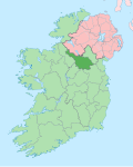
Dunmakeever is a townland in the Civil Parish of Kinawley, Roman Catholic Parish of Glangevlin, Barony of Tullyhaw, County Cavan, Ireland.
The townland name is an anglicisation of the Gaelic placename "Dún Mhic Íomhair" which means 'The Fort of Íomhair’s Son'. Íomhair, who lived about 850 A.D., was Lord of Tullyhaw and the son of Cosgrach mac Dúnghal. Íomhair’s son was Ruarc, after whom the townland is named, who lived about 880 A.D and was also Lord of Tullyhaw and an ancestor of the McGovern clan. Ruarc’s name is also preserved in the adjoining townland of Aghatirourke which is an anglicisation of 'Achadh-tigh-Ruairc' which means "The Field of Ruarc’s House". These townland names, along with Moneensauran, supply important evidence that the McGovern clan originally came from Glangevlin and only later spread out to other parts of Tullyhaw such as Ballymagauran and Blacklion. The earliest surviving mention of the townland name is 'Dunnemakevir', from a list of Co. Cavan townlands printed in 1790.
Dunmakeever is bounded on the north by Aghatirourke, Gortmaconnell, Legnabrocky, Aghnahoo, Tromogagh and Legg, County Fermanagh townlands, on the east by Alteen, Bursan and Commas (Kinawley) townlands, on the south by Tonanilt, Tullyminister and Corracleigh townlands and on the west by Tullycrafton, Ardvagh and Tullynacross (Glangevlin) townlands. Its chief geographical features are Cuilcagh Mountain reaching an altitude of 2,200 feet, Dunmakeever Lough, Dunmakeever Lough North, the Owenmore River (County Cavan) and several waterfalls. Dunmakeever is traversed by the R200 road from Ballinamore to Glangevlin and some minor lanes. The townland covers an area of 1,233 statute acres.
In the 1609 Plantation of Ulster, Dunmakeever formed part of lands which were granted to John Sandford of Castle Doe, Co. Donegal by letters patent dated 7 July 1613 (Pat. 11 James I – LXXI – 38, 'Glangewley' & 'Quilkagh'). It was later sold by Sandford to his wife's uncle, Sir Toby Caulfeild, 1st Baron Caulfeild, Master of the Ordnance. Sir Toby had the sale confirmed by letters patent of 12 July 1620 (Pat. 19 James I. XI. 45).
A deed by Thomas Enery dated 29 Jan 1735 includes the lands of Dunmaguire. [1]
A deed dated 13 Nov 1738 includes the lands of Dunmaguier. [2]
In the 1821 census of Ireland, there are ten families listed in the townland and it states- Doonmakeever contains 100 acres of green pasture & 500 acres of BlackRock mountain. [3]
The 1825 Tithe Applotment Books spell the name as Doonmaquiver. [4]
In 1841 the population of the townland was 93, being 49 males and 41 females. There were thirteen houses in the townland and all were inhabited. [5]
In 1851 the population of the townland was 96, being 51 males and 45 females. There were sixteen houses in the townland and all were inhabited. [5]
Griffith's Valuation of 1857 lists fourteen occupiers in the townland. [6]
In 1861 the population of the townland was 95, being 52 males and 43 females. There were fifteen houses in the townland and all were inhabited. [7]
In 1871 the population of the townland was 96, being 56 males and 40 females. There were fifteen houses in the townland and all were inhabited.(page 296 of census) [8]
In 1881 the population of the townland was 105, being 61 males and 44 females. There were fifteen houses in the townland, all were inhabited. [9]
In 1891 the population of the townland was 107, being 59 males and 48 females. There were sixteen houses in the townland, all were inhabited. [10]
In the 1901 census of Ireland, there are fourteen families listed in the townland. [11]
In the 1911 census of Ireland, there are eighteen families listed in the townland. [12]
Moneensauran is a townland in the civil parish of Templeport, County Cavan, Ireland. It lies within the Roman Catholic parish of Glangevlin and barony of Tullyhaw.
Bellavally Lower, is a townland in the civil parish of Templeport, County Cavan, Ireland. The local pronunciation is Bealbally. It lies in the Roman Catholic parish of Glangevlin and barony of Tullyhaw.
Bellavally Upper, in Gaelic= 'Béal an Bhealaigh Uachtarach', meaning The Upper Entrance to the Pass or Gap, is a townland in the civil parish of Templeport, County Cavan, Ireland. The local pronunciation is Bealbally. It lies in the Roman Catholic parish of Glangevlin and barony of Tullyhaw.
Bursan, in Gaelic 'Bus-an' possibly meaning The Little Mouth, is a townland in the civil parish of Templeport, County Cavan, Ireland. It lies in the Roman Catholic parish of Glangevlin and barony of Tullyhaw.
Corracleigh, an Anglicisation of the Gaelic, ‘Corr na Cloiche’ meaning The Round Hill of the Stone, is a townland in the civil parish of Templeport, County Cavan, Ireland. It lies in the Roman Catholic parish of Glangevlin and barony of Tullyhaw. The local pronunciation is Curracliff.
Curraghglass, an Anglicisation of the Gaelic, ‘Currach Glas’ meaning The Green Moor, is a townland in the civil parish of Templeport, County Cavan, Ireland. It lies in the Roman Catholic parish of Glangevlin and barony of Tullyhaw.
Derrynananta Lower, an Anglicisation of the Gaelic, ‘Doire na Neannta Íochtar’, meaning The Lower Oak-wood of the Nettles, is a townland in the civil parish of Templeport, County Cavan, Ireland. It lies in the Roman Catholic parish of Glangevlin and barony of Tullyhaw.
Drumhurrin, an Anglicisation of the Gaelic ‘Droim Shoirn’, meaning The Hill-Ridge of the Lime-Kiln or Furnace, is a townland in the civil parish of Templeport, County Cavan, Ireland. It lies in the Roman Catholic parish of Glangevlin and barony of Tullyhaw.
Eshveagh, an Anglicisation of the Gaelic, either ‘Ais Bheathach’, meaning The Marsh of the Birches, or ‘Éis Bheathach’, meaning The Hill of the Birches, or ‘Eas Bheathach’, meaning The Waterfall of the Birches is a townland in the civil parish of Kinawley, County Cavan, Ireland. It lies in the Roman Catholic parish of Glangevlin and barony of Tullyhaw.
Gub, an Anglicisation of the Gaelic, 'Gob', meaning The Headland, is a townland in the civil parish of Templeport, County Cavan, Ireland. It lies in the Roman Catholic parish of Glangevlin and barony of Tullyhaw. It is also known as Garvalt Upper. It contains part of the village of Glangevlin.
Legnagrow, an Anglicisation of the Gaelic, either Lag na gCnó 'The Hollow of the Nuts', or Lag na gCro 'The Hollow of the Huts or Sheep-Folds', is a townland in the civil parish of Templeport, County Cavan, Ireland. It lies in the Roman Catholic parish of Glangevlin and barony of Tullyhaw.
Mullaghlea Glen, is a townland in the civil parish of Templeport, County Cavan, Ireland. It lies in the Roman Catholic parish of Glangevlin and barony of Tullyhaw.
Mully Lower, an Anglicisation of the Gaelic, ‘Mullach Íochtar’ meaning The Lower Summit of the Hill, is a townland in the civil parish of Templeport, County Cavan, Ireland. It lies in the Roman Catholic parish of Glangevlin and barony of Tullyhaw.
Tullycrafton, an Anglicisation of the Gaelic, ‘Tulaigh Crofton’ meaning The Hill of the Crofton Family, is a townland in the civil parish of Kinawley, County Cavan, Ireland. It lies in the Roman Catholic parish of Glangevlin and barony of Tullyhaw.
Tullynacross, an Anglicisation of the Gaelic, ‘Tulaigh na Croise’ meaning The Hill of the Cross, is a townland in the civil parish of Templeport, County Cavan, Ireland. It lies in the Roman Catholic parish of Glangevlin and barony of Tullyhaw.
Tullyminister, an Anglicisation of the Gaelic, ‘Tulaigh an Mhinistir’ meaning The Hill of the Parson, is a townland in the civil parish of Templeport, County Cavan, Ireland. It lies in the Roman Catholic parish of Glangevlin and barony of Tullyhaw.
Tullytiernan, an Anglicisation of the Gaelic, ‘Tulaigh Thiarnáin', meaning Tiernan’s Hill, is a townland in the civil parish of Templeport, County Cavan, Ireland. It lies in the Roman Catholic parish of Glangevlin and barony of Tullyhaw. It contains part of the village of Glangevlin.
Commas is a townland in the civil parish of Kinawley, barony of Tullyhaw, County Cavan, Ireland. Sub-divisions of the townland are- (a) The Strait - A name given to a hollow in the townland up near Cuilcagh mountain; (b) Knocknamaddoo (Irish derived place name Cnoc na Mada, meaning ‘The Hill of the Dogs ’; Sruhan Doo, Easa Iarainn and Loinin, are names given to streams flowing down the mountain in Commas.
Alteen is a townland in the civil parish of Kinawley, barony of Tullyhaw, County Cavan, Ireland. The local pronunciation is IL-Keen. A sub-division is called Tullynahunshin.