Duntisbourne Rouse

Last updated

Duntisbourne Rouse
Duntisbourne Rouse Ford.jpg
The ford at Duntisbourne Rouse
Gloucestershire UK location map.svg
Red pog.svg
Duntisbourne Rouse
Location within Gloucestershire
Population70 (2001)
Civil parish
  • Duntisbourne Rouse
District
Shire county
Region
Country England
Sovereign state United Kingdom
Post town CIRENCESTER
Postcode district GL7
Dialling code 01285
Police Gloucestershire
Fire Gloucestershire
Ambulance South Western
UK Parliament
List of places
UK
England
Gloucestershire
51°45′25″N2°01′37″W / 51.757°N 2.027°W / 51.757; -2.027

Duntisbourne Rouse is a village and civil parish in Gloucestershire, England. It lies in the Cotswolds, an Area of Outstanding Natural Beauty. At the 2001 census, it had a population of 70. [1]

Contents

History

Toponymy

The village was recorded as Duntesburne in 1055 and Duntesborne in the 1086 Domesday Book, the name coming from the Old English for "stream of a man called Dunt". [2] The manorial affix came from a family called le Rous, who were at one time the lords of the manor. [2] [3] By 1287, the village was known as Duntesbourn Rus. [2]

Governance

The parishes of Duntisbourne Rouse and the neighbouring village of Duntisbourne Abbots are covered by a single 7-person council, the Duntisbournes Parish Council. [4] Duntisbourne Rouse is part of the Ermin ward of the district of Cotswold and is represented by Councillor Nicholas Parsons, a member of the Conservative Party. [5] Duntisbourne Rouse is part of the constituency of Cotswold, represented at parliament by Conservative MP Geoffrey Clifton-Brown. [6] It was part of the South West England constituency of the European Parliament prior to Britain leaving the European Union in January 2020.

Geography

Duntisbourne Rouse is in the county of Gloucestershire, and lies within the Cotswolds, a range of hills designated an Area of Outstanding Natural Beauty. It is approximately 16 km (9.9 mi) south-east of Gloucester and approximately 6.5 km (4.0 mi) north-west of Cirencester. Nearby villages include Duntisbourne Abbots, Duntisbourne Leer, Bagendon and Daglingworth.

Church

St. Michael's church Duntisbourne Rouse Church.jpg
St. Michael's church

The church at Duntisbourne Rouse is dedicated to St. Michael and is located on the side of a hill overlooking the Dunt valley. [7] The church, which dates from Saxon times, includes a small crypt beneath the building. [8] The chancel was added in Norman times. [9] The choir stalls contain five misericords. [9] Whether they were originally installed in this church or imported from elsewhere is unknown. [10] The windows date from the 12th century, the tower from the 15th century and the pews and panelling from the 18th century. [7] The organ was donated by Vera, Charlotte and Jeanne Beauchamp in memory of their sister, modernist writer Katherine Mansfield. A plaque to this effect is located on the side of the organ. [11] The church was designated a Grade I listed building by English Heritage on 26 November 1958. [12]

Notable people

Related Research Articles

<span class="mw-page-title-main">Stow-on-the-Wold</span> English market town in Gloucestershire

Stow-on-the-Wold is a market town and civil parish in Gloucestershire, England, on top of an 800-foot hill at the junction of main roads through the Cotswolds, including the Fosse Way (A429), which is of Roman origin. The town was founded by Norman lords to absorb trade from the roads converging there. Fairs have been held by royal charter since 1330; a horse fair is still held on the edge of town nearest to Oddington in May and October each year.

<span class="mw-page-title-main">Cirencester</span> Market town in Gloucestershire, England

Cirencester is a market town in Gloucestershire, England, 80 miles (130 km) west of London. Cirencester lies on the River Churn, a tributary of the River Thames. It is the eighth largest settlement in Gloucestershire and the largest town within the Cotswolds. It is the home of the Royal Agricultural University, the oldest agricultural college in the English-speaking world, founded in 1840. The town had a population of 20,229 in 2021.

<span class="mw-page-title-main">Stroud District</span> Non-metropolitan district in England

Stroud District is a local government district in Gloucestershire, England. The district is named after its largest town of Stroud. The council is based at Ebley Mill in Cainscross. The district also includes the towns of Berkeley, Dursley, Nailsworth, Stonehouse and Wotton-under-Edge, along with numerous villages and surrounding rural areas. Over half of the district lies within the Cotswolds Area of Outstanding Natural Beauty.

<span class="mw-page-title-main">Bisley-with-Lypiatt</span> Civil parish in Stroud, England

Bisley-with-Lypiatt is a civil parish in the Stroud district of Gloucestershire, England. It had a population of 2350 in 2019. It includes Bisley, Lypiatt, Eastcombe and Oakridge.

<span class="mw-page-title-main">Broadwell, Cotswold</span> Human settlement in England

Broadwell is a village and civil parish in the English county of Gloucestershire. It is about 1.5 miles (2.4 km) north of Stow-on-the-Wold, In the 2001 United Kingdom census, the parish had a population of 384. decreasing to 355 at the 2011 census.

<span class="mw-page-title-main">Somerford Keynes</span> Village in Gloucestershire, England

Somerford Keynes is a village and civil parish in the Cotswold district of Gloucestershire, England, close to the River Thames and about 5 miles from its source. It lies on the boundary with Wiltshire, midway between Cirencester, Swindon and Malmesbury. The parish population at the 2011 census was 479, and a 2019 estimate put it at 558. The parish includes the village of Shorncote.

<span class="mw-page-title-main">Coln St. Aldwyns</span> Human settlement in England

Coln St. Aldwyns is a village and civil parish in the Cotswold district of the English county of Gloucestershire.

<span class="mw-page-title-main">Duntisbourne Abbots</span> Human settlement in England

Duntisbourne Abbots is a village and civil parish located in the English county of Gloucestershire. Duntisbourne Abbots forms part of the Cotswold District.

<span class="mw-page-title-main">Siddington, Gloucestershire</span> Village and parish in Gloucestershire, England

Siddington is a village and civil parish in Gloucestershire, England. It is located immediately south of Cirencester. At the 2011 United Kingdom Census, the parish had a population of 1,249.

<span class="mw-page-title-main">Hatherop</span> Human settlement in England

Hatherop is a village and civil parish in the Cotswolds Area of Outstanding Natural Beauty, about 2.5 miles (4.0 km) north of Fairford in Gloucestershire, England. The River Coln forms part of the western boundary of the parish.

<span class="mw-page-title-main">Cold Aston</span> Human settlement in England

Cold Aston is a village and civil parish in Gloucestershire, England, approximately 18 miles (29 km) to the east of Gloucester. It lies in the Cotswolds, an Area of Outstanding Natural Beauty. In the 2011 census, the population was 255.

Ozleworth is a village and civil parish in Gloucestershire, England, approximately 30 km (19 mi) south of Gloucester. It lies in the Cotswolds, an Area of Outstanding Natural Beauty.

<span class="mw-page-title-main">Notgrove</span> Human settlement in England

Notgrove is a village and civil parish in Gloucestershire, England, approximately 28.5 to the east of Gloucester. It lies in the Cotswolds, an Area of Outstanding Natural Beauty.

<span class="mw-page-title-main">Turkdean</span> Human settlement in England

Turkdean is a village and civil parish in Gloucestershire, England, approximately 30 km (19 mi) to the east of Gloucester. It lies in the Cotswolds, an Area of Outstanding Natural Beauty.

<span class="mw-page-title-main">Edgeworth, Gloucestershire</span> Human settlement in England

Edgeworth is a small village and civil parish in the English county of Gloucestershire. It is located east of Stroud, west of Cirencester and south of Cheltenham.

<span class="mw-page-title-main">St Michael's Church, Duntisbourne Rouse</span> Church in Gloucestershire, England

St Michael's Church is an Anglican church in the Cotswold village of Duntisbourne Rouse, Gloucestershire, England. It dates from no later than the 11th or 12th century and, since 1958, has been designated a Grade I listed building. It is an active parish church in the Diocese of Gloucester, the archdeaconry of Cheltenham and the deanery of Cirencester.

<span class="mw-page-title-main">Duntisbourne Leer</span> Human settlement in England

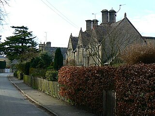
Duntisbourne Leer is a hamlet in the county of Gloucestershire, and lies within the Cotswolds, a range of hills designated an Area of Outstanding Natural Beauty. It is approximately 10.5 miles (16.9 km) southeast of Gloucester and approximately 4.5 miles (7.2 km) northwest of Cirencester.

<span class="mw-page-title-main">Poulton, Gloucestershire</span> Human settlement in England

Poulton is a village and civil parish in the English county of Gloucestershire, approximately 24 miles (39 km) to the south-east of Gloucester. It lies in the south of the Cotswolds, an Area of Outstanding Natural Beauty. In the 2001 United Kingdom census, the parish had a population of 398, increasing to 408 at the 2011 census.

<span class="mw-page-title-main">Elkstone</span> Human settlement in England

Elkstone is a village and civil parish in the English county of Gloucestershire. In the 2001 United Kingdom census, the parish had a population of 203, increasing to 248 at the 2011 census
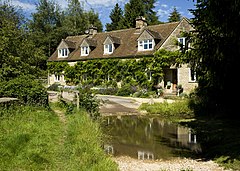
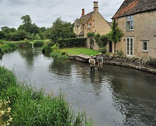
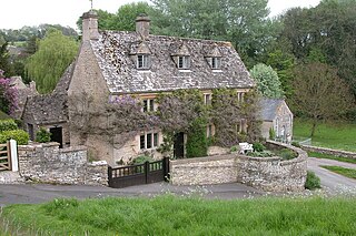
<span class="mw-page-title-main">Five Mile House, Duntisbourne Abbots</span> Pub in Duntisbourne Abbots, Gloucestershire, England

The Five Mile House is a former pub on Old Gloucester Road, Duntisbourne Abbots, Gloucestershire, England. It was built in the 17th century and is grade II listed.

References

  1. "Parish Headcounts: Cotswold". Neighbourhood Statistics. Office for National Statistics. Retrieved 23 December 2012.
  2. 1 2 3 Mills, A. D. (1998). Dictionary of English Place-Names. Oxford University Press. p. 120. ISBN   0-19-280074-4.
  3. Hall, Michael (1993). Stratford-Upon-Avon and the Cotswolds. The Pevensey Press. p. 76. ISBN   0-907115-68-3.
  4. "Duntisbournes Parish Council". Gloucestershire County Council. 4 September 2007. Retrieved 3 June 2008.
  5. "COTSWOLD — Find your councillor". Cotswold District Council. Archived from the original on 15 June 2008. Retrieved 3 June 2008.
  6. "Cotswold — Constituency — Conservative Party". Conservative Party. Archived from the original on 17 October 2006. Retrieved 26 April 2008.
  7. 1 2 "Parish of Duntisbourne Rous". ParishConnections.org. 2008. Retrieved 26 December 2008.
  8. Fewins, Clive (2005). The Church Explorer's Handbook. SCM-Canterbury Press Ltd. p. 126. ISBN   1-85311-622-X.
  9. 1 2 Betjeman, John (1958). Collins Guide to English Parish Churches. Collins. p. 172.
  10. Remnant, G. L.; Mary Désirée Anderson (1969). A Catalogue of Misericords in Great Britain. Oxford University Press. p. 48. ISBN   0-19-817164-1.
  11. "Organ Plaque". Katherine Mansfield Society. 2008. Retrieved 27 September 2009.
  12. "Church Of St Michael". Heritage Gateway. English Heritage. Retrieved 5 September 2010.
  13. "Moberly, George Herbert", in Alumni Oxonienses 1715-1886, Vol. 3 (1892), p. 965