
The Isle of Wight is a county and the largest and second-most populous island of England. It is in the English Channel, between two and five miles off the coast of Hampshire, from which it is separated by the Solent. Referred to as 'The Island' by residents, the island has resorts that have been holiday destinations since Victorian times, and is known for its mild climate, coastal scenery, and verdant landscape of fields, downland and chines. The island is historically part of Hampshire, and is designated a UNESCO Biosphere Reserve.
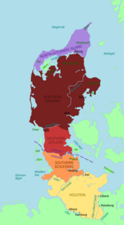
The Jutes, Iuti, or Iutæ were one of the Germanic tribes who settled in Great Britain after the departure of the Romans. According to Bede, they were one of the three most powerful Germanic nations, along with the Angles and the Saxons.
Year 686 (DCLXXXVI) was a common year starting on Monday of the Julian calendar. The denomination 686 for this year has been used since the early medieval period, when the Anno Domini calendar era became the prevalent method in Europe for naming years.
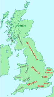
The Kingdom of the South Saxons, today referred to as the Kingdom of Sussex, was one of the seven traditional kingdoms of the Heptarchy of Anglo-Saxon England. On the south coast of the island of Great Britain, it was originally a sixth-century Saxon colony and later an independent kingdom. The kingdom remains one of the least known of the Anglo-Saxon polities, with no surviving king-list, several local rulers and less centralisation than other Anglo Saxon kingdoms. The South Saxons were ruled by the kings of Sussex until the country was annexed by Wessex, probably in 827, in the aftermath of the Battle of Ellendun.

Cerdic is described in the Anglo-Saxon Chronicle as a leader of the Anglo-Saxon settlement of Britain, being the founder and first king of Saxon Wessex, reigning from 519 to 534 AD. Subsequent kings of Wessex were each claimed by the Chronicle to descend in some manner from Cerdic. His origin, ethnicity, and even his very existence have been extensively disputed. However, though claimed as the founder of Wessex by later West Saxon kings, he would have been known to contemporaries as king of the Gewissae, a folk or tribal group. The first king of the Gewissae to call himself 'King of the West Saxons', was Caedwalla, in a charter of 686.

Cædwalla was the King of Wessex from approximately 685 until he abdicated in 688. His name is derived from the Welsh Cadwallon. He was exiled from Wessex as a youth and during this period gathered forces and attacked the South Saxons, killing their king, Æthelwealh, in what is now Sussex. Cædwalla was unable to hold the South Saxon territory, however, and was driven out by Æthelwealh's ealdormen. In either 685 or 686, he became King of Wessex. He may have been involved in suppressing rival dynasties at this time, as an early source records that Wessex was ruled by underkings until Cædwalla.

Borthwood Copse, near Sandown, Isle of Wight, England is a piece of woodland owned by the National Trust and is one of the numerous copses which make up part of the medieval forest which covered most of the eastern end of the Island. Borthwood Copse sits on the outskirts of Newchurch, and is close to the neighbouring hamlet of Apse Heath and the villages of Queen's Bower and Alverstone. Borthwood Copse was originally a royal hunting ground. It was bequeathed to the National Trust in 1926 by Frank Morey. He had purchased it a few years earlier to preserve it for wildlife. Subsequent additions have added to the land and it now covers a total of 60 acres (240,000 m2).

The Isle of Wight is rich in historical and archaeological sites, from prehistoric fossil beds with dinosaur remains, to dwellings and artefacts dating back to the Bronze Age, Iron Age, and Roman periods.
As an island, the Isle of Wight maintains a culture close to, but distinct from, that of the south of England. A high proportion of the population are now 'overners' rather than locally born, and so with a few notable exceptions it has more often formed the backdrop for cultural events of wider rather than island-specific significance.

Hampshire and Isle of Wight Wildlife Trust is a Wildlife Trust with 27,000 members across the counties of Hampshire and the Isle of Wight, England.

Æthelwealh was ruler of the ancient South Saxon kingdom from before 674 till his death between 680 and 685. He was baptised in Mercia, becoming the first Christian king of Sussex. He was killed by a West Saxon prince, Cædwalla, who eventually became king of Wessex.

Bowcombe is a hamlet on the Isle of Wight. It has an elevation of 144 feet (44 m) and is located 2+1⁄2 miles (4 km) southwest of Newport in the centre of the Island. Public transport is provided by Southern Vectis buses on route 12.
The First Battle of Alton was a skirmish in 1001 between the English and the Vikings. According to the Anglo-Saxon Chronicle it took place at somewhere called, in Old English, Æthelingadene. Traditionally, the site was believed to have been what is now Alton, Hampshire. However, it is thought more likely to have been in the East and West Dean area of modern-day West Sussex.
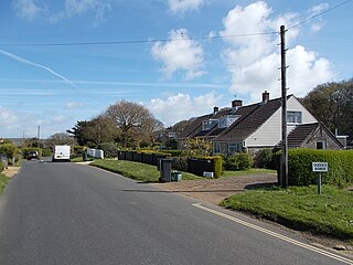
Queen's Bower is a hamlet on the Isle of Wight, England that has effectively merged with Winford and Apse Heath to create a village. It is classed as part of Sandown, with the postcode PO36. It is in the civil parish of Newchurch, Isle of Wight. Transport is provided by Southern Vectis bus route 8 to Sandown, which stops at Hairpin Bend on Alverstone Road once every hour throughout the day, which is right on the perimeter of Borthwood Copse.
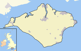
Wihtwara was the kingdom founded on the Isle of Wight, a 147-square-mile (380 km2) island off the south coast of England, during the Anglo-Saxon settlement of Britain. The name was derived from the Jutish name Wihtwara. Its capital was a fort named Wihtwarasburgh. It has been suggested that the modern-day village of Carisbrooke was built on top of Wihtwarasburgh due to the fact that they share their location. It has also been suggested that Wihtwarasburgh was built on top of a pre-existing Roman fort, but this has not been proven.
Cymenshore is a place in Southern England where, according to the Anglo-Saxon Chronicle, Ælle of Sussex landed in AD 477 and battled the Britons with his three sons Cymen, Wlencing and Cissa, after the first of whom Cymenshore was held to have been named. Its location is unclear but was probably near Selsey.
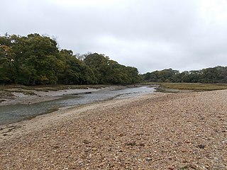
King's Quay is a place on the north east coast of the Isle of Wight, an island off the South Coast of England. It comprises the estuary of a stream called Palmer's Brook, situated between East Cowes and Wootton Creek, about 2 miles (3.2 km) north west of Wootton. It is said, probably apocryphally, to have been the place that King John fled to after signing Magna Carta, from which it derives its name.

Carisbrooke Priory was an alien priory, a dependency of Lyre Abbey in Normandy. The priory was situated on rising ground on the outskirts of Carisbrooke close to Newport on the Isle of Wight.
Meonwara or Meonsæte is the name of a people who controlled a territory in south-east Hampshire, focused on the Meon valley, during the late 5th and early 6th centuries. Meonwara means "People of the Meon" in Old English.
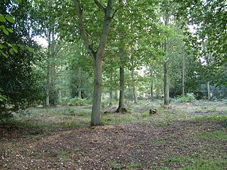
Pamber Forest and Silchester Common is a 341.7-hectare (844-acre) biological Site of Special Scientific Interest in Tadley in Hampshire. Pamber Forest and Upper Inhams Copse is managed by the Hampshire and Isle of Wight Wildlife Trust and Pamber Forest is a Local Nature Reserve.


