Related Research Articles

Alum Bay is a bay near the westernmost point of the Isle of Wight, England, within close sight of the Needles rock formation. Of geological interest and a tourist attraction, the bay is noted for its multi-coloured sand cliffs. The waters and adjoining seabed form part of the Needles Marine Conservation Zone and the shore and heath above are part of the Headon Warren and West High Down Site of Special Scientific Interest.

Foreland or Forelands, and the adjacent Foreland Fields, is the easternmost point of the Isle of Wight, part of the village of Bembridge. It is located about 6.5 miles due south of the city of Portsmouth on the British mainland, separated by the eastern reaches of the Solent. It is characterised by a pub called the Crab and Lobster Inn and various beach huts plus a beach cafe and a coast guard lookout. In the sea are the reefs of Bembridge Ledge which is rich in edible crabs, lobsters and spider crabs and shoals of mackerel. In the Crab & Lobster Inn are photographs of the many shipwrecks, which included the submarine HMS Alliance, now a museum ship at Gosport and the First World War troopship the S.S. Mehndi carrying troops from South Africa, with great loss of life.

Playden is a village and civil parish in the Rother district of East Sussex, England. The village is located one mile (1.6 km) north-west of Rye.
Priory Woods is a 2.94 hectare geological Site of Special Scientific Interest near the town of Bembridge, Isle of Wight, notified in 1998. It is a National Trust property and is served by a public footpath. Concealed within it is "The Priory Oyster" - an oyster bar attached to the Priory Bay Hotel and open only in the height of summer. It has significant recent archaeology with the remains of a sea wall and rusted iron railings. Acheulean hand axes have been found in strata dated from c.400,000 years ago, which would indicate their users were early Neanderthals or late Homo heidelbergensis. The woods overlook Priory Bay and its private beach.

Kellaways - West Tytherton, River Avon SSSI is a 4.1 hectare geological Site of Special Scientific Interest in Wiltshire, notified in 1998.
Polyne Quarry is a 0.1 hectare Site of Special Scientific Interest (SSSI) in Cornwall, England, UK. It is located to the north of Lansallos civil parish, 2 miles (3.2 km) to the west of Looe.

Chalbury Hill And Quarry is an 11.9 hectare biological and geological Site of Special Scientific Interest in Dorset, England, notified in 1977. The site consists of grassland and a disused limestone quarry. The SSSI includes the area covered by Chalbury Hill Fort.
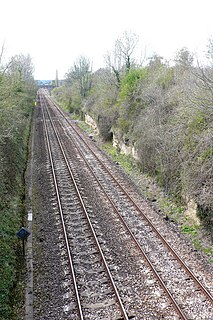
Bradford Abbas Railway Cutting is a 1.4 hectare geological Site of Special Scientific Interest in Dorset, notified in 1990.

Shillingstone Quarry SSSI, Dorset is an 8.13 hectare geological Site of Special Scientific Interest in Dorset, England, notified in 1995.

Bembridge Down is a 56.3 hectare Site of special scientific interest which is north-east of Sandown, Isle of Wight, England. The site was notified in 1951 for both its biological and geological features.

Peppercombe is a small valley (combe) on the north-western coast of Devon, England. It is situated on the South West Coast Path between Westward Ho! to the north and Bucks Mills to the west. There is also a path descending from Horns Cross on the A39 road. The small stream of Peppercombe Water is a little over a kilometre long, but its valley is relatively deep. It ends in a waterfall consisting in a series of cascades, each between 0.5 and 1.5 metres high, that have formed due to the unequal hardness of the different beds of the underlying rock. The seaward section of Peppercombe is at the eastern end of the Hobby to Peppercombe biological Site of Special Scientific Interest (SSSI), while the coast section to north-east is part of the Mermaid's Pool to Rowden Gut geological SSSI.
Brading Marshes to St. Helen's Ledges is a 488.5 hectare Site of special scientific interest which stretches from Brading along the Yar valley between Bembridge and St Helens, Isle of Wight through to the sea at Priory Bay on the north east coast of the Isle of Wight. It encompasses the Brading Marshes RSPB reserve, Bembridge harbour and the inter tidal sand, mud flats and rocky ledges exposed off the coast at low water, including the land around St Helens Fort which is not attached to the mainland. It is the second largest SSSI on the Isle of Wight. The site was notified in 1951 for both its biological and geological features.

Headon Warren and West High Down is a 276.3 hectare Site of Special Scientific Interest (SSSI) located at the westernmost end of the Isle of Wight. The SSSI encompasses Headon Warren, a heather clad down to the north, the chalk downs of West High Down and Tennyson Down to the south, and the Needles, The Needles Batteries and Alum Bay to the west.
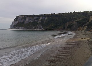
Whitecliff Bay is a sandy bay near Foreland which is the easternmost point of the Isle of Wight, England, about two miles south-west of Bembridge and just to the north of Culver Down. The bay has a shoreline of around three-quarters of a mile (1.2 km) and has a popular sandy shingle beach which is over half a mile long. It is a tourist site with three holiday parks in the vicinity of the bay; it has two cafes though minimal facilities. Access is limited and only possible down two steeply sloping concrete tracks.

Baulk Head to Mullion is a coastal Site of Special Scientific Interest (SSSI) in Cornwall, England, UK, noted for both its biological and geological characteristics.
Kennack to Coverack is a coastal Site of Special Scientific Interest (SSSI) on the Lizard Peninsula in Cornwall, England, UK, noted for both its biological and geological interest. It is of botanical importance, with 8 Red Data Book of rare and endangered plant species being found on the site as well as other nationally scarce varieties.

Meneage Coastal Section is a coastal Site of Special Scientific Interest (SSSI) in southern Cornwall, England, UK, noted for its geological characteristics.
The Naze SSSI is a 22 hectare geological Site of Special Scientific Interest on The Naze peninsula north of Walton-on-the-Naze in Essex. It is a Geological Conservation Review site both for its Pleistocene fossils and for its birds. It is part of The Naze Nature Reserve, which is managed by the Essex Wildlife Trust.
References
- ↑ Bembridge Cliffs and School SSSI citation Archived 26 September 2007 at the Wayback Machine , Natural England website.
Coordinates: 50°40′26″N1°05′28″W / 50.674°N 1.091°W
| | This article about a Site of Special Scientific Interest in England is a stub. You can help Wikipedia by expanding it. |
| | This Isle of Wight location article is a stub. You can help Wikipedia by expanding it. |