Related Research Articles

New Haven County is a county in the south central part of the U.S. state of Connecticut. As of the 2020 census, the population was 864,835, making it the third-most populous county in Connecticut. Two of the state's five largest cities, New Haven (3rd) and Waterbury (5th), are part of New Haven County.
Lithonia is a city in eastern DeKalb County, Georgia, United States. The city's population was 2,662 at the 2020 census. Lithonia is in the Atlanta metropolitan area.

Waterbury is a city in the U.S. state of Connecticut. Waterbury had a population of 114,403 as of the 2020 Census. The city is 33 miles (53 km) southwest of Hartford and 77 miles (124 km) northeast of New York City. Waterbury is the largest city in the Naugatuck Valley Planning Region and second-largest city in New Haven County.

Lincoln Heights is one of the oldest neighborhoods in Los Angeles, California, United States. It was originally called "East Los Angeles" from 1873 to 1917. It is a densely populated, mostly Latino and Asian neighborhood that includes many historic landmarks and was known as "the Bedroom of the Pueblo".
Willowbend is a neighborhood in near Southwest Houston, Texas.

Buckman is a neighborhood in the Southeast section of Portland, Oregon. The neighborhood is bounded by the Willamette River on the west, E Burnside St. on the north, SE 28th Ave. on the east, and SE Hawthorne Blvd. on the south.
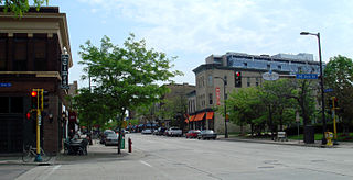
Northeast is a defined community in the U.S. city of Minneapolis that is composed of 13 smaller neighborhoods whose street addresses end in "NE". Unofficially it also includes the neighborhoods of the University community which have "NE" addresses, and the entirety of the Old Saint Anthony business district, which sits on the dividing line of "NE" and "SE" addresses. In the wider community, this business district, which is the oldest settlement in the city, is often identified as the heart of Northeast, in part because it lies across the Mississippi River from Downtown Minneapolis. Northeast is sometimes referred to as "Nordeast", reflecting the history of northern and eastern European immigrants and their language influence.
Near Northside is a historic neighborhood located in Northside, Houston, Texas. Near Northside is primarily occupied by people of Hispanic descent.
The West Side of Stamford is the area immediately west of Downtown Stamford, covering the area north of Interstate 95 between the Greenwich town line and the Rippowam River. The northern boundary is commonly taken as West Broad Street and Palmers Hill Road. Another version of the boundaries of the West Side has it located between Stillwater Avenue, Broad Street, West Main Street and West Avenue up to Exit 6 Interstate 95.
Gifford Park is a historic neighborhood in midtown Omaha, Nebraska. It is roughly bounded by the North Freeway on the east, North 38th Street on the west, Dodge Street on the south and Cuming Street on the north. Its namesake park was added to the City parks network in 1916. The neighborhood is bounded by several historic neighborhoods, including Bemis Park, Gold Coast, and the Near North Side.
Waterville is a neighborhood of the city of Waterbury, Connecticut. It was formerly known as Pine Hole and Haydensville. It has been home to industrial and manufacturing facilities from the 1960s onward. The ethnic makeup of Waterville consists of Italian, Irish, French and Latin American. This section of Waterbury contains two parks and the main office of the city's Department of Transportation.
Riverside Terrace is a neighborhood in Houston, Texas, United States. It is along Texas State Highway 288 and north of the Texas Medical Center and located near Texas Southern University and University of Houston. There about 20 sections of Riverside Terrace that span across North and South MacGregor. The community, formerly an affluent Jewish neighborhood, became an affluent community for African Americans in the 1950s and '60s. It is still predominantly African American neighborhood with different income levels. It has been undergoing a gradual change in demographics and aesthetics due to gentrification efforts since the early 2000s.
Town Plot is a neighborhood in the west end of the city of Waterbury, Connecticut.

Historic South Central Los Angeles is a 2.25-square-mile neighborhood in Los Angeles, California, within the South Los Angeles region. It is the site of the Bob Hope Patriotic Hall.
Many Neighborhoods of Toledo, Ohio are of historic interest.
The South End is a neighborhood/section of the city of Waterbury. It lies southeast of I-84, just south of the downtown district. The section has its own schools, parks and commercial facilities. As it is with other sections/neighborhoods in Waterbury, its distinctive character, shaped by the history and geography of the city, has led residents to form an unusual loyalty to their neighborhood.
The North End is a neighborhood/section of the city of Waterbury, Connecticut. It is just north of the city's downtown district and contains its own commercial facilities, schools and municipalities. The North End is one of Waterbury's oldest neighborhoods and self-sustaining.
Brooklyn is a section/neighborhood of the city of Waterbury, Connecticut. Its name is derived from immigrants who moved up the road from Brooklyn in New York City. The area lies southwest of I-84 and west of route 8, nestled between the sections of Town Plot and the South End. At its height, Brooklyn contained five grammar schools, three drug stores, three theaters, eight bakeries, two breweries, a library, a firehouse, a YMCA, and 22 taverns.
Bunker Hill is a neighborhood of the city of Waterbury, Connecticut. Though part of the city of Waterbury, it has its own identity with its own commercial center, schools, parks and gatherings. Like the other sections/neighborhoods of Waterbury, its distinctive character, shaped by the history and geography of the city, has led residents to form an unusual loyalty to their neighborhood.
References
- ↑ "East End Waterbury". Point 2. Retrieved 9 June 2013.