Related Research Articles

Clovis points are the characteristically fluted projectile points associated with the New World Clovis culture, a prehistoric Paleo-American culture. They are present in dense concentrations across much of North America and they are largely restricted to the north of South America. There are slight differences in points found in the Eastern United States bringing them to sometimes be called "Clovis-like". Clovis points date to the Early Paleoindian period, with all known points dating from roughly 13,400–12,700 years ago. As an example, Clovis remains at the Murry Springs Site date to around 12,900 calendar years ago. Clovis fluted points are named after the city of Clovis, New Mexico, where examples were first found in 1929 by Ridgely Whiteman.

The Clovis culture is an archaeological culture from the Paleoindian period of North America, spanning around 13,050 to 12,750 years Before Present (BP). The type site is Blackwater Draw locality No. 1 near Clovis, New Mexico, where stone tools were found alongside the remains of Columbian mammoths in 1929. Clovis sites have been found across North America. The most distinctive part of the Clovis culture toolkit are Clovis points, which are projectile points with a fluted, lanceolate shape. Clovis points are typically large, sometimes exceeding 10 centimetres (3.9 in) in length. These points were multifunctional, also serving as cutting tools. Other stone tools used by the Clovis culture include knives, scrapers, and bifacial tools, with bone tools including beveled rods and shaft wrenches, with possible ivory points also being identified. Hides, wood, and natural fibers may also have been utilized, though no direct evidence of this has been preserved. Clovis artifacts are often found grouped together in caches where they had been stored for later retrieval, and over 20 Clovis caches have been identified.
The Buhl Woman was an Paleoindian Indigenous American woman whose remains were found in a quarry near Buhl, Idaho, United States, in January 1989. The remains are thought to have been deliberately buried. Radiocarbon dating has placed the age of the skeleton at 12,740–12,420 calibrated years before present, making her remains some of the oldest in the Americas, though the quality of the dating has been questioned.

The Lindenmeier site is a stratified multi-component archaeological site most famous for its Folsom component. The former Lindenmeier Ranch is in the Soapstone Prairie Natural Area, in northeastern Larimer County, Colorado, United States. The site contains the most extensive Folsom culture campsite yet found with calibrated radiocarbon dates of c. 12,300 B.P.. Artifacts were also found from subsequent Archaic and Late pre-historic periods.

The Manis Mastodon site is a 2-acre (1 ha) archaeological site on the Olympic Peninsula near Sequim, Washington, United States, discovered in 1977. During the 1977-78 excavation, the remains of an American mastodon were recovered with a 13,800-year-old projectile point made of the bone from a different mastodon embedded in its rib. The site was placed on the National Register of Historic Places in 1978.

The Lind Coulee Archaeological Site, also known as 45GR97, is the site of an archaeological dig near Warden, Washington. It dates to c. 11,000 cal BP.

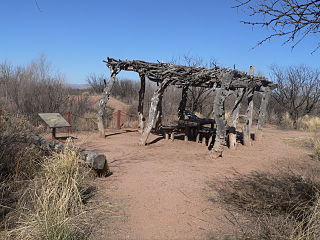
The Windust Caves (45-FR-46) are a series of nine caves eroded into a basalt cliff on the north side of the lower Snake River in Franklin County, southeastern Washington. The caves were excavated from 1959 until 1961 by a crew led by Harvey S. Rice. The site contains cultural artifacts dating back over 10,000 years and is culturally associated with other sites in the Columbia Basin.

The Jones-Miller Bison Kill Site, located in northeast Colorado, was a Paleo-Indian site where Bison antiquus were killed using a game drive system and butchered. Hell Gap complex bones and tools artifacts at the site are carbon dated from about ca. 8000-8050 BC.

Lamb Spring is a pre-Clovis prehistoric Paleo-Indian archaeological site located in Douglas County, Colorado with the largest collection of Columbian mammoth bones in the state. Lamb Spring also provides evidence of Paleo-Indian hunting in a later period by the Cody culture complex group. Lamb Spring was listed in 1997 on the National Register of Historic Places.
Murray Springs is located in southern Arizona near the San Pedro River and once served as a Clovis hunting camp approximately 11,000 years BP. The site is unique for the massive quantity of large megafauna processing and extensive tool making. Archaeologists identified five buried animal kills and processing locations and a Clovis camp location. The site is located in the San Pedro Riparian National Conservation Area, administered by the Bureau of Land Management.
Michael Waters is an American academic working as a professor of anthropology and geography at Texas A&M University, where he holds the Endowed Chair in First American Studies. He specializes in geoarchaeology, and has applied this method to the investigation of Clovis and later Paleo-Indian, and possible pre-Clovis occupation sites.

The Gault archaeological site is an extensive, multicomponent site located in Florence, Texas, United States on the Williamson-Bell County line along Buttermilk Creek about 250 meters upstream from the Buttermilk Creek complex. It bears evidence of human habitation for at least 20,000 years, making it one of the few archaeological sites in the Americas at which compelling evidence has been found for human occupation dating to before the appearance of the Clovis culture. Archaeological material covers about 16 hectares with a depth of up to 3 meters in places. About 30 incised stones from the Clovis period engraved with geometric patterns were found there as well as others from periods up to the Early Archaic. Incised bone was also found.
The Anzick site (24PA506), located adjacent to Flathead Creek, a tributary of the Shields River in Wilsall, Park County, Montana, United States, is the only known Clovis burial site in the New World. The term "Clovis" is used by archaeologists to define one of the New World's earliest hunter-gatherer cultures and is named after the site near Clovis, New Mexico, where human artifacts were found associated with the procurement and processing of mammoth and other large and small fauna.
The Heaven's Half Acre complex is a concentration of Paleoindian sites situated on a series of Pleistocene terraces overlooking a sinkhole in northeastern Colbert County, Alabama, near the town of Leighton. Over one hundred and fifty fluted points have been recovered on these sites, making it one of the most dense fluted point localities in North America.
The Welling site is an archaeological site of the Paleo-Indian period, meaning the time of the earliest humans. Located in Coshocton County, Ohio, it was a site for quarrying stone in the Upper Mercer chert source area. Based upon the microwear analysis of stone tools, it is believed to be a base camp where people learned and shared Clovis tool-making techniques, ate, exchanged information, and perhaps found mates from others groups.
The Fifield Site (Pr-55) is located on Damon Run Creek in Porter County, north-western Indiana. It is classified as a late prehistoric, single-component Upper Mississippian Fisher village.
The Huber Site (11Ck-1) is located on Tinley Creek 2 miles west of Blue Island in Cook County, Illinois, near the city of Chicago. It is classified as a late prehistoric site with Upper Mississippian affiliation.
The Anker Site (11Ck-21) is located on the Little Calumet River near Chicago, Illinois. It is classified as a late prehistoric site with Upper Mississippian Huber affiliation.
The Fisher Mound Group is a group of burial mounds with an associated village site located on the DesPlaines River near its convergence with the Kankakee River where they combine to form the Illinois River, in Will County, Illinois, about 60 miles southwest of Chicago. It is a multi-component stratified site representing several Prehistoric Upper Mississippian occupations as well as minor Late Woodland and Early Historic components.

Cooper's Ferry is an archaeological site along the lower Salmon River near the confluence with Rock Creek in the western part of the U.S. state of Idaho, and part of the Lower Salmon River Archeological District. It is 17 kilometres (11 mi) south of the town of Cottonwood and 63 kilometres (39 mi) upstream from the Snake River. Various lithic and animal remains from the Pleistocene to early Holocene ages have been found there. The site is on traditional Nez Perce land, and known to the tribe as the historical village of Nipéhe.
References
- Notes
- ↑ Kirk, Ruth and Daugherty, Richard D., Archaeology in Washington, University of Washington Press, 2007.
- Bibliography
- Gramly, R.M., The Richey Clovis Cache, Persimmon Press, 1993.
- Kirk, Ruth and Daugherty, Richard D., Archaeology in Washington, University of Washington Press, 2007.
- Marshall, Maureen E. Wenatchee's Dark Past. Wenatchee, Wash: The Wenatchee World, 2008.
- Mierendorf, R. "Comments on the East Wenatchee Clovis Site (45DO482), Washington State, As Reported on by Rilchard M. Gramley", Current Research in the Pleistocene, 1997, V. 14:57-59.
- Mehringer, P. J., Jr., "Clovis cache found: Weapons of ancient Americans", National Geographic Magazine, 1988, 174(4):500-503.
- Mehringer, P. J., Jr., "Apples and Archaeology", Universe (WSU Graduate School Magazine), 1(2):2-8, Reprinted in Mammoth Trumpet 5(2):1, 4-5, 1989.
- Mehringer, P. J., Jr. & F. F. Foit, "Volcanic ash dating of the Clovis cache at East Wenatchee, Washington", national Geographic Research 6(4):495-503, 1990.
- Robbins, Jefferson, "Clovis: Ancient site, modern world," The Wenatchee World, Wenatchee, Wash., May 27, 2007.
- Becker, Paula, "Moises Aquirre and Mark Mickels discover prehistoric Clovis point artifacts in an East Wenatchee apple orchard on May 27, 1987.", Oct 3, 2006, www.history link.org.