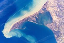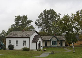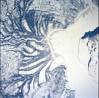
Long Point is a sand spit and medium-sized hamlet on the north shore of Lake Erie, part of Norfolk County in the province of Ontario, Canada.

The Oak Ridges Moraine is an ecologically important geological landform in the Mixedwood Plains of south-central Ontario, Canada. The moraine covers a geographic area of 1,900 square kilometres (730 sq mi) between Caledon and Rice Lake, near Peterborough. One of the most significant landforms in southern Ontario, the moraine gets its name from the rolling hills and river valleys extending 160 km (99 mi) east from the Niagara Escarpment to Rice Lake, formed 12,000 years ago by advancing and retreating glaciers during the last glaciation period. Below the approximately 200 metre thick glacial derived sediments of the moraine lies thick bedrock successions of Precambrian rocks and up to 200 metres of Ordovician aged rock, capped by a regional unconformity of erosion and non-deposition to the Quaternary period. Rivers and lakes scatter the landscape and are important for creating habitat for the rich diversity of species of animals, trees and shrubbery. These are also the supply of fresh water to aquifers in the moraine through complex subterranean connections. Construction development nearby, and with expansion of communities around the moraine in need of potable water, it is a contested site in Ontario, since it stands in the path of major urban development. Conservation of the moraine is thus an important step for keeping aquifers in a safe drinkable condition while also protecting the natural ecosystems surrounding and within the moraine. This region has been subject to multiple decades of scientific research to study the origins of formation, and how early communities used the land. A larger focus currently is how to source potable water without removing the aquifer entirely.

The Amable du Fond River is a river in Nipissing District, in Northern Ontario, Canada.

King City is an unincorporated Canadian community in the township of King, Ontario, located 40 kilometres (25 mi) north of Toronto. It is the largest community in King township, with 2,730 dwellings and a population of 8,396 as of the 2021 Canadian census.
Ansnorveldt is a hamlet located at the northeastern extent of King Township, in Ontario, Canada. It is located in the Holland Marsh, north of Highway 9. Whereas most of King township is in the Oak Ridges—Markham electoral district, Ansnorveldt and all other portions of King north of Highway 9 are part of the York—Simcoe electoral district, represented federally by Scot Davidson of the Conservative Party of Canada and provincially by Caroline Mulroney of the Progressive Conservative Party of Ontario.
Pottageville is an unincorporated community located in northeastern King Township, in Ontario, Canada. It is near Schomberg. It is named for one of its early settlers, Edward Pottage.
The politics of the Oak Ridges Moraine in southern Ontario, Canada, have centred on the question of how to preserve this extensive natural resource that is increasingly threatened by human modification. Although preservation of the moraine was first suggested in the 1940s, and intermittently over the subsequent fifty years, it was not until 1991 that the issue achieved prominence in political discourse. For the ensuing decade, use of the moraine was hotly contested between the interests of local residents, developers and environmentalists.

Daylighting is the opening up and restoration of a previously buried watercourse, one which had at some point been diverted below ground. Typically, the rationale behind returning the riparian environment of a stream, wash, or river to a more natural above-ground state is to reduce runoff, create habitat for species in need of it, or improve an area's aesthetics. In the United Kingdom, the practice is also known as deculverting.

The geology of Minnesota comprises the rock, minerals, and soils of the U.S. state of Minnesota, including their formation, development, distribution, and condition.

Cold Creek Conservation Area, usually referred simply as Cold Creek, is an ecologically diverse protected Area of Natural and Scientific Interest in south-central Ontario, Canada. The 190-hectare (470-acre) conservation area was opened on 20 June 1962 by Wilf Spooner and the Toronto and Region Conservation Authority. It is located on the western end of King Township, overlapping the Oak Ridges Moraine. The Government of Ontario Ministry of Natural Resources classifies the area as a provincially significant Area of Natural and Scientific Interest for its "provincially or regionally significant representative ecological features". The area was also a site classified for the International Biological Program. The Life Science area, known as Cold Creek Swamp, is composed of a swamp and forest.
There are numerous natural areas in King, a township in Ontario, Canada. These areas are zones officially designated by the Government of Ontario that are within the township and exhibit provincially or regionally significant features representative of the region. The list of zones is defined and maintained by the provincial Ministry of Natural Resources Natural Heritage Information Centre.
Matchedash Bay is a bay and Ramsar wetland in Simcoe County in Central Ontario, Canada. It is the "final inland extension of Severn Sound" on Lake Huron's Georgian Bay, and is "situated at the interface between the Saint Lawrence Lowlands and the Canadian Shield ". It exhibits geologically unique features at the junction of the Canadian Shield and southern Ontario limestone. Wetland habitats in Matchedash Bay are varied, and include swamps, fens, cattail marshes, wet meadows and beaver ponds. Other features include "permanent freshwater lakes; upland hardwood forest, agricultural lands, native grass meadows and a unique, coniferous wetland forest".

Southern James Bay is a coastal wetland complex in northeastern Ontario, Canada bordering James Bay and Quebec. It was designated as a wetland of international importance via the Ramsar Convention on May 27, 1987. The shallow waters of the James Bay region represent an important late autumn staging area for migratory, Arctic-breeding waterbirds.
The Glenville Hills Kames is a 345 hectare provincially significant Earth Science Area of Natural and Scientific Interest in Ontario, Canada.
The Saugeen Kame Terraces is a 431-hectare provincially significant Earth Science Area of Natural and Scientific Interest in Ontario, Canada. It is in Grey County, bounding the eastern and southern shores of Wilder Lake, a kettle lake, and is part of the larger Singhampton Kame Moraine formation. It is a kame formation that is the result of glacial retreat sediment deposition about 14,000 years ago.

The Central Asian Flyway (CAF), Central Asian-Indian Flyway, or Central Asian-South Asian Flyway is a flyway covering a large continental area of Eurasia between the Arctic Ocean and the Indian Ocean and the associated island chains. The CAF comprises several important migration routes of waterbirds, most of which extend from the northernmost breeding grounds in Siberia to the southernmost non-breeding wintering grounds in West Asia, India, the Maldives and the British Indian Ocean Territory.

Alam-Pedja Nature Reserve is the largest nature reserve in Estonia. It is a vast wilderness area which covers 342 km2 and consists of a complex of 5 large bogs separated by unregulated rivers, their floodplains, and extensive forests. The nature reserve aims to protect diverse ecosystems and rare species, mainly through preserving the natural development of forests and bogs and securing the continuing management of semi-natural floodplain grasslands.

Salt Creek is a 24.0-mile-long (38.6 km) tributary of the East Arm Little Calumet River that begins south of Valparaiso in Porter County, Indiana and flows north until it joins the East Arm Little Calumet River just before it exits to Lake Michigan via the Port of Indiana-Burns Waterway.
The Little White River is a river in the Unorganized North Part of Algoma District in Northeastern Ontario, Canada. It is in the Great Lakes Basin and is a left tributary of the Mississagi River.


