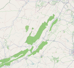
Tornado, also called Upper Falls, is a census-designated place (CDP) in Kanawha County, West Virginia, United States.
Deerfield is an unincorporated community and census-designated place (CDP) located within Upper Deerfield Township, Cumberland County, in the U.S. state of New Jersey. It was first listed as a CDP in the 2020 census with a population of 230.
Solon Mills is an unincorporated community and census-designated place in McHenry County, Illinois, United States. Solon Mills is located on U.S. Route 12, 2 miles (3.2 km) southwest of Spring Grove. Solon Mills is part of ZIP code 60071; it once had its own post office with ZIP code 60080 before it closed on September 28, 2002. It was named a CDP before the 2020 census, at which time it had a population of 133.

Amherstdale is a census-designated place (CDP) in Logan County, West Virginia, United States, situated along Buffalo Creek. The CDP includes the unincorporated communities of Amherstdale, Becco, Fanco, and Braeholm. The CDP population was 350 as of the 2010 census.
Chauncey is a census-designated place (CDP) in Logan County, West Virginia, United States. Chauncey is located along West Virginia Route 44 and Island Creek, 5.5 miles (8.9 km) south of Logan. Chauncey had a post office, which opened on August 23, 1913, and closed on June 27, 2009. As of the 2010 census, its population is 283.
Lakewood is an unincorporated community and census designated place (CDP) in Lakewood Township, Shelby County, Illinois, United States. Lakewood is located on County Highway 12, 8 miles (13 km) southwest of Shelbyville. Lakewood had a post office, which opened on July 26, 1872, and closed on November 2, 2002.
Earling is an unincorporated community and census-designated place (CDP) in Logan County, West Virginia, United States. It was first listed as a CDP prior to the 2020 census. The Earling post office closed on July 1, 1989. The town now shares ZIP Code 25632 with Lyburn and Taplin.
Ripplemead is an unincorporated community and census designated place (CDP) in Giles County, Virginia, United States. Ripplemead is located along the New River, 2.8 miles (4.5 km) east-northeast of Pearisburg. Ripplemead has a post office with ZIP code 24150.

Adams Run is a census-designated place (CDP) in Charleston County, South Carolina, United States. It was first listed as a CDP in the 2020 census with a population of 421.

East Stone Gap is an unincorporated community and census-designated place in Wise County, Virginia, United States. East Stone Gap is an eastern suburb of Big Stone Gap; U.S. Route 23 separates the two settlements. It was first listed as a CDP in the 2020 census with a population of 537. East Stone Gap has a post office with ZIP code 24246.
Doran is an unincorporated community and census-designated place in Tazewell County, Virginia, United States. Doran is located along the Clinch River, U.S. Route 460 and Virginia State Route 67 between Richlands and Raven. Doran has a post office with ZIP code 24612. The community was named for Joseph I. Doran, who was the general counsel for the Norfolk and Western Railway. It was first listed as a CDP in the 2020 census with a population of 113.

Dixie is an unincorporated community and census-designated place (CDP) in Brooks County, Georgia, United States. Dixie is located near U.S. Route 84, 6.2 miles (10.0 km) west of Quitman. Dixie has a post office with ZIP code 31629.
Remlap is a census-designated place in Blount County, Alabama, United States, located along Alabama State Route 75, 11.7 miles (18.8 km) southwest of Oneonta. Remlap has a post office with ZIP code 35133.
Grenloch is an unincorporated community and census-designated place (CDP) located within Washington Township, in Gloucester County, in the U.S. state of New Jersey. Grenloch is located along New Jersey Route 168 10.25 miles (16.50 km) south-southeast of Camden. Grenloch has a post office with ZIP Code 08032.

Cologne is an unincorporated community and census-designated place (CDP) located within Galloway Township, in Atlantic County, in the U.S. state of New Jersey. Cologne is located on U.S. Route 30, about 2.5 miles (4.0 km) southeast of Egg Harbor City. Cologne has a post office with ZIP Code 08213.

Dividing Creek is an unincorporated community and census-designated place (CDP) located in Downe Township in Cumberland County, in the U.S. state of New Jersey.
Milmay is an unincorporated community and census-designated place (CDP) located mostly within Buena Vista Township, in Atlantic County, in the U.S. state of New Jersey. Part of the CDP extends southwest into Maurice River Township in Cumberland County.
Newtonville is an unincorporated community and census-designated place (CDP) in Buena Vista Township in Atlantic County, in the U.S. state of New Jersey. Newtonville is located on a Conrail line 4.7 miles (7.6 km) east-northeast of Buena. Newtonville has a post office with ZIP Code 08346.
La France is an unincorporated community and census-designated place (CDP) in Anderson County, South Carolina. It was first listed as a CDP in the 2020 census with a population of 476.
Axson is an unincorporated community and census designated place (CDP) in Atkinson County, Georgia, United States. The community is located on U.S. Route 82, 7.1 miles (11.4 km) east of Pearson. Axson has a post office with ZIP code 31624. Per the 2020 census, the population was 360.


