Eign Hill

Last updated

Eign Hill
Hafod Road, Hereford - geograph.org.uk - 6015053.jpg
Hafod Road, Eign Hill, Hereford
Herefordshire UK location map.svg
Red pog.svg
Eign Hill
Location within Herefordshire
Population3,390 2011 Census (Ward Profile)
Civil parish
Unitary authority
Ceremonial county
Region
Country England
Sovereign state United Kingdom
Post town Hereford
Postcode district HR1
Dialling code 01432
Police West Mercia
Fire Hereford and Worcester
Ambulance West Midlands
UK Parliament
List of places
UK
England
Herefordshire
52°03′14″N2°41′53″W / 52.054°N 2.698°W / 52.054; -2.698

Eign Hill is an eastern suburb and ward of Hereford in Herefordshire, England. The population at the 2011 census of the ward was 3,390. [1] [2] Eign Hill is one of the sixteen wards of Hereford City Council. Eign Hill is bordered by the suburbs of Bartonsham, The Hamptons, and Tupsley.

Contents

History

Sir Edward Elgar lived in the area on Plas Gwyn between 1904 and 1911, where he had written some of his famous work during his time living in Eign Hill Sir Edward Elgar statue, Hereford.jpg
Sir Edward Elgar lived in the area on Plas Gwyn between 1904 and 1911, where he had written some of his famous work during his time living in Eign Hill

Early history

Eign Hill was first recorded from prehistoric times and has been a prominent landmark hill in the city for many centuries. It became urbanised around 1849 due to the coming of the industrial revolution and its location to both the Hereford - Worcester Line and River Wye.

Industrial revolution

A wharf was opened known as "Eign Wharf" [3] where it was located in the suburb of Bartonsham to the south and was the location of both the "Whalebone Inn" and fishing dock. [4]

Sir Edward Elgar

The area was also home to the famous author, Sir Edward Elgar between 1904 and 1911 where he had written and published most of his works in Eign Hill.

Notable buildings

Brockington House, formerly the meeting place of Herefordshire Council, now a care home on Hafod Road Brockington - Herefordshire Council headquarters - geograph.org.uk - 841849.jpg
Brockington House, formerly the meeting place of Herefordshire Council, now a care home on Hafod Road
Rose and Crown, Ledbury Road Rose & Crown, Hereford - IMG 0057.JPG
Rose and Crown, Ledbury Road

The area is home to some landmark buildings including:

Demographics

At the 2011 census, the population of Eign Hill's ward profile was 3,390. Of the findings, the ethnicity and religious composition of the ward was:

Eign Hill: Ethnicity: 2011 Census
Ethnic groupPopulation %
White3,27192,8%
Asian or Asian British513.6%
Mixed423%
Black or Black British120.2%
Arab70.2%
Other Ethnic Group70.2%
Total3,390100%

The religious composition of Eign Hill's ward at the 2011 Census was recorded as:

Eign Hill: Religion: 2011 Census
ReligiousPopulation %
Christian2,39370.6%
Irreligious69420.5%
Muslim30.1%
Hindu60.2%
Buddhist130.4%
Other religion30.1%
Total3,390100%

Geography

Eign Hill is located to the east of Hereford City Centre and between the suburbs of Bartonsham. Old Eign Hill, Tupsley and Burcott. It is on the A438 to Ledbury and is close to both Hereford County Hospital and Hereford Railway Station.

Related Research Articles

<span class="mw-page-title-main">Ledbury</span> Town in Herefordshire, England

Ledbury is a market town and civil parish in the county of Herefordshire, England, lying east of Hereford, and west of the Malvern Hills.
<span class="mw-page-title-main">Bromyard</span> Market town in Herefordshire, England

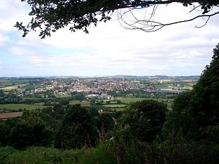
Bromyard is a town in the parish of Bromyard and Winslow, in Herefordshire, England, in the valley of the River Frome. It is near the county border with Worcestershire on the A44 between Leominster and Worcester. Bromyard has a number of traditional half-timbered buildings, including some of the pubs; the parish church is Norman. For centuries, there was a livestock market in the town.

<span class="mw-page-title-main">Herefordshire</span> County of England

Herefordshire is a ceremonial county in the West Midlands region of England. It is bordered by Shropshire to the north, Worcestershire to the east, Gloucestershire to the south-east, and the Welsh counties of Monmouthshire and Powys to the west. The city of Hereford is the largest settlement and the county town.
<span class="mw-page-title-main">Malvern Hills District</span> Non-metropolitan district in England

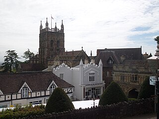
Malvern Hills is a local government district in Worcestershire, England. Its council is based in Malvern, the district's largest town. The district also includes the towns of Tenbury Wells and Upton-upon-Severn and a large rural area covering much of the western side of the county, including numerous villages. The district is named after the Malvern Hills, which are a designated Area of Outstanding Natural Beauty.
<span class="mw-page-title-main">South Herefordshire</span> Former local government district in England

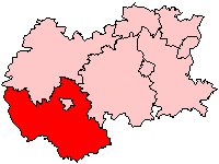
South Herefordshire was one of nine local government districts of the English county of Hereford and Worcester from 1974 to 1998.

<span class="mw-page-title-main">Leominster (district)</span> Local government district in England

Leominster was a non-metropolitan district in Hereford and Worcester, England from 1974 to 1998. The council was based in the town of Leominster.

<span class="mw-page-title-main">Leominster (UK Parliament constituency)</span> Parliamentary constituency in the United Kingdom, 1868–2010

Leominster was a parliamentary constituency represented until 1707 in the House of Commons of England, then until 1801 in that of Great Britain, and finally until 2010, when it disappeared in boundary changes, in the Parliament of the United Kingdom.

Herefordshire Council elections are held every four years. Herefordshire Council is the local authority for the unitary authority and ceremonial county of Herefordshire in England. Since the last boundary changes in 2015, 53 councillors have been elected from 53 wards.

<span class="mw-page-title-main">Bosbury</span> Village in Herefordshire, England

Bosbury is a village and civil parish in Herefordshire, England, approximately 3.5 miles (5.6 km) north of Ledbury. The small River Leadon flows through the parish, passing along the west side of the village. Bosbury shares a parish council with neighbouring Coddington.

<span class="mw-page-title-main">Hereford and South Herefordshire (UK Parliament constituency)</span> Parliamentary constituency in the United Kingdom, 2010 onwards

Hereford and South Herefordshire is a constituency of the House of Commons of the UK Parliament. It comprises the city of Hereford and most of south Herefordshire and has been represented since 2010 by Jesse Norman of the Conservative Party.

<span class="mw-page-title-main">North Herefordshire (UK Parliament constituency)</span> Parliamentary constituency in the United Kingdom, 2010 onwards

North Herefordshire is a constituency represented in the House of Commons of the UK Parliament since 2024 by Ellie Chowns of the Green Party of England and Wales. It is the first Green seat in the West Midlands region.

<span class="mw-page-title-main">Herefordshire Council</span> Unitary local government authority for the county of Herefordshire in England

Herefordshire Council is the local authority for the county of Herefordshire in England. It is a unitary authority, combining the powers of a district and county council.

<span class="mw-page-title-main">Felton, Herefordshire</span> Human settlement in England

Felton is a small village and civil parish in the county of Herefordshire, England, and is 7 miles (11 km) north-east from the city and county town of Hereford. The closest town is the market town of Bromyard, 6 miles (10 km) to the north-east.

<span class="mw-page-title-main">Bartonsham</span> Suburb of Hereford in Herefordshire, England

Bartonsham is an inner city suburb of the city of Hereford in Herefordshire, England. It is located southeast of the city centre on the River Wye. It is bounded by Hereford City Centre, Eign Hill, The Hamptons and Tupsley. It is part of the Central Ward.

<span class="mw-page-title-main">Tupsley</span> Suburb of Hereford in Herefordshire, England

Tupsley is a historic village, ward and suburb of the city of Hereford in Herefordshire, England. It is located southeast of the city centre and close to the River Wye. Tupsley is surrounded by the suburbs of Bartonsham, Eign Hill, and The Hamptons. The population of the ward at the 2021 Census was recorded at 3,075. It is one of the sixteen wards of Hereford City Council. It is represented by Cllr Jim Kenyon.

<span class="mw-page-title-main">The Hamptons, Hereford</span> Suburb of Hereford in Herefordshire, England

The Hamptons also known collectively Hampton Dene, Hampton Grangeand Hampton Park are a cluster of suburbs of the city of Hereford in the ceremonial county of Herefordshire, England. The suburbs are bordered by the suburbs of Bartonsham, Eign Hill, and Tupsley.

<span class="mw-page-title-main">Central, Hereford</span> Suburb and ward of Hereford in Herefordshire, England

Central is the name given to the ward covering the city centre of Hereford and suburb of Bartonsham in the ceremonial county of Herefordshire, England. It is one of the 16 wards on Hereford City Council and is currently represented by Cllr Jeremy Milln. The ward includes the main city centre and Bartonsham.

<span class="mw-page-title-main">Malvern Hills District (1974–1998)</span>

Malvern Hills is a former non-metropolitan district of Hereford and Worcester, England from 1974 to 1998.

References

  1. "Interesting Information for Bodenham Road, Hereford, HR1 2UF Postcode". StreetCheck. Retrieved 31 August 2024.
  2. KEY STATISTICS, 2011 CENSUS. "Eign Hill ward profile" (PDF). understanding.herefordshire.gov.uk. Herefordshire Council. Retrieved 31 August 2024.{{cite web}}: CS1 maint: numeric names: authors list (link)
  3. "Parish History 7 Eign Wharf". Bartonsham History Group. Retrieved 31 August 2024.
  4. "The Whalebone Inn". Bartonsham History Group. Retrieved 31 August 2024.
  5. "About Us - The Rose & Crown". www.roseandcrownhay.com. Retrieved 31 August 2024.
  6. "Care home plan for former council offices approved". Hereford Times. 14 April 2017. Retrieved 31 August 2024.
  7. "The Hereford and Worcester (Structural, Boundary and Electoral Changes) Order 1996". www.legislation.gov.uk. www.legislation.gov.uk. Retrieved 31 August 2024.