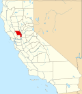
El Macero, California

Last updated

El Macero
California Locator Map with US.PNG
Red pog.svg
El Macero
Location in California
Usa edcp location map.svg
Red pog.svg
El Macero
El Macero (the United States)
Coordinates: 38°32′49″N121°41′39″W / 38.54694°N 121.69417°W / 38.54694; -121.69417
Country Flag of the United States (23px).png  United States
State Flag of California.svg  California
County Yolo County
Elevation
[1]
11 m (36 ft)
Population
 (2020) [2]
  Total1,074

El Macero is an unincorporated community and census-designated place (CDP) [3] just outside the city limits of Davis, California, United States, in Yolo County. Until 2006 it had a separate ZIP Code, 95618. In 2006, eastern and southern parts of Davis were added to the 95618 zone. Formerly, a separate post office served El Macero; this is now closed. El Macero was named for Bruce Mace, on whose land it was built. The community is in area code 530. It lies at an elevation of 36 feet (11 m). A golf course is in the community.

Contents

El Macero corresponds to Yolo County census tract 104.01, block group 1, at the 2010 census, which had a population of 619. The racial makeup of El Macero was 533 (86.1%) White, 0 (0%) African American, 0 (0%) Native American, 64 (10.3%) Asian, 0 (0%) Pacific Islander, 0 (0%) from other races, and 22 (3.6%) from two or more races. Hispanic or Latino of any race were 37 persons (6.0%). [4]

History

The ownership of the land can be traced back to General Mariano Guadelupe Vallejo. [5] The land was bought by the Montgomery Family in 1851 who settled during the gold rush. [6] One century later, the land was bought by Bruce Mace. [7] [8] Mace hired Robert Baldock, a golf course designer from Fresno. He then opened the club house a decade later by spring of 1961, along with the golf course and the first 175 lots for sale. [9]

Related Research Articles

<span class="mw-page-title-main">Davis, California</span> City in California, United States

Davis is the most populous city in Yolo County, California, United States. Located in the Sacramento Valley region of Northern California, the city had a population of 66,850 in 2020, not including the on-campus population of the University of California, Davis, which was over 9,400 in 2016. As of 2019, there were 38,369 students enrolled at the university.

<span class="mw-page-title-main">Yolo County, California</span> County in California, United States

Yolo County, officially the County of Yolo, is a county located in the northern portion of the U.S. state of California. Yolo County was one of the original counties of California, created in 1850 at the time of statehood. As of the 2020 census, the population was 216,403. Its county seat is Woodland.

<span class="mw-page-title-main">Hot Springs Village, Arkansas</span> Census-designated place in Arkansas, United States

Hot Springs Village is a census-designated place (CDP) in Garland and Saline counties in the U.S. state of Arkansas. As it is situated in two counties, it is also part of two metropolitan statistical areas. The portion in Garland County is within the Hot Springs Metropolitan Statistical Area, while the portion extending into Saline County is part of the Little Rock–North Little Rock–Conway Metropolitan Statistical Area. The population was 12,807 at the 2010 census. It is the largest gated community in the United States.

<span class="mw-page-title-main">Lely Resort, Florida</span> Census-designated place in Florida

Lely Resort is a census-designated place (CDP) in Collier County, Florida, United States. The population was 4,646 at the 2010 census, up from 1,426 in 2000. It is part of the Naples–Marco Island Metropolitan Statistical Area.

<span class="mw-page-title-main">Hunter's Creek, Florida</span> Census-designated place in Florida, United States

Hunter's Creek is a master planned, unincorporated community and census-designated place in Orange County, Florida, United States. It is part of the Orlando–Kissimmee–Sanford, Florida Metropolitan Statistical Area. The population was 14,321 at the 2010 census. It has grown up around a large planned community named Hunter's Creek, though the CDP name given by the United States Census Bureau lacks the apostrophe.

<span class="mw-page-title-main">Montgomery Village, Maryland</span> Census-designated place in Maryland

Montgomery Village is a census-designated place (CDP) in Montgomery County, Maryland, United States, and a northern suburb of Washington, D.C. It is a large, planned suburban community, developed in the late 1960s and 1970s just outside Gaithersburg's city limits. Montgomery Village's population was 34,893 at the time of the 2020 U.S. Census, and it is a part of the Washington metropolitan area.

<span class="mw-page-title-main">Rossmoor, New Jersey</span> Populated place in Middlesex County, New Jersey, US

Rossmoor is an unincorporated community and census-designated place (CDP) located within Monroe Township in Middlesex County, in the U.S. state of New Jersey. As of the 2010 United States Census, the CDP's population was 2,666.

<span class="mw-page-title-main">Sudden Valley, Washington</span> Census-designated place in Washington, United States

Sudden Valley is a census-designated place (CDP) just outside of Bellingham in Whatcom County, Washington.

<span class="mw-page-title-main">Tornado, West Virginia</span> Census-designated place in West Virginia, United States

Tornado, also called Upper Falls, is a census-designated place (CDP) in Kanawha County, West Virginia, United States.

<span class="mw-page-title-main">Wawona, California</span> Census-designated place in California, United States

Wawona is a census-designated place in Mariposa County, California, United States. The population was 111 at the 2020 census.

<span class="mw-page-title-main">Blackhawk, California</span> Unincorporated community in California, United States

Blackhawk is an unincorporated planned community and census-designated place located in Contra Costa County, California, United States, east of Danville and Oakland. As of the 2010 census it had a population of 9,354. Governed by county rules/regulations and a homeowner association (HOA), Blackhawk has a country club, two golf courses, sports complex, restaurants, and the adjacent Blackhawk Plaza. 24-hour security plus additional law enforcement contracted through the Contra Costa County Sheriff's Office is provided by HOA dues. The area is covered by the San Ramon Valley Fire Protection District. The ZIP code is 94506. The community is inside area code 925. Blackhawk is known for its uniform architecture and suburban lifestyle, with the median household income being $167,875 and median home price of $1,117,500.

<span class="mw-page-title-main">Gold Canyon, Arizona</span> Census-designated place in Arizona, United States

Gold Canyon is a census-designated place (CDP) and unincorporated community in Pinal County, Arizona, United States. The community is sometimes incorrectly called Gold Camp.

Pioneer is a census-designated place in Amador County, California. It is located 5 miles (8.0 km) east-northeast of Pine Grove, at an elevation of 2986 feet, along State Route 88. The community is in ZIP code 95666 and area code 209. The population was 1,094 at the 2010 census.

Rumsey is an unincorporated community and census-designated place (CDP) in Yolo County, California. It is located 18 miles (29 km) northwest of Esparto, in the Capay Valley, in the northwestern part of the county. Rumsey's ZIP Code is 95679 and its area code 530. It lies at an elevation of 420 feet.

Yolo is an unincorporated community and census-designated place in Yolo County, California. It is located 4.9 miles northwest of the county seat, Woodland and 24 miles northwest of the state capital of Sacramento. Yolo's ZIP Code is 95697 and its area code 530. It lies at an elevation of 82 feet. The population was 421 at the 2020 census.

<span class="mw-page-title-main">Guinda, California</span> Census-designated place in California, United States

Guinda is a census-designated place in Yolo County, California. It is located in the Capay Valley, in the northwestern portion of the county, 13 miles (21 km) northwest of Esparto. Guinda's ZIP Code is 95637 and the town is in area code 530. It lies at an elevation of 361 feet.

<span class="mw-page-title-main">Knights Landing, California</span> Census-designated place in California, United States

Knights Landing is a census-designated place in Yolo County, California, United States, founded by William Knight. It is located on the Sacramento River around 25 miles northwest of Sacramento in the northeastern portion of the county. Knights Landing's ZIP Code is 95645 and its area code 530. It lies at an elevation of 36 feet. The 2010 census reported that Knights Landing had a population of 995.

<span class="mw-page-title-main">Sleepy Hollow, Marin County, California</span> Census-designated place in California, United States

Sleepy Hollow is a census-designated place in Marin County, California, United States. It is located 7 miles (11 km) south of downtown Novato at an elevation of 177 feet (54 m). Its population as of the 2020 census was 2,401.

Pasatiempo is an unincorporated community and census-designated place (CDP) in Santa Cruz County, California, United States, located along State Route 17 between Scotts Valley and Santa Cruz. Bus service is provided by Santa Cruz Metro and the Highway 17 Express. Pasatiempo sits at an elevation of 394 feet (120 m). The 2020 United States census reported Pasatiempo's population was 1,093.

<span class="mw-page-title-main">Brooktrails, California</span> Unincorporated community in California, United States

Brooktrails is a census-designated place and unincorporated community in Mendocino County, California, United States. It shares ZIP code 95490 with Willits. The population was 3,632 at the 2020 census.

References

  1. U.S. Geological Survey Geographic Names Information System: El Macero, California
  2. "El Macero CDP, California". United States Census Bureau. Archived from the original on April 25, 2024. Retrieved April 25, 2024.
  3. "2020 U.S. Gazetteer Files – California". United States Census Bureau. Retrieved April 2, 2021.
  4. "2010 Census P.L. 94-171 Summary File Data". United States Census Bureau.
  5. "History".
  6. https://www.elmacerohoa.com/
  7. https://www.elmacerohoa.com/
  8. "Davis".
  9. https://www.elmacerohoa.com/