Municipalities are the second-level administrative divisions of Mexico, where the first-level administrative division is the state. As of January 2021, there are 2,454 municipalities in Mexico, excluding the 16 boroughs of Mexico City.
Aguadulce is a municipality in Seville. In 2005, it had a population of 1,993. It has an area of 13.98 square kilometers and has a population density of 142.4 people per square kilometer. Aguadulce is at an elevation of 264 meters and is situated 99 kilometers from Seville.
Almadén de la Plata is a municipality in Seville, Spain. It had a population of 1,696 in 2005 and has population density of 6.6 people per km², with a total area of about 256 km². It is located at an altitude of 450 meters and is 59 kilometers from Seville.

El Águila is a town and municipality located in the Department of Valle del Cauca, Colombia.

Bormujos is a city located in the province of Seville, Spain. According to the 2007 census (INE), the city has a population of 15,741 inhabitants.

El Coronil is a city located in the province of Seville, Spain. According to the 2005 census (INE), the city has a population of 5044 inhabitants.

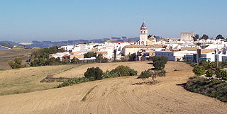
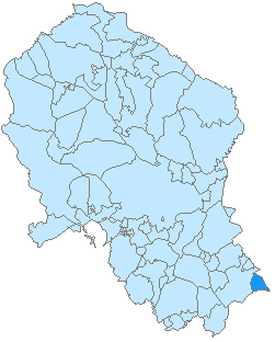
Almedinilla is a city located in the province of Córdoba, Spain. According to the 2006 census (INE), the city has a population of 2536 inhabitants.

Villanueva de las Torres is a municipality located in the province of Granada, Spain. According to the 2004 census (INE), the city has a population of 786 inhabitants.

Guijo de Galisteo is a municipality located in the province of Cáceres, Extremadura, Spain. According to the 2008 census (INE), the municipality has a population of 1513 inhabitants.

El Torno is a municipality located in the province of Cáceres, Extremadura, Spain. According to the 2005 census (INE), the municipality has a population of 938 inhabitants.

Peral de Arlanza is a municipality and town located in the province of Burgos, Castile and León, Spain. According to the 2004 census (INE), the municipality has a population of 223 inhabitants.
Bayé is a town in the Solenzo Department of Banwa Province in western Burkina Faso. As of 2005 it had a population of 5,478.

Łęg is a village in the administrative district of Gmina Śrem, within Śrem County, Greater Poland Voivodeship, in west-central Poland. It lies approximately 4 kilometres (2 mi) east of Śrem and 37 km (23 mi) south of the regional capital Poznań.
Nanchital is a Municipality in Veracruz, Mexico. It is located in south-east zone of the State of Veracruz, about 438 km from the state capital, Xalapa. It has a surface of 63.99 km2. It is located at 18°04′N94°25′W.

Caxhuacan is a town and municipality in Puebla in south-eastern Mexico.

Cuautlancingo Municipality is a town and municipality in Puebla, south-eastern Mexico. It is part of the Metropolitan area of Puebla. The town is bordered on the north by the state of Tlaxcala, Tlaxcala, east to the municipality of Tlaxcala and the city of Puebla, to the south with the municipality of San Pedro Cholula and Puebla and west by the municipality of Coronango.

Moraleja is a municipality located in the province of Cáceres, Extremadura, Spain. It is the most important town in the Sierra de Gata comarca. The Postal Code is 10128.

Rexford Glacier is a glacier flowing northeast into the head of Wagoner Inlet on the north side of Thurston Island. Named by Advisory Committee on Antarctic Names (US-ACAN) after Aviation Radioman Phillip W. Rexford, PBM Mariner aircrewman in the Eastern Group of U.S. Navy Operation Highjump, which obtained aerial photographs of this glacier and adjoining coastal areas, 1946–47.

Mustafabeyli is a town in Ceyhan district of Adana Province, Turkey. It is on the highway D.400 near the intersection D.817 at 37°05′N36°04′E. The distance to Ceyhan is 27 kilometres (17 mi). The population of the town is 1856 as of 2015.


