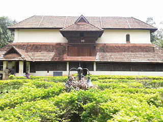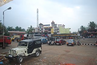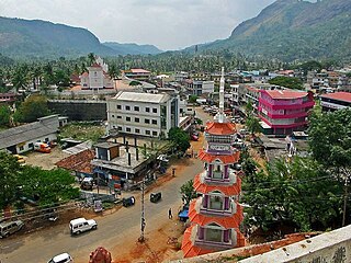
Nedumangad is a Major Town and municipality in Thiruvananthapuram metropolitan area of Thiruvananthapuram district in the Indian state of Kerala, It's also the headquarters of Nedumangad (tehsil) and Nedumangad Revenue Division (RDO). It is a suburb of the extended metropolitan region of Thiruvananthapuram city. It is located around 18 km to the north-east of Thiruvananthapuram city on the Thiruvananthapuram — Shencottah. It is an Important commercial center in the district. It is a growing commercial, educational hub and important Government institutions are situated in the Town. Nedumangadu Market is one of the Important Market in Kerala. It is an important centre for the commercial trade in Hill products Such as pepper and rubber. A wholesale market set up by the Department of Agriculture is also situated there.

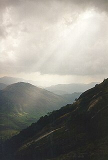
Idukki is one of the 14 districts of Kerala state, India, created on 26 January 1972 bifurcating Kottayam District. At that time, the district headquarters was at Kottayam. In June 1976 it was moved to Painavu. Idukki lies in the Western Ghats of Kerala. Idukki is the second largest district in area but has the lowest population density. Idukki has a vast forest reserve area; more than a half of the district is covered by forests. The urban areas are densely populated whereas villages are sparsely populated. Idukki is also known as the spice garden of Kerala.

Tirurangadi is a municipal and census town in Malapuram district of Kerala, South India. It is a historic town famed for its active participation in the freedom struggle, especially those dating back to the 1920s. It serves as a local taluk and is located 25 km west of Malappuram, the district headquarters, 30 km south of Calicut and 140 km north of Ernakulam.

Muvattupuzha is a prominent old town in the midlands directly to the east of Kochi. It is situated at around 36 km (22 mi) from downtown Kochi. The town is a growing urban centre in central Kerala and also an aspiring new district headquarter. The town is also popular as the starting point of Muvattupuzha river which happens by the merging of three rivers – namely Thodupuzhayar, Kaliyar and Kothayar – to form Muvattupuzhayaar. Thus, this Thriveni Sangamam or confluence of three rivers is called Muvattupuzha.

Kalpetta is a town and a municipality in the Wayanad district, state of Kerala, India. Kalpetta is the headquarters of Wayanad district as well as the headquarters of Vythiri taluk. It is a bustling town surrounded by dense coffee and tea plantations and mountains. It lies on the Kozhikode-Mysore National Highway NH 766 at an altitude of about 780 m above sea level. Kalpetta is 72 km from Kozhikode and 140 km from Mysore.

Mannarkkad, formerly known as Mannarghat, is a municipal City in Palakkad district of the Indian state of Kerala.

Vazhachal Falls is situated in Athirappilly Panchayath of Thrissur district in Kerala on the southwest coast of India. Located on the west-flowing Chalakudy River near the Vazhachal Forest Division and at the edge of the Sholayar ranges, it is just 5 km from entrance of Athirappilly Falls. It is located 36 km from Chalakudy.

Kavvayi is a group of small islands, near Payyannur in the Kannur district of Kerala state in India. The island is connected to Payyannur by a small bridge on the Kavvayi River. The population is mainly Muslim.

Anchal is a village located in the centre of the Kollam district of Kerala, India, between National Highway 744 and Main Central Road. Anchal is a village in Kerala and is located between Thiruvananthapuram and Pathanamthitta.

Venmony is a village in Chengannur taluk of Alappuzha district of Central Travancore area in Kerala state, India. Venmoney is 18 km south of Thiruvalla, 11 km east of Mavelikkara and 9 km northwest of Pandalam. 12 Km from Chengannur. It is located 55 KM towards East from District head quarters Alappuzha. 107 KM from State capital Thiruvananthapuram and 138 KM from Cochin International Airport.This Place is in the border of the Alappuzha District and Pathanamthitta District.The Achenkovil river flows on its southern boundary and is spanned by the Pulakadavu bridge.

Kunchithanny is a village situated in the Idukki district in the Indian state of Kerala. Located on the banks of the river Muthirappuzha, this village is home to people from different parts of the state of Kerala.

Rajakkad is a town in the Idukki district in the Indian state of Kerala situated in the Western Ghats. It is one of Kerala's fastest growing towns.
Manathana is a village in Kannur district in the Indian state of Kerala.

Adimaly is a town in the Idukki district of Kerala, India. National Highway 185 is a highway in India running from Adimali to Kumily through Kattappana and ends in Adoor in Kerala. Adimaly is located on the National Highway 49, now NH 85, known as Kochi-Dhanushkodi National Highway (India) connecting Kochi and Madurai, India. From Adimaly, it is only 27 kilometers to Munnar, which is a famous hill station. The waterfalls Cheeyappara, Adimaly waterfalls and Valara are located nearby. Pepper cultivation is the main agricultural activity of this place. The Ponmudi Dam was constructed in 1963 across the Panniar river, nearly 15 km southeast of Adimali, on the way to Rajakkad. Adimali is known for its proximity to munnar and natural environment. Adimaly has almost all the basic facilities like roads, educational institutions and hospitals.

Peruva is a little small village in the Mulakulam panchayat of Kottayam district in Kerala. It is located 35 km from Kottayam and 40 km from Ernakulam. The other nearby towns are piravom (6 km), Kaduthuruthy (8 km), and Thalayolaparambu (10 km).

Government Medical College, Manjeri, is a medical college established in Malappuram District affiliated to Kerala University of Health Sciences (KUHS), located in Manjeri around 12 kilometres (7.5 mi) from Malappuram. The hospital has 500 beds and 12 operation theatres with an intake of 100 students every year.

Government Higher Secondary School Rajakkad, Kerala, India, was started in 1955. The school is situated in rajakkad about 20 kilometer away from Adimali town. Rajakkad Temple and Christhuraja Church are two religious centers near to school.

Pothupara is a Place in Idukki district in the Indian state of Kerala situated in the Western Ghats. Pothupara is 9 km from Rajakkad, 4 km from Kunchithanny, 17 km from Munnar and 2 km from Ellakkal
K. K. Jayachandran is the member of 13th Kerala Legislative Assembly. He belongs to Communist Party of India (Marxist) and represents Udumbanchola constituency. He was previously elected to Kerala Legislative Assembly in 2001 and 2006.
Edamalakkudy or Idamalakkudy is a remote tribal village of Idukki district of Kerala province of India.


