Emma, North Carolina | |
|---|---|
 Emma  Emma | |
| Coordinates: 35°36′07″N82°35′45″W / 35.60194°N 82.59583°W | |
| Country | United States |
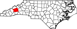
| State | North Carolina |
| County | Buncombe |
| Area | |
• Total | 1.09 sq mi (2.82 km2) |
| • Land | 1.09 sq mi (2.82 km2) |
| • Water | 0.00 sq mi (0.00 km2) |
| Elevation | 2,179 ft (664 m) |
| Population (2020) | |
• Total | 2,174 |
| • Density | 2,000.00/sq mi (772.00/km2) |
| Time zone | UTC-5 (Eastern (EST)) |
| • Summer (DST) | UTC-4 (EDT) |
| ZIP Code | 28806 (Asheville) |
| Area code | 828 |
| FIPS code | 37-21260 |
| GNIS feature ID | 2812778 [2] |
Emma is an unincorporated community and census-designated place (CDP) in Buncombe County, North Carolina, United States. [2] It was first listed as a CDP in the 2020 census with a population of 2,174. [3]
Contents
The community is in central Buncombe County, bordered to the east and south by the city of Asheville, the county seat, and to the north by Woodfin.