Enterprise, Iowa | |
|---|---|
 An aerial photo of Enterprise, taken on June 10, 2025 | |
 Enterprise, Iowa Enterprise, Iowa  Enterprise, Iowa Enterprise, Iowa (the United States) | |
| Coordinates: 41°43′55″N93°31′49″W / 41.7319325°N 93.5302150°W | |
| Country | |
| State | |
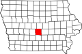
| County | Polk |
| Township | Douglas |
| Elevation | 1,004 ft (306 m) |
| Time zone | UTC-6 (Central (CST)) |
| • Summer (DST) | UTC-5 (CDT) |
| Area code | 515 |
| GNIS feature ID | 456382 [1] |
Enterprise is an unincorporated community in Polk County, Iowa, United States. [1] Enterprise is located in Douglas Township. [2] The state capital and county seat of Des Moines is located slightly less than 10 miles away.