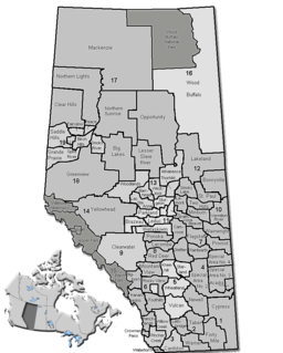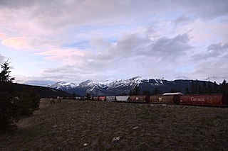
The Yellowhead Highway is a major interprovincial highway in Western Canada that runs from Winnipeg to Graham Island off the coast of British Columbia via Saskatoon and Edmonton. It stretches across the four western Canadian provinces of British Columbia, Alberta, Saskatchewan, and Manitoba and is part of the Trans-Canada Highway system and the larger National Highway System, but should not be confused with the more southerly, originally-designated Trans-Canada Highway. The highway was officially opened in 1970. Beginning in 1990, the green and white Trans-Canada logo was used to designate the roadway.

Hinton is a town in west-central Alberta, Canada.

West Yellowhead is a provincial electoral district in Alberta, Canada. The district is one of 87 current ridings mandated to return a single member to the Legislative Assembly of Alberta using the first past the post method of voting.

South Cooking Lake is a hamlet in Alberta, Canada within Strathcona County. It is located on Highway 14, approximately 19 km (12 mi) southeast of Sherwood Park.
The Fiddle Range is a mountain range of the Canadian Rockies located south of Highway 16 on the east border of Jasper National Park, Canada.
The Miette Range is a mountain range of the Canadian Rockies located south of Highway 16 near the east border of Jasper National Park, Alberta, Canada.

The Smoky River is a river in western Alberta, Canada. It is a major tributary of the Peace River. The descriptive name refers to the presence of "smouldering beds of coal in the riverbank" noted by the Cree Indians.

Cadomin is a hamlet in the west-central Alberta, Canada within Yellowhead County. It is located along the McLeod River in the foothills of the Rocky Mountains, approximately 50 kilometres (31 mi) south of Hinton near the Bighorn Highway. It is served by a spur of the Canadian National Railway.
Norman's Cove-Long Cove is a town in the Canadian province of Newfoundland and Labrador. The town had a population of 666 in the Canada 2016 Census, down from 720 in 2011.

Carvel is a hamlet in Alberta, Canada within Parkland County. It is located on Highway 770, approximately 35 kilometres (22 mi) west of Edmonton. The hamlet's name is derived from the novel Richard Carvel by the American writer Winston Churchill.

Brownvale is a hamlet in northern Alberta, Canada within the Municipal District of Peace No. 135. It is located on Highway 737 less than 1 kilometre (0.62 mi) off Highway 2, approximately 48 kilometres (30 mi) southwest of the Town of Peace River and 20 kilometres (12 mi) southwest of Grimshaw. Duncan's First Nation reserve is less than 5 km (3.1 mi) to the south.

Eaglesham is a hamlet in northern Alberta, Canada within Birch Hills County, located 6 kilometres (3.7 mi) north of Highway 49, approximately 89 kilometres (55 mi) northeast of Grande Prairie.

Jean Cote, or Jean Côté, is a hamlet in northern Alberta, Canada within the Municipal District of Smoky River No. 130. It is located approximately 11 kilometres (6.8 mi) west of Highway 2 and 123 kilometres (76 mi) northeast of Grande Prairie.

Lafond is a hamlet in northern Alberta, Canada within the County of St. Paul No. 19. It is located 5 kilometres (3.1 mi) east of Highway 36, approximately 117 kilometres (73 mi) northwest of Lloydminster.

Notikewin is a hamlet in northern Alberta, Canada within the County of Northern Lights.

Pocahontas is a campground, an unincorporated area in Improvement District No. 12 within Alberta's Rockies. It is located on Highway 16, approximately 38 km (24 mi) northeast of Jasper, at the junction that provides access to Jasper National Park's Miette Hot Springs.

Ridgevalley is a hamlet in northern Alberta, Canada within the Municipal District of Greenview No. 16. It is located 2.5 kilometres (1.6 mi) southwest of Highway 43, approximately 57 kilometres (35 mi) east of Grande Prairie.

Jasper House National Historic Site, in Jasper National Park, Alberta, is the site of a trading post on the Athabasca River that functioned in two different locations from 1813 to 1884 as a major staging and supply post for travel through the Canadian Rockies.
Miette Hot Springs are commercially developed hot springs located in Jasper National Park in Alberta, Canada, near Jasper. The pool is outdoors and offers visitors a view of the surrounding Fiddle River Valley. The hot springs are located at the end of a 15 km seasonal road and are located 61 km northeast of Jasper. Water temperature is kept at approximately 40°C (104°F)

The Alberta Coal Branch is the name given to a segment of the Canadian National Railway and the region through which it passes. It is located within Yellowhead County in west-central Alberta, Canada.


