Espanola basin

Last updated
Map showing the location of the Espanola Basin withine the Rio Grande rift, New Mexico, US EBloc.jpg
Map showing the location of the Espanola Basin withine the Rio Grande rift, New Mexico, US

The Espanola basin is a structural basin in northern New Mexico. It is located in the Rio Grande watershed and is part of the Rio Grande rift. The definition of its boundaries is not fully settled, but the basin is usually defined such that it includes the cities of Santa Fe, Los Alamos, and Espanola. [1]

Contents

Geology

The basin is part of the Rio Grande rift, a north-south sequence of structural basins that have developed where tectonic forces have pulled the Colorado Plateau away from the interior of North America. The basin is partially filled with sediments eroded from the higher ground to the east and west or brought in by the ancestral Rio Grande. The Jemez volcanic field is located on the western margin of the basin and has contributed additional volcanic sediments to the basin. [1] The sediments formed the Tesuque Formation and Chamita Formation of the Santa Fe Group. [2]

The basin began forming during the middle to late Oligocene, around 25 million years ago. The early basin was more extensive than the present basin, and there is no evidence of boundary faults at this stage of development. The basin was likely a shallow depression between the Sierra Nacimiento to the west and the Sangre de Cristo Mountains to the east. Faulting and volcanism began on the west side of the basin in mid-Miocene time, around 14 million years ago. In the early Pliocene, rifting became focused on the Velarde graben, which is bounded on the west by the Pajarito fault zone. This is located on the western edge of the city of Los Alamos, at the feet of the Jemez Mountains. [3] [4]

The basin is an asymmetric half-graben, with the beds within the basin dipping to the west. No major bounding faults are found on the east side of the basin. The accumulated sediments in the center of the basin are about 2 to 3 km thick, becoming thinner to the east and pinching out against the Precambrian rock of the Sangre de Cristo Mountains. At greater depths near the basin center, there is are thick beds of older sedimentary rock that may be an old lake deposit of the Eocene Galisteo or El Rito Formations. [5] The deepest portion of the rift is along the Velarde graben, which is up to 5 km deep. [6]

The Rio Grande became established in the basin in the Pliocene, around 4 million years ago. Volcanic activity in the Cerros del Rio periodically dammed the river and created a large lake in the Espanola basin. [3]

Fossils

The Espanola basin has yielded vertebrate fossils since the 1870s, which provide the most extensive Miocene fossil record in New Mexico. Most of the fossils are mammals, but lizard and turtle fossils have also been recovered, [7] along with freshwater diatoms. [8]

Economic resources

The sediments beneath the basin form a major regional aquifer supplying water to most residents of the basin. This aquifer is under stress from urban development and drought and the basin has been heavily studied to permit better management of this resource. [1] [9]

Geophysical measurements show a deep layer of sedimentary rock in the basin, and this has been the target of exploratory drilling for petroleum. However, the beds were found to most likely be relatively young (Eocene) lake sediments rather than the petroleum-bearing Mesozoic or Paleozoic beds that were hoped for. [5]

Related Research Articles

<span class="mw-page-title-main">Rio Grande rift</span> Continental rift zone in the southwest United States

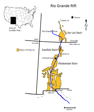
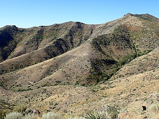
The Rio Grande rift is a north-trending continental rift zone. It separates the Colorado Plateau in the west from the interior of the North American craton on the east. The rift extends from central Colorado in the north to the state of Chihuahua, Mexico, in the south. The rift zone consists of four basins that have an average width of 50 kilometres (31 mi). The rift can be observed on location at Rio Grande National Forest, White Sands National Park, Santa Fe National Forest, and Cibola National Forest, among other locations.

<span class="mw-page-title-main">Basin and Range Province</span> Physiographic region extending through western United States and Mexico

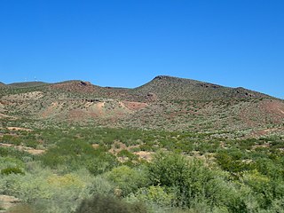
The Basin and Range Province is a vast physiographic region covering much of the inland Western United States and northwestern Mexico. It is defined by unique basin and range topography, characterized by abrupt changes in elevation, alternating between narrow faulted mountain chains and flat arid valleys or basins. The physiography of the province is the result of tectonic extension that began around 17 million years ago in the early Miocene epoch.

<span class="mw-page-title-main">Los Angeles Basin</span> Sedimentary basin located along the coast of southern California

The Los Angeles Basin is a sedimentary basin located in Southern California, in a region known as the Peninsular Ranges. The basin is also connected to an anomalous group of east-west trending chains of mountains collectively known as the Transverse Ranges. The present basin is a coastal lowland area, whose floor is marked by elongate low ridges and groups of hills that is located on the edge of the Pacific Plate. The Los Angeles Basin, along with the Santa Barbara Channel, the Ventura Basin, the San Fernando Valley, and the San Gabriel Basin, lies within the greater Southern California region. The majority of the jurisdictional land area of the city of Los Angeles physically lies within this basin.

<span class="mw-page-title-main">Jemez Mountains</span> Mountain range in New Mexico, United States

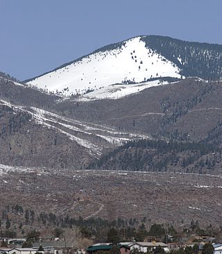
The Jemez Mountains are a group of mountains in Rio Arriba, Sandoval, and Los Alamos counties, New Mexico, United States.

<span class="mw-page-title-main">Albuquerque Basin</span> Basin and ecoregion within the Rio Grande rift in central New Mexico

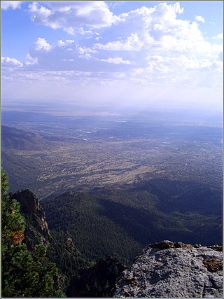
The Albuquerque Basin is a structural basin and ecoregion within the Rio Grande rift in central New Mexico. It contains the city of Albuquerque.

<span class="mw-page-title-main">Abiquiu Formation</span> A geologic formation in New Mexico

The Abiquiu Formation is a geologic formation found in northern New Mexico. Radiometric dating constrains its age to between 18 million and 27 million years, corresponding to the late Oligocene to Miocene epochs.

<span class="mw-page-title-main">Chamita Formation</span> Geologic formation in New Mexico

The Chamita Formation is a geologic formation in north-central New Mexico. It preserves unique fossils dating back to the Neogene period. The presence of volcanic ash beds in the formation, which can be radiometrically dated, gives the absolute age of the fossils, which is valuable for establishing the geologic time scale of the Neogene.

<span class="mw-page-title-main">Popotosa Formation</span> A group of geologic formations in New Mexico

The Popotosa Formation is a geologic formation in New Mexico. It preserves fossils dating back to the Neogene period. These include the Socorro flora, notable for its fine preservation of plant reproductive structures.

<span class="mw-page-title-main">Tesuque Formation</span> Geologic formation in New Mexico, United States

The Tesuque Formation is a geologic formation in north-central New Mexico, United States. The formation provides an unusually complete record of the evolution of mammals during the Miocene epoch.

<span class="mw-page-title-main">Galisteo Formation</span> A geologic formation in New Mexico

The Galisteo Formation is a geologic formation in New Mexico. It contains fossils characteristic of the Bartonian stage of the Eocene epoch, Duchesnean in the NALMA classification.

<span class="mw-page-title-main">Geology of New Mexico</span> Overview of the geology of the U.S. state of New Mexico

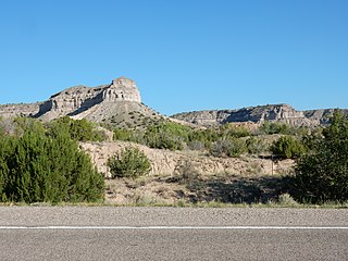
The geology of New Mexico includes bedrock exposures of four physiographic provinces, with ages ranging from almost 1800 million years (Ma) to nearly the present day. Here the Great Plains, southern Rocky Mountains, Colorado Plateau, and Basin and Range Provinces meet, giving the state great geologic diversity.

<span class="mw-page-title-main">Espinaso Formation</span> A geologic formation in New Mexico

The Espinaso Formation is a geologic formation in New Mexico. It has a radiometric age of 34.6 to 26.9 million years, corresponding to the late Eocene through Oligocene epochs.

<span class="mw-page-title-main">Santa Fe Group (geology)</span> Group of geologic formations filling the Rio Grande rift

The Santa Fe Group is a group of geologic formations in New Mexico and Colorado. It contains fossils characteristic of the Oligocene through Pleistocene epochs. The group consists of basin-filling sedimentary and volcanic rocks of the Rio Grande rift, and contains important regional aquifers.

<span class="mw-page-title-main">Bandelier Tuff</span> A geologic formation in New Mexico

The Bandelier Tuff is a geologic formation exposed in and around the Jemez Mountains of northern New Mexico. It has a radiometric age of 1.85 to 1.25 million years, corresponding to the Pleistocene epoch. The tuff was erupted in a series of at least three caldera eruptions in the central Jemez Mountains.

<span class="mw-page-title-main">El Rito Formation</span> A geologic formation in New Mexico

The El Rito Formation is a geologic formation in New Mexico dating to the Eocene epoch. It records a time when sediments were trapped in deep basins in western North America rather than being carried downstream to the Gulf of Mexico, so that sediments of this age in the western Gulf are mostly from the Appalachian Mountains.

<span class="mw-page-title-main">Polvadera Group</span> A group of geologic formations in New Mexico

The Polvadera Group is a group of geologic formations exposed in and around the Jemez Mountains of northern New Mexico. Radiometric dating gives it an age of 13 to 2.2 million years, corresponding to the Miocene through early Quaternary.

<span class="mw-page-title-main">Keres Group</span> A group of geologic formations in New Mexico

The Keres Group is a group of geologic formations exposed in and around the Jemez Mountains of northern New Mexico. Radiometric dating gives it an age of 13 to 6 million years, corresponding to the Miocene epoch.

<span class="mw-page-title-main">Puye Formation</span> A geologic formation in New Mexico

The Puye Formation is a geologic formation exposed east of the Jemez Mountains of northern New Mexico. Radiometric dating constrains its age to between 5 and 2 million years, corresponding to the Pliocene epoch.

<span class="mw-page-title-main">Tewa Group</span> A group of geologic formations in New Mexico

The Tewa Group is a group of geologic formations exposed in and around the Jemez Mountains of northern New Mexico. Radiometric dating gives it an age of 1.85 million to 72 thousand years, corresponding to the Pleistocene epoch.

<span class="mw-page-title-main">Hayner Ranch Formation</span> A geologic formation in New Mexico

The Hayner Ranch Formation is a geologic formation found near the San Diego Mountains of New Mexico. It is estimated to have been deposited during the Miocene epoch.

References

  1. 1 2 3 "The Española Basin, New Mexico". Española Basin Technical Advisory Group. New Mexico Bureau of Geology & Mineral Resources. Retrieved 27 June 2022.
  2. Aldrich, M. J. Jr.; Dethier, David P. (1 December 1990). "Stratigraphic and tectonic evolution of the northern Española basin, Rio Grande rift, New Mexico". GSA Bulletin. 102 (12): 1695–1705. Bibcode:1990GSAB..102.1695A. doi:10.1130/0016-7606(1990)102<1695:SATEOT>2.3.CO;2.
  3. 1 2 Manley, Kim (1979). "Stratigraphy and Structure of the Española Basin, Rio Grande Rift, New Mexico". Special Publications: 71–86. doi:10.1029/SP014p0071. ISBN   9781118664988.
  4. Golombek, Matthew P. (1 February 1983). "Geology, structure, and tectonics of the Pajarito fault zone in the Española basin of the Rio Grande rift, New Mexico". GSA Bulletin. 94 (2): 192–205. Bibcode:1983GSAB...94..192G. doi:10.1130/0016-7606(1983)94<192:GSATOT>2.0.CO;2.
  5. 1 2 Biehler, S.; Ferguson, J.; Baldridge, W. S.; Jiracek, G. R.; Aldern, J. L.; Martinez, M.; Fernandez, R.; Romo, J.; Gilpin, B.; Braile, L. W.; Hersey, D. R.; Luyendyk, B. P.; Aiken, C. L. (March 1991). "A geophysical model of the Española Basin, Rio Grande rift, New Mexico". Geophysics. 56 (3): 340–353. Bibcode:1991Geop...56..340B. doi:10.1190/1.1443048.
  6. Golombek, Matthew P.; McGill, George E.; Brown, Laurie (May 1983). "Tectonic and geologic evolution of the Espanola Basin, Rio Grande Rift: Structure, rate of extension, and relation to the state of stress in the western United States". Tectonophysics. 94 (1–4): 483–507. Bibcode:1983Tectp..94..483G. doi:10.1016/0040-1951(83)90031-8.
  7. Lichtig, Asher J.; Lucas, Spencer G. (2022). "New giant tortoise skulls from the Miocene of the Espanola Basin, New Mexico USA". New Mexico Museum of Natural History and Science Bulletin. 88: 25–32. Retrieved 27 June 2022.
  8. Kociolek, J.P.; Danz, A. (11 January 2022). "Taxonomy and valve ultrastructure of new and interesting freshwater fossil diatoms (Bacillariophyta) of Miocene age from the Espanola Formation of New Mexico, U.S.A. II. Description of a New Grunowia species with comments on the genus". Phytotaxa. 530 (3): 295–300. doi:10.11646/phytotaxa.530.3.5. S2CID   245888751.
  9. Mankin, Kyle R.; Rumsey, Christine; Sexstone, Graham; Ivahnenko, Tamara; Houston, Natalie; Chavarria, Shaleene; Senay, Gabriel; Foster, Linzy; Thomas, Jonathan; Flickinger, Allison; Galanter, Amy E.; Moeser, David; Welborn, Toby L.; Pedraza, Diana E.; Lamber, Patrick M. (2022). "Upper Rio Grande Basin water-resource status and trends: Focus area study review and synthesis". Journal of the ASABE. 65 (4): 881–901. doi: 10.13031/ja.14964 .

35°54′N106°06′W / 35.9°N 106.1°W / 35.9; -106.1