Tesuque Formation

Last updated
Tesuque Formation
Stratigraphic range: Miocene, 25.6–12.4  Ma
Tesuque Formation at type area.jpg
Tesuque Formation at its type area, Tesuque, New Mexico. This is the Nambe Member.
Type Formation
Unit of Santa Fe Group
Sub-unitsSee text
Underlies Chamita Formation, Ancha Formation
Overlies Espinaso Formation, Abiquiu Formation
Thickness2,100 m (6,900 ft)
Lithology
Primary Siltstone
Other Sandstone, conglomerate
Location
Coordinates 35°44′46″N105°55′20″W / 35.74611°N 105.92222°W / 35.74611; -105.92222
Region New Mexico
Country United States
Type section
Named for Tesuque, New Mexico
Named byBrewster Baldwin
Year defined1956
Usa edcp relief location map.png
Yellow pog.svg
Tesuque Formation (the United States)
USA New Mexico relief location map.svg
Yellow pog.svg
Tesuque Formation (New Mexico)

The Tesuque Formation is a geologic formation in north-central New Mexico, United States. The formation provides an unusually complete record of the evolution of mammals during the Miocene epoch.

Contents

Description

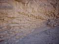
The formation is primarily siltstone and fine sandstone, with some boulder conglomerate beds in its eastern exposures close to the Sangre de Cristo Mountains. It is interpreted as coalesced alluvial fans with highly variable lithology. There is significant crossbedding and lenticular bedding, and some sandstone beds are well cemented with calcite. The formation dips 10 degrees to the west. Faulting makes an accurate estimate of its thickness uncertain, and it was originally estimated to be over 2,000 meters (6,600 feet) thick. [1] However, a careful reconstruction taking into account faults gives a thickness of 1,370–1,460 meters (4,490–4,790 feet). [2]

The Nambe Member is pinkish to reddish coarse-grained alluvial fan deposits resting on basement rock of the Sangre de Cristo Mountains. The member is named for Nambé Pueblo and has a total thickness of about 125 meters (410 feet). [3] An ash bed within the member has an aged based on Ar-Ar dating of 25.52 ± 0.07 million years (Ma). Its age range is estimated to be from 25.6 to 16.1 Ma. [4]

The Skull Ridge Member is separated from the Nambe Member by a distinctive ash bed. The member has numerous other ash beds, which result in relatively strong cementing that makes this a cliff-forming member. The upper portion is much less resistant to erosion. The member is up to 230 meters (750 feet) thick. Galusha and Blick did not identify the geographical location for which the member was named, and the place name "Skull Ridge" is unknown in New Mexico. [5] An ash bed in the Skull Ridge Member has an Ar-Ar age of 15.45±0.06 Ma. [6]

The Pojoaque Member is separated from the Skull Ridge Member by a greenish-gray conglomerate bed interpreted as lag gravel on an erosional surface. It is named for the Pojoaque Bluffs, also known as Los Barrancos, near the town of Pojoaque, New Mexico. The formation disappears into the subsurface under the Rio Grande River floodplain but is at least 550 meters (1,800 feet) thick. [7] Its age range is estimated to be from 14.9 to 12.5 Ma. [8]

The Chama-El Rito Member is found only in the northwestern portion of the Espanola Basin. It correlates with the Skull Ridge and Pojoaque Members, but contains conglomerate lenses with distinctive volcanic clasts (rock fragments) likely derived from the San Juan volcanic field. [9]

The Ojo Caliente Member is 140 meters (460 feet) of soft eolian sandstone overlying the Chama-El Rito member. It is named for the village of Ojo Caliente. [10] Radiometric dating of ash beds suggests the base of the member has a maximum age of 13.5 to 13.3 Ma. [11]

The Cuarteles Member is found in the northeastern part of the Espanola Basin. It was originally defined in the Chamita Formation west of the Rio Grande, but is assigned to the Tesuque Formation east of the Rio Grande. [12]

The Cejita Member is found in the northeastern part of the Espanola Basin, where it overlies the Cuarteles member. It is interbedded conglomerate and sandstone. It is probably similar in age to the Skull Ridge and Pojoaque Members. [13]

In addition to the traditional lithostratigraphic units, the Tesuque Formation is divided into two lithosomes. Lithosome A is granitic material deposited by a network of westward-flowing streams off the Sangre de Cristo Mountains. Lithosome B is richer in clay and Paleozoic clasts and was deposited by south- to southwest-flowing rivers coming from the Penasco area. The two can be distinguished in the field by the redder coloration of Lithosome A compared with the tan to gray color of Lithosome B. [14]

Fossils

G.K. Gilbert visited San Ildefonso Pueblo with the Hayden Survey in 1873 and found fossil mammal bones characteristic of the Pliocene. Some of these were sent to Othniel Marsh. Marsh's bitter rival, Edward Drinker Cope, arrived at San Ildefonso the next year and collected a number of Miocene reptile, bird, and mammal fossils. [15]

Childs Frick sent an expedition into the Tesuque area in 1924, and immediately recognized the paleontological potential of the Santa Fe beds. The Fricks Laboratory (merged with the Department of Vertebrate Paleontology of the American Museum of Natural History in 1968) carried out field work through 1972. Work prior to 1940 was careless about identifying exact source strata, though greater care was taken thereafter. [16] Most of the fossils came from the Pojoaque Member of the Tesuque Formation and were almost entirely found within thin (0.5–3 m) maroon-red to pale green claystone to fine-grained siltstone beds of lithosome B. These are interpreted as small lacustrine deposits. [17]

Fossils found in the Tesuque Formation include the canids Hemicyon and Carpocyon webbi, the antilocaprids Cosoryx , Merycodus , and Ramoceros , chiroptera from the Vespertilionidae and Antrozoinae, the turtles Glyptemys valentinensis and Kinosternon pojoaque , [18] and mastodonts. [19] [20] The formation provides an unusually complete record of the evolution of mammals through the Miocene. [21]

History of investigation

The beds making up the unit were originally described by Bryan and McCann in 1937 as the Middle Red member of the Santa Fe Formation. [22] The formation was named by Baldwin in 1956 at the same time that the Santa Fe Formation was raised to group rank. The formation is named after exposures around the town of Tesuque, New Mexico. [23]

In 1971, Galusha and Blick removed the uppermost beds from the Tesuque Formation as the Chamita Formation and divided the Tesuque Formation into members. These were, in ascending stratigraphic order, the Skull Ridge Member, the Nambe Member, Pojoaque Member, the Chama-El Rito Member, and the Ojo Caliente Member. [19] Manley added the Cejita Member in 1977. [13] Koning and Aby added the Cuarteles Member in 2005. [12]

Footnotes

See also

Related Research Articles

<span class="mw-page-title-main">Rio Arriba County, New Mexico</span> County in New Mexico, United States

Rio Arriba County is a county in the U.S. state of New Mexico. As of the 2020 census, the population was 40,363. Its county seat is Tierra Amarilla. Its northern border is the Colorado state line.

<i>Cosoryx</i> Extinct species of mammals

Cosoryx is an extinct genus of antilocaprid that lived in the Miocene of Nevada. Fossils of this genus have also been found in the Santa Fe Group in New Mexico.

<i>Osbornoceros</i> Extinct genus of mammals

Osbornoceros is an extinct artiodactyl genus of the family Antilocapridae. All antilocaprid species are extinct except for the pronghorn. Osbornoceros osborni is the only known species of the genus Osbornoceros. Osbornoceros lived during the Late Miocene around 7 to 6 million years ago in what is now North America. It is well represented in fossil discoveries, with nearly a dozen specimens having been found to date. All come from the Chamita Formation in a quarry near Lyden, New Mexico, the site of numerous other finds such as that of Chamitataxus, a prehistoric badger that lived at the same time. The holotype specimen of Osbornoceros was discovered in 1937 and many more were found nearby during further expeditions.

<span class="mw-page-title-main">Albuquerque–Santa Fe–Las Vegas combined statistical area</span> Combined statistical area in New Mexico, United States

The Albuquerque–Santa Fe–Las Vegas combined statistical area is made up of eight counties in north central New Mexico. The combined statistical area consists of the Albuquerque and Santa Fe metropolitan statistical areas, and the Las Vegas, Los Alamos, and Española micropolitan statistical areas. The 2013 delineations included the Grants micropolitan statistical area, but it was removed in the 2018 revisions. As of the 2020 census, the CSA had a population of 1,162,523. Roughly 56% of New Mexico's residents live in this area. Prior to the 2013 redefinitions, the CSA consisted only of the Santa Fe metropolitan statistical area and the Española micropolitan statistical area. The total land area of the Albuquerque–Santa Fe–Las Vegas combined statistical area in the 2013 definition is 26,421 sq mi (68,430 km2).

<span class="mw-page-title-main">Pojoaque Valley High School</span> Public high school in Santa Fe County, New Mexico, United States

Pojoaque Valley High School is a public high school in unincorporated Santa Fe County, New Mexico. It is located on the Jacona Campus, which is outside of the Jacona census-designated place. It serves the Pojoaque Valley in New Mexico and its colors are kelly green and white. Their mascot is the Elk.

<span class="mw-page-title-main">San Juan–Chama Project</span> Water management project in New Mexico and Colorado

The San Juan–Chama Project is a U.S. Bureau of Reclamation interbasin water transfer project located in the states of New Mexico and Colorado in the United States. The project consists of a series of tunnels and diversions that take water from the drainage basin of the San Juan River – a tributary of the Colorado River – to supplement water resources in the Rio Grande watershed. The project furnishes water for irrigation and municipal water supply to cities along the Rio Grande including Albuquerque and Santa Fe.

Kinosternon pojoaque is an extinct turtle in the genus Kinosternon. It existed in what is now New Mexico, United States, during the Middle Miocene period. It was described by Jason R. Bourque in 2012.

<span class="mw-page-title-main">Rio Ojo Caliente</span> River in New Mexico, United States

The Rio Ojo Caliente is a tributary of the Rio Chama mostly in Rio Arriba County, New Mexico, with a small part near Ojo Caliente in Taos County.

<span class="mw-page-title-main">Abiquiu Formation</span> A geologic formation in New Mexico

The Abiquiu Formation is a geologic formation found in northern New Mexico. Radiometric dating constrains its age to between 18 million and 27 million years, corresponding to the late Oligocene to Miocene epochs.

<span class="mw-page-title-main">Chamita Formation</span> Geologic formation in New Mexico

The Chamita Formation is a geologic formation in north-central New Mexico. It preserves unique fossils dating back to the Neogene period. The presence of volcanic ash beds in the formation, which can be radiometrically dated, gives the absolute age of the fossils, which is valuable for establishing the geologic time scale of the Neogene.

<span class="mw-page-title-main">Zia Formation</span> Rock formation in New Mexico

The Zia Formation is a geologic formation in the southwestern Jemez Mountains and northwestern Santo Domingo basin. It contains vertebrate fossils that date it to early to middle Miocene in age.

<span class="mw-page-title-main">North Central Regional Transit District</span>

The North Central Regional Transit District operates a network of several local and intercity bus routes in northern New Mexico, serving Santa Fe, Española, Taos, and many smaller communities along a network of 25 fixed routes and one demand-response route, one dial-a-ride and complementary Paratransit service in the Taos area. Routes operate Monday through Friday only, with the exceptions of the "Taos Express," which operates only on weekends, the Mountain Trail route to the Santa Fe National Forest and Ski Santa Fe, which operates daily, and seasonal daily service from the Town of Taos to Taos Ski Valley. All routes are fare-free, with the exception of the Taos Express and Mountain Trail route which are premium fare-based routes. The service is supported primarily by transit gross receipt taxes, which provides approximately 70% of the RTD's revenues. In 2023, the system had a ridership of 119,700, or about 300 per weekday as of the fourth quarter of 2023.

<span class="mw-page-title-main">Santa Fe Group (geology)</span> Group of geologic formations filling the Rio Grande rift

The Santa Fe Group is a group of geologic formations in New Mexico and Colorado. It contains fossils characteristic of the Oligocene through Pleistocene epochs. The group consists of basin-filling sedimentary and volcanic rocks of the Rio Grande rift, and contains important regional aquifers.

<span class="mw-page-title-main">El Rito Formation</span> A geologic formation in New Mexico

The El Rito Formation is a geologic formation in New Mexico dating to the Eocene epoch. It records a time when sediments were trapped in deep basins in western North America rather than being carried downstream to the Gulf of Mexico, so that sediments of this age in the western Gulf are mostly from the Appalachian Mountains.

<span class="mw-page-title-main">Ancha Formation</span> Geologic formation near Santa Fe, New Mexico

The Ancha Formation is a geologic formation found near Santa Fe, New Mexico. It is estimated to be between 1 and 3 million years in age, corresponding to the late Pliocene and Pleistocene.

<span class="mw-page-title-main">Cerro Conejo Formation</span> A geologic formation in New Mexico

The Cerro Conejo Formation is a middle to late Miocene geologic formation exposed near Albuquerque, New Mexico.

<span class="mw-page-title-main">Picuris Formation</span> Geologic formation in New Mexico

The Picuris Formation is a geologic formation exposed in the eastern flank of the Rio Grande rift in northern New Mexico. It was deposited from the late Eocene to Miocene epochs.

<span class="mw-page-title-main">Espanola basin</span> Structural basin in northern New Mexico, US

The Espanola basin is a structural basin in northern New Mexico. It is located in the Rio Grande watershed and is part of the Rio Grande rift. The definition of its boundaries is not fully settled, but the basin is usually defined such that it includes the cities of Santa Fe, Los Alamos, and Espanola.

References